25th Annual Black Diamond Fall Fundraising Party
Thursday, September 13; 6:00-10:00 PM; Black Diamond Parking Lot
25th Annual Black Diamond Fall Fundraising Party
Thursday, September 13; 6:00-10:00 PM; Black Diamond Parking Lot
| Advisory: Provo Area Mountains | Issued by Evelyn Lees for Thursday - March 1, 2018 - 7:30am |
|---|


|
bottom line The avalanche danger is CONSIDERABLE on steep, upper elevation slopes facing north through southeast, where deeper, wider slides can be triggered. . A MODERATE danger exists on all other steep, mid and upper elevation slopes. Wind drifts can be found and triggered around the compass, both along ridge lines and well off the ridges. With the complex snowpack, continue cautious route finding, careful snowpack evaluation and conservative decision making are important. You will find better and safer skiing and riding conditions on lower-angled wind sheltered slopes, with no steep slopes above.
|
 |
special announcement Spend some time improving your rescue skills or learning about avalanches in this upcoming Salt Lake City area class:
|
 |
current conditions
|
 |
recent activity With clearer skies, more evidence of the large avalanche cycle Monday when the strong, southerly winds blew. Cascade ridgeline, Wasatch Powderbirds photos. Full observation will be posted later today.
|
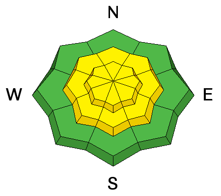
| type | aspect/elevation | characteristics |
|---|

|
|
LIKELIHOOD
 LIKELY
UNLIKELY
SIZE
 LARGE
SMALL
TREND
 INCREASING DANGER
SAME
DECREASING DANGER
|
|
description
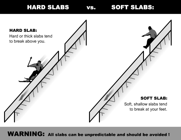
A few new wind slabs will be created by today’s increasingly strong southerly winds, easy to trigger. They will be loaded on top of Monday’s pencil hard wind slabs, which are along ridge lines and scattered in open bowls and the mid elevations. The older, hard wind slabs are stubborn, but can still be triggered by a person, and be anywhere from a few inches to two feet deep. Hard slabs are different – they almost always break above you, and often on the second or third person. Cornices are becoming more widespread along ridgelines – continuing to grow with today’s increasing southerly winds. Cornices often break back further than expected, on to what looks like flat terrain. So give them a wide berth and avoid travel below them. Recent upper elevation hard wind slab avalanche.
hard slab diagram – read more about them here. |
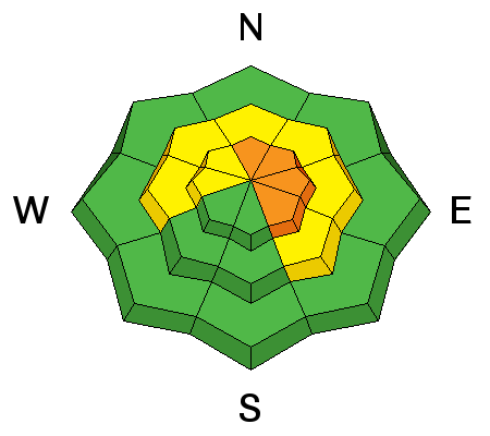
| type | aspect/elevation | characteristics |
|---|

|
|
LIKELIHOOD
 LIKELY
UNLIKELY
SIZE
 LARGE
SMALL
TREND
 INCREASING DANGER
SAME
DECREASING DANGER
|
|
description
Avalanches continue to be triggered on buried layers of faceted snow in the Wasatch mountains. Many slopes have poor structure – soft sugary, weak layers, both mid-pack and near the ground. It seems some of the steep slopes are just waiting for a trigger – and which slopes will slide are variable and unpredictable. A few deeper, wider slides broke near the ground this week, 2 to 5 feet deep. These natural avalanches were on Mill Canyon peak, in Mineral Fork and White Pine. They can be triggered by a person, smaller slides or cornice falls. Avoid, steep shallow, rocky, wind loaded terrain, where the snowpack is thinner and more suspect. If you trigger a persistent slab avalanche it will likely be unsurvivable. Cracking and collapsing are bulls-eye clues to instability, but these clues may not be present, and snow pit tests could be unreliable |
 |
weather A weak disturbance crossing northern Utah will increase the winds and produce an inch or two of snow this afternoon. Mostly cloudy skies today, with the southerly winds slowly increasing throughout the day. By evening, mid elevations ridge lines could average 25 mph with gusts to 30 mph, and the high elevations average 35 mph, gusting in the 50s. By morning, winds will be very strong. Temperatures will warm into the mid 20s to low 30s. The next storm continues to look good, though slowing down – it will be preceded by strong winds starting after midnight and continuing all day Friday. The main cold front should arrive Saturday with periods of snow, heavy at times, continuing into Sunday. We are still hoping for one to two feet of snow at the higher elevations |
| general announcements CLICK HERE FOR MORE GENERAL INFO AND FAQ The UAC has new support programs with Outdoor Research and Darn Tough. Support the UAC through your daily shopping. When you shop at Smith's, or online at Outdoor Research, REI, Backcountry.com, Darn Tough, Patagonia, NRS, Amazon, eBay a portion of your purchase will be donated to the FUAC. See our Donate Page for more details on how you can support the UAC when you shop. Benefit the Utah Avalanche Center when you buy or sell on eBay - set the Utah Avalanche Center as a favorite non-profit in your eBay account here and click on eBay gives when you buy or sell. You can choose to have your seller fees donated to the UAC, which doesn't cost you a penny This information does not apply to developed ski areas or highways where avalanche control is normally done. This advisory is from the U.S.D.A. Forest Service, which is solely responsible for its content. This advisory describes general avalanche conditions and local variations always occur. |