25th Annual Black Diamond Fall Fundraising Party
Thursday, September 13; 6:00-10:00 PM; Black Diamond Parking Lot
25th Annual Black Diamond Fall Fundraising Party
Thursday, September 13; 6:00-10:00 PM; Black Diamond Parking Lot
| Advisory: Provo Area Mountains | Issued by Greg Gagne for Friday - April 14, 2017 - 6:43am |
|---|


|
bottom line LOW avalanche hazard. Isolated pockets of wind drifts are possible in the upper elevations, and if the skies do clear and winds are light, small loose wet slides are possible on solar aspects.
|
 |
special announcement Great news… so far there haven’t been any avalanche fatalities in Utah this winter! It has been 26 years since we’ve had a fatality-free winter. Let’s keep it that way and stay safe this spring. Our goal is for everyone to enjoy the Greatest Snow on Earth and come home safe every day. The final regular advisory will be this Sunday, April 16. For the rest of the month we'll issue Friday updates for the central Wasatch Mountains and updates any time there is measurable snowfall; however, we will discontinue issuing avalanche danger ratings after Sunday. Although we will be shutting down regular operations, we will continue to post observations through the end of the month as we receive them, so please do continue to send them to us. You can check the latest observations here. We also follow avalanche-related activity on Instagram - be sure to tag your photos with #utavy . |
 |
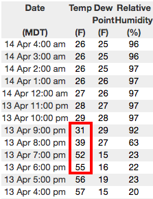
current conditions A dry cold front moved through the Provo mountains at about 8 pm last evening, quickly dropping mountain temperatures in its wake. Temperatures this morning range throughout the upper 20's F and winds are out of the west/northwest and light, gusting in the mid teens at upper elevations. Skies are mostly cloudy. The snow surface has frozen with the dropping temperatures, and is locked up tightly this morning. The screenshot is from the Alta Guard weather station in Little Cottonwood Canyon, showing the arrival of the cold front last evening and the temperature drop.
Week in Review [Detailed Version] A storm system entered the region this past weekend, with warm temperatures and a high rain/snow line on Saturday April 8th. A cold front with an ample moisture supply late Saturday night and well into the day on Sunday provided nearly 18-24" in the Cottonwoods and Ogden mountains, with 8-15" along the Park City ridgeline. The Provo mountains recorded 3-6". Limited avalanche activity was reported with this storm, with a few slides breaking at a graupel interface of the old snow surface, or within a density inversion within the storm snow. Monday brought clearing skies, but cool temperatures kept wet activity to a minimum. A short-duration wind event on Tuesday morning created pockets of wind drifts in isolated terrain, and a wind slab avalanche was triggered by a party of skiers hiking uphill at Snowbird Ski Resort. Another small wind drift was triggered in White Pine in Little Cottonwood canyon. Warming temperatures highlighted Wednesday and Thursday, but wet activity was minimal. A dry cold front entered the region Thursday evening, providing a solid refreeze of the snowpack by Friday morning. |
 |
recent activity No avalanche activity was reported other than minor wet loose activity. |
| type | aspect/elevation | characteristics |
|---|

|

|
LIKELIHOOD
 LIKELY
UNLIKELY
SIZE
 LARGE
SMALL
TREND
 INCREASING DANGER
SAME
DECREASING DANGER
|
|
description
A Low hazard is forecasted for today, but a few things to watch for: - You may find isolated pockets of wind drifts at the upper elevations. Although these are likely to be shallow and not that widespread, consider the consequences of triggering one of these drifts in steep, unforgiving terrain. - Cool temperatures and cloudy skies should limit warming of the snow surface today, but if the skies do clear more than forecasted and winds are light, small loose wet slides are possible. - Although not an avalanche problem, it will be hard to arrest from any falls on steep terrain with a frozen snow surface. The snow will be slow to soften today, and may not soften much, if at all. If skies do clear and the winds remain light, semi-soft corn conditions may be found this afternoon on wind-sheltered, mid elevations facing south and west. |
 |
weather Temperatures are forecasted to remain cool today, rising to just above freezing at 8000' and about 20 F. at 10,000' Winds will be out the west and will be generally light, with some gusts in the teens and 20's mph at the mid and upper elevations. Skies will remain partly to mostly cloudy this morning, with partial clearing this afternoon. A reinforcing shot of colder air will lead to a colder night tonight, with temperatures dropping into the low and mid teens F. For those seeking corn on Saturday, you probably won't have to set the alarm too early. |
general announcements
|