25th Annual Black Diamond Fall Fundraising Party
Thursday, September 13; 6:00-10:00 PM; Black Diamond Parking Lot
25th Annual Black Diamond Fall Fundraising Party
Thursday, September 13; 6:00-10:00 PM; Black Diamond Parking Lot
| Advisory: Provo Area Mountains | Issued by Greg Gagne for Friday - March 31, 2017 - 7:29am |
|---|

|
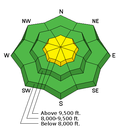
bottom line The avalanche hazard is Moderate at the upper elevations for fresh wind drifts from easterly winds which are forecasted to increase during the afternoon. These drifts may be found in unusual places - such as westerly aspects - but winds may also cross-load any upper elevation aspect. Outside of wind-affected terrain, the avalanche hazard is mostly Low, but loose snow avalanches are possible on steep upper elevation aspects. Best bet for the best riding today will be upper elevation, wind-sheltered aspects.
|
 |
special announcement Thanks for everyone that donated to organizations that make living in Utah a better place during yesterday's Love Utah Give Utah. We here at the Utah Avalanche Center gratefully appreciate the support we receive from this amazing community. |
 |
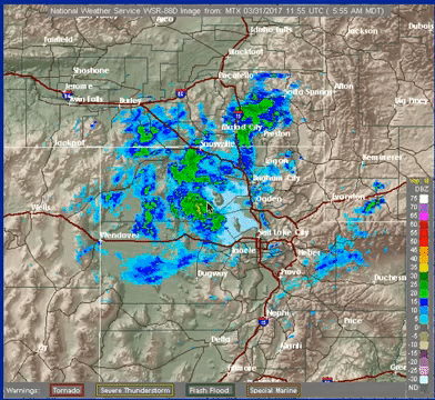
current conditions Temperatures this morning in the Provo mountains range from upper 20's to low 30's F. Winds are out of the east and are currently light, averaging less than 15 mph. However overnight the east winds gusted into the upper teens for several hours. Total snowfall from late yesterday afternoon is decent, with generally 3-5" reported from the mid elevations in the Provo mountains, with rain reported at lower elevations. Week in Review [Detailed Version] This past week has been highlighted by the see-sawing of storm and bluebird days, with avalanche activity ranging from storm and wind slabs during stormy periods, to predictable wet activity on sunny days. A weak storm on Saturday delivered 4-6" by late in the day in the central Wasatch. Sunday started cool & clear, but the strong March sun brought the usual round of shallow wet loose activity by mid-day. Monday was a classic March storm, with snow totals ranging from 6-13" during the day. A particular highlight was Alta recording 7" of snow from noon - 1 pm. Jim Steenburgh has a nice write up of this phenomenon on his classic Wasatch Weather Weenies page. During the day Monday there were widespread sensitive storm snow instabilities, including a natural cycle during the height of precipitation intensity. Tuesday was a transition day with wet slab activity, as well as sensitive wind slabs in the upper alpine regions, reported. By Wednesday, warm and clear conditions signaled the return to loose wet activity, especially on steep southerly aspects. Thursday flipped back to unsettled weather as a modest storm entered the region, depositing 5-8" across the Salt Lake and Park City mountains by Friday morning. |
 |
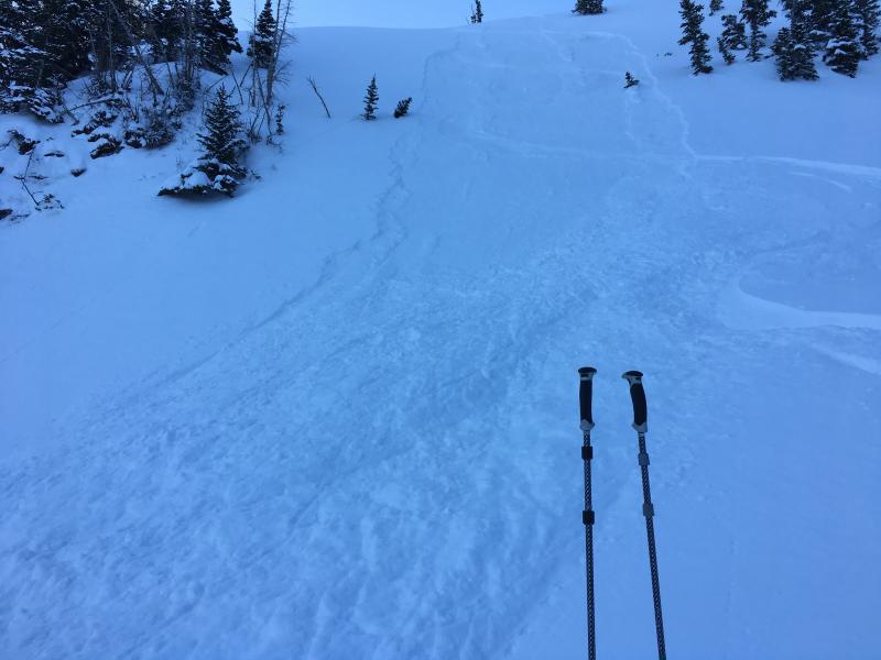
recent activity There were zero reports from the backcountry on Thursday. Where I was traveling yesterday afternoon in the upper reaches of Big and Little Cottonwood canyons in the Salt Lake mountains I was finding the trace to 1" storm snow to bond well to the old snow surface. I ran into a party that was touring in Silver Fork and they reported that, even though they tried, they were unable to get any snow to move. |
| type | aspect/elevation | characteristics |
|---|

|
|
LIKELIHOOD
 LIKELY
UNLIKELY
SIZE
 LARGE
SMALL
TREND
 INCREASING DANGER
SAME
DECREASING DANGER
|
|
description
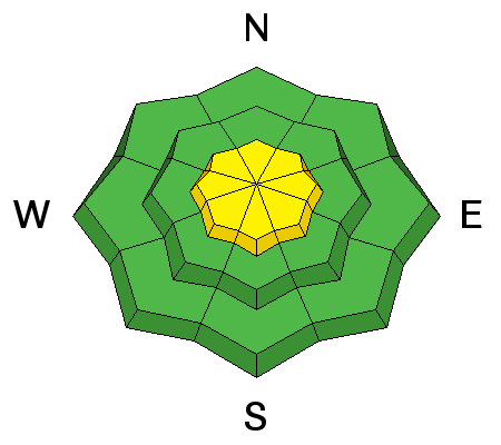
Wild card today are the East winds. Although they are generally light this morning, they are forecasted to increase today, especially by mid to late afternoon. I do not trust east winds, and have been surprised with their associated unusual avalanche activity in the past. Pay attention for fresh wind drifts in unusual places along the upper elevation ridgelines. This includes fresh cornices and wind drifts with a westerly aspect, as well as cross-loading on any upper elevation aspect. By late afternoon winds may be strong enough to work down into the mid elevations. |
| type | aspect/elevation | characteristics |
|---|

|

|
LIKELIHOOD
LIKELY
UNLIKELY
SIZE
LARGE
SMALL
TREND
 INCREASING DANGER
SAME
DECREASING DANGER
|
|
description
Outside of wind-affected terrain, rules for normal caution apply: Loose snow avalanches may be possible on steeper, upper elevation aspects. Although these will be shallow (generally up to 6") and not not break out very wide, the moving snow may be enough to knock you into a tree of over a cliff or rock band.
Wet loose snow avalanches - particularly at lower elevations - are possible. |
 |
weather Cloudy today with ridge top temperatures just below freezing, and warming into the mid and upper 30's F at the mid elevations. Winds will be from the east and will start out light this morning, but increase throughout the day, especially during the afternoon. Rain showers at low elevations, with an outside chance of getting a trace to few inches of snow today at the mid and upper elevations. We are in a cut-off low that is spinning weather from the east; increasingly strong easterly winds overnight with - at best - a trace of snow forecasted. (If this thing were to only turn the other direction ......)
Unfortunately the models are showing an increasingly weakening system for Monday/Tuesday, which may only bring cooler temperatures. |
general announcements
|