25th Annual Black Diamond Fall Fundraising Party
Thursday, September 13; 6:00-10:00 PM; Black Diamond Parking Lot
25th Annual Black Diamond Fall Fundraising Party
Thursday, September 13; 6:00-10:00 PM; Black Diamond Parking Lot
| Advisory: Provo Area Mountains | Issued by Drew Hardesty for Saturday - January 7, 2017 - 7:09am |
|---|

|
bottom line A MODERATE danger exists for overnight and developing wind drifts just off the ridgelines. These sensitive drifts may be up to a foot or so deep and may be triggered at a distance. The drifts will be more pronounced on northwest to east facing slopes, but may be cross-loaded onto other aspects as well. Loose dry sluffs are to be expected on the steepest slopes at the mid and upper elevations. Elevations below 7500' also have poor snowpack structure and may be susceptible to human triggering in steep terrain. Many areas have LOW avalanche danger: Safe and 5 star riding may be found on sun and wind-sheltered mid-elevation terrain on slopes less than 30°.
|
 |
special announcement Buy a lift ticket and help fund avalanche forecasting and education. More details here - CNN launched 24 hour news back in the 80s, but you can get 24 hour avalanche info - and contribute to it - on our various Twitter and Instagram #utavy, #waobs, and up in Ogden #ogdenavalanche feeds. Check it out - |
 |
current conditions Skies are partly-becoming-mostly cloudy. Temps are out of the ice-box with the mercury readings in the mid to upper teens - a far cry from yesterday morning's bone-numbing temps at 5 to 10° F below zero. The southwesterly winds picked up and are now blowing 15-20mph. The most exposed anemometers with direct "line-of-sight" to the southwesterlies spin 25-30mph with gusts to near 40. Greatest snow on Earth? The skiing and riding conditions are the stuff dreams are made of. Week in Review by Greg Gagne The New Years holiday weekend featured clear skies and Low avalanche hazard. Beginning late Sunday night, a storm system came in that lasted through Tuesday morning. Storm totals in the Cottonwoods and Park City mountains were upwards of 2' with close to 2" of water (SWE). This low density snow fell on a preserved layer of near surface facets and surface hoar. Although there was one skier-triggered slide reported on Monday that failed on this layer, most avalanche activity through Tuesday was only sluffing within the storm snow as the low density snow was not acting as a cohesive slab. On Wednesday and Thursday the UAC issued an avalanche warning with the arrival of a storm system that brought dense snow and strong winds. The Ogden mountains northward received the brunt of the snowfall with over 2' of snow and widespread avalanche activity. The Cottonwoods and Park City mountains received 12-18". The Provo mountains received 29" with 4.5" of water, and went through a significant natural avalanche cycle on all aspects and elevations Wednesday and overnight into Thursday. There are several excellent observations from this past week that provide useful information as you prepare for your weekend plans. |
 |
recent activity Some explosive testing in the backcountry yielded few to no results, but observers in the backcountry reported only minor sluffing in the upper few inches of the low density snow. Pic: Mark White. (Also congrats Mark and Marla for the 14th anniversary of recovering a full burial of a solo skier in Cardiff Fork of BCC).
There was a close call with a skier-triggered slide on Hoyt Peak in the Uintas on Thursday. This occurred on a steep northeast aspect at 10000'. The party submitted an observation from this incident. We greatly appreciate all observations that we receive, especially those involving avalanches. Remember that your information helps save lives. |
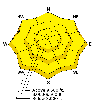
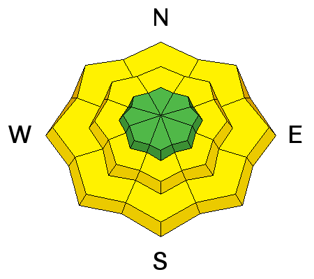
| type | aspect/elevation | characteristics |
|---|

|

|
LIKELIHOOD
 LIKELY
UNLIKELY
SIZE
 LARGE
SMALL
TREND
 INCREASING DANGER
SAME
DECREASING DANGER
|
|
description
Developing wind drifts will be your primary concern to mitigate or avoid on your backcountry travels today. The soft drifts are likely to be particularly sensitive as they will bond poorly to the recrystallized (ie: lightly faceted and weak) snow surfaces on many aspects. Jake Hutchinson looked at these surface weaknesses and has a great write-up from his outing yesterday. The drifts will be more prominent on northwest to east facing slopes, but may be cross-loaded onto other aspects as well. Watch for shooting cracks and avoid smooth rounded or scalloped looking snow. |
| type | aspect/elevation | characteristics |
|---|

|

|
LIKELIHOOD
 LIKELY
UNLIKELY
SIZE
 LARGE
SMALL
TREND
INCREASING DANGER
SAME
DECREASING DANGER
|
|
description
Expect to trigger sluffs in the loose, low density surface snow in terrain approaching 40° and steeper at the mid and upper elevations. Sluffs, or point-release avalanches tend to move at your feet or ride and start at a point and fan out as they move downslope. The key here is to move quickly and diagonally down the slope to avoid being tangled up in your own loose snow avalanche. This animal above Butler east displayed poor "sluff-management" and went for a short ride yesterday. Still waiting for his write-up.
|
| type | aspect/elevation | characteristics |
|---|

|
|
LIKELIHOOD
LIKELY
UNLIKELY
SIZE
LARGE
SMALL
TREND
 INCREASING DANGER
SAME
DECREASING DANGER
|
|
description
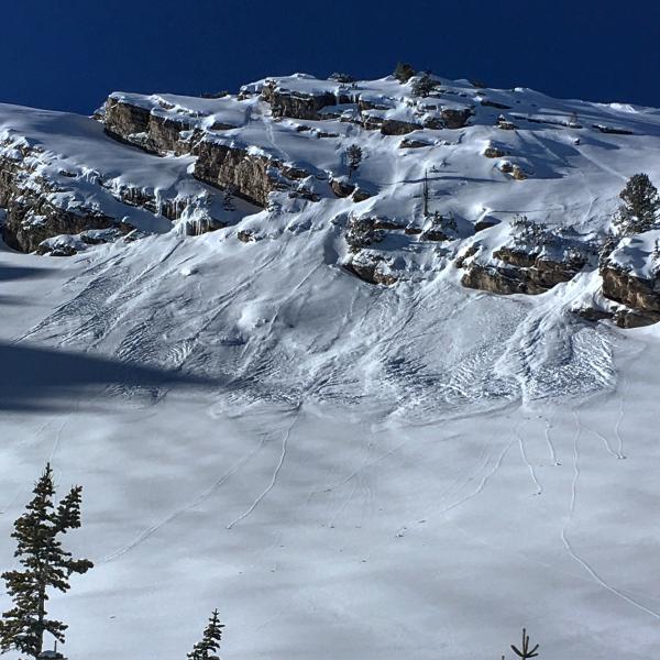
Many avalanches from Wednesday night's storm were more dramatic and interesting at the mid to low elevations on many aspects, but most notably on northwest to east to southeast. These were 18-26" deep and running on damp facets above the mid-December rain crust and easily overloaded with so much new snow. These have gained some stability over the past 48 hours, but remain suspect in steep terrain notably below 7500'. Watch for collapsing, cracking in this layering and it's best to pull out your shovel to gather snowpack information on your outing today. Good, recent obs from Provo can be found here. Photo of this avalanche problem from Primrose Cirque, below. Look just above the willows. Primose cirque had many naturals Wednesday night with many over-running the trail to the waterfalls and some coming close to the aspen grove parking lot.
|
 |
weather Buckle your seat belt. A series of powerful storms with a good moisture tap is set to engulf the state. For tomorrow, we'll start off wet, warm, and windy with alternating ripples of warm and cold features through at least mid-week. Snow will turn to freezing rain and then rain in the various valley and mountain valleys with a rain-snow line reaching toward 8500' by Sunday evening. The mountains may see heavy, dense snowfall Sunday into Monday with a following cold front Monday afternoon. In the meantime, we'll see increasing clouds, warming temps and advancing southwest winds today. Temps will rise to near 20°F and the 30F at 10,000' and 8000', respectively. Southwest winds will blow 25-35mph by midday into the afternoon. Light snowfall may begin by early evening. Now, you don't want to put your eggs in to one basket (and other disclaimers, etc, etc), but one "grouping' of weather models suggests - well - see for yourself. |
general announcements
|