25th Annual Black Diamond Fall Fundraising Party
Thursday, September 13; 6:00-10:00 PM; Black Diamond Parking Lot

25th Annual Black Diamond Fall Fundraising Party
Thursday, September 13; 6:00-10:00 PM; Black Diamond Parking Lot
| Advisory: Provo Area Mountains | Issued by Mark Staples for Thursday - January 5, 2017 - 7:43am |
|---|
 |
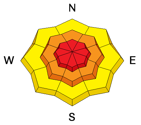
avalanche warning THE FOREST SERVICE UTAH AVALANCHE CENTER IN SALT LAKE CITY HAS CONTINUED A BACKCOUNTRY AVALANCHE WARNING. * TIMING...IN EFFECT FROM 6 AM MST THIS MORNING TO 6 AM MST FRIDAY * AFFECTED AREA...FOR THE MOUNTAINS OF NORTHERN UTAH INCLUDING THE WASATCH RANGE...BEAR RIVER RANGE AND THE WESTERN UINTA MOUNTAINS. * AVALANCHE DANGER...THE AVALANCHE DANGER FOR THE WARNING AREA IS HIGH. * REASON/IMPACTS...HEAVY SNOW HAS CREATED WIDESPREAD AREAS OF UNSTABLE SNOW. BOTH HUMAN TRIGGERED AND NATURAL AVALANCHES ARE LIKELY OR OCCURRING. STAY OFF OF AND OUT FROM UNDER SLOPES STEEPER THAN 30 DEGREES. THIS WARNING DOES NOT APPLY TO SKI AREAS WHERE AVALANCHE HAZARD REDUCTION MEASURES ARE PERFORMED. |
 |
special announcement Utah Department of Transportation (UDOT) has issued several closures in the Provo area this morning: Provo Canyon Backcountry Closure: Slide Canyon - Lost Creek Thursday, January 5, 2017 - 6:00am to 11:00am Provo Canyon Road Closure: Provo Canyon HWY 189 - Canyon Glen to Vivian Park Thursday, January 5, 2017 - 9:00am to 11:00am Please follow them on twitter and Instagram for the latest updates. You can also click the HERE for more details. |
 |
current conditions Temperatures have dropped into the mid teens to low 20's F this morning. Westerly winds are blowing 5-15 mph with gusts of 25 mph. This storm started early yesterday morning and is ending this morning. It started warm with lots of graupel and finished cold with some light snow; therefore, its hard to say exactly how much snow fell. Most areas received at least 1.5 inches of snow water equivalent and 10 inche of snow while near Sundance ski area, 28 inches of snow fell containing 4.3 inches of snow water equivalent!! That is a massive load and a major red flag by itself. Video of Craig Gordon explaining why this storm increased the avalanche danger. |
 |
recent activity With such stormy weather yesterday, few people were able to see much terrain and spot recent avalanches. Road cuts did produce small avalanches. When this happens, it's always a good bet that much bigger avalanches happened in the backcountry. I suspect there were some very large avalanches that occurred last night on Timpanogos and Cascade mountains. |
| type | aspect/elevation | characteristics |
|---|


|


|

LIKELIHOOD
 LIKELY
UNLIKELY
SIZE
 LARGE
SMALL
TREND
 INCREASING DANGER
SAME
DECREASING DANGER
|
|
description
Strong westerly winds blew yesterday during the storm. Even though I think the peak instability occurred last night, I'm being conservative today with the danger rating simply based on the amount of new snow from this storm coupled with the storm from Monday/Tuesday. |
| type | aspect/elevation | characteristics |
|---|


|


|

LIKELIHOOD
 LIKELY
UNLIKELY
SIZE
 LARGE
SMALL
TREND
 INCREASING DANGER
SAME
DECREASING DANGER
|
|
description
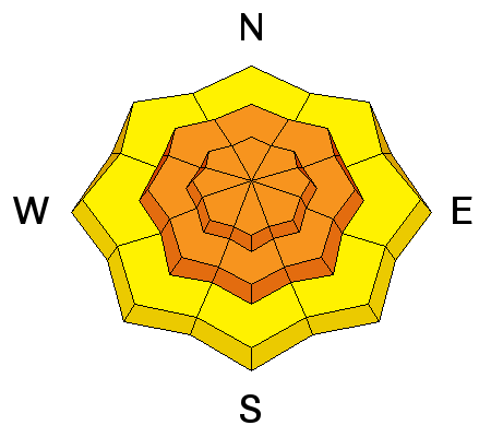
Monday/Tuesday's storm was cold and produced light snow which is now capped by dense snow from this storm. Dense, cohesive snow on top of light snow is always a good recipe for avalanches. This layering may not be very obvious today because yesterdays dense snow will become more supportable today. Additionally, snow early this morning will be light and will hide this upside down layering (dense snow on top of light snow). The good news is that this type of instability can heal itself fairly quickly. |
| type | aspect/elevation | characteristics |
|---|


|


|

LIKELIHOOD
 LIKELY
UNLIKELY
SIZE
 LARGE
SMALL
TREND
 INCREASING DANGER
SAME
DECREASING DANGER
|
|
description
Buried faceted layers of snow concern me and could be a longer lasting problem. With so much snow from yesterday/last night and early this week, these layers will be stressed today. One layer should be buried 2-3 feet deep under the snow that fell just after New Years. The other layer maybe in the middle of the snowpack or deeper near an ice crust from mid December. It is worth looking for these layers no matter where you are. If you find them, give them a few days at least to adjust to the weight of the new snow. For now I don't trust them. |
 |
weather With cold air descending from the north, today shouldn't warm at all, and temperatures may even continue to drop a few more degrees. The good news is that winds should steadily decrease through the day and the sun may break through cloudy skies by afternoon. . |
general announcements
|