| During the month of April, Mark Miller will donate $75 to the charity of your choice (5 to chose from, including the Utah Avalanche Center!) Mark Miller Subaru has raised over $300k in the previous 6 Do Good Feel Good events. More Info here |  |
| During the month of April, Mark Miller will donate $75 to the charity of your choice (5 to chose from, including the Utah Avalanche Center!) Mark Miller Subaru has raised over $300k in the previous 6 Do Good Feel Good events. More Info here | |
| Advisory: Provo Area Mountains | Issued by Bruce Tremper for Friday - November 14, 2014 - 7:23am |
|---|


|
bottom line Although we have a LOW avalanche danger today, it will almost certainly rise to at least MODERATE Saturday through the weekend on steep slopes above about 9,500' that face northwest, north and northeast. We'll update the avalanche forecast as the snow arrives and through the weekend.
|
 |
special announcement To those skinning uphill at resorts: it is your responsibility to know the resort policy on uphill travel. Some allow uphill travel and have guidelines, some don't. Contact the Ski Patrol at each resort for details. IMPORTANT: Before skinning at a resort under new snow conditions, check in with Ski Patrol. Resorts can restrict or cut off access if incompatible with control and grooming operations. Stay tuned for uphill closures over the next week or two as resorts get their terrain open. None of the mountain resorts are open for the season and you must treat the snow as a backcountry snowpack. It was exactly three years ago today - Nov 13, 2011 - when over 8 people were caught and carried in separate events in the unopened terrain in upper Little Cottonwood, resulting in a broken femur in upper Albion Basin and a tragic fatality in the Gad Valley. Here's Evelyn's forecast the following day. Powder Magazine is publishing an online video series called The Human Factor, which details the human factors involved in avalanche accidents. It features a number of avalanche experts on human factors including Utah Avalanche Center Director, Bruce Tremper. They will publish a new chapter each Tuesday for the next few weeks. Here is the link: http://www.powder.com/human-factor/ |
 |
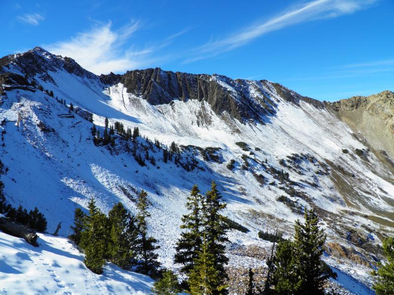
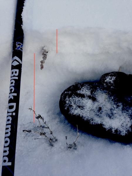
current conditions The storm started out slow with just a couple inches yesterday but it should get more serious this afternoon through Saturday with 8 inches to a foot expected as a cold front arrives. This new snow is falling on top 8 inches to a foot of old snow remaining above about 9,500' on northerly facing slopes and it will fall on bare ground on all the other aspects. Here are a couple photos of the pre-existing snow (Mark White photo below from a few days ago followed by Evelyn's)
|
| type | aspect/elevation | characteristics |
|---|

|
|
LIKELIHOOD
 LIKELY
UNLIKELY
SIZE
 LARGE
SMALL
TREND
 INCREASING DANGER
SAME
DECREASING DANGER
|
|
description
Here's the setup: The first snow of the season fell nearly a couple weeks ago and since then the warm, sunny weather melted most of the snow except on very upper elevation, northerly facing slopes. Therein lies the problem; that remaining snow quickly turned into a weak, suggery mess, exposed to a clear sky for so many days through the temperature gradient process. So we now have a weak layer thick enough to cover a lot of the rocks and shrubs. Finally, tonight into Saturday, the storm will deposit a slab on top of it combined with wind, giving us all the ingredients for slab avalanches for the first time of the season. Plus, any avalanches you trigger will slide through lots of buried rocks and stumps to bang you up on the way down. Not good.
If that's not enough, human factors will crescendo this weekend as well. Early season stoke, powder snow, Saturday, clearing skies, lots of people, ski areas closed and not yet doing any avalanche control--it's all adding up to an ugly recipe. Don't end your season before it even begins. The problem exists above about 9,500' on northwest, north and northeast facing slopes. You can check out photos of pre-existing snow patters from a couple recent observations HERE and HERE. In the meantime, check out our Education schedule here - we have a few free Avalanche Awareness classes coming up. We have a guest Blog post from long time observer Todd Leeds about getting ready for the early season - |
 |
weather We will continue with cloudy, foggy conditions today with light snow showers, but snow should increase this afternoon and overnight with the arrival of a cold front. We expect an additional 8 inches to a foot of new snow by mid day Saturday. The wind should pick up to 30, gusting to 40 overnight from the west and northwest and this should create some wind slabs in downwind terrain. Temperatures are warm today, 20-25 degrees but they should plummet to near zero by Saturday night. Skies should clear quickly by mid day Saturday. The extended forecast calls for clear with warming temperatures Monday through Wednesday. |
general announcements
|


_3.jpg)