| During the month of April, Mark Miller will donate $75 to the charity of your choice (5 to chose from, including the Utah Avalanche Center!) Mark Miller Subaru has raised over $300k in the previous 6 Do Good Feel Good events. More Info here |  |
| During the month of April, Mark Miller will donate $75 to the charity of your choice (5 to chose from, including the Utah Avalanche Center!) Mark Miller Subaru has raised over $300k in the previous 6 Do Good Feel Good events. More Info here | |
| Advisory: Provo Area Mountains | Issued by Bruce Tremper for Friday - November 22, 2013 - 6:54am |
|---|


|
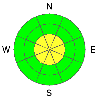
bottom line Slopes to avoid:
|
 |
current conditions Perhaps you noticed your windows rattling last night. I had to sleep with earplugs. As the big low pressure center tracks through southern Utah--giving them the fist big dump of the season--the circulation has come around the backside with winds from the east on the peaks. Combined with a surface pressure gradient, the canyon winds are still nuking this morning with the strongest winds around Farmington, as usual. At Snowbasin, the top of Strawberry lift is blowing 43, gusting to 60 overnight with the very exposed Ogden Peak blowing 62, gusting to 71 this morning. Winds farther south in the Salt Lake area mountains are more reasonable with ridge top winds 22, gusting to 36. As usual, canyon winds blow much harder at the canyon mouths than in the mountains. Mountain temperatures are in the mid 20's. |
 |
recent activity No new avalanche activity reported from the backcountry. |
| type | aspect/elevation | characteristics |
|---|

|
|
LIKELIHOOD
 LIKELY
UNLIKELY
SIZE
 LARGE
SMALL
TREND
 INCREASING DANGER
SAME
DECREASING DANGER
|
|
description
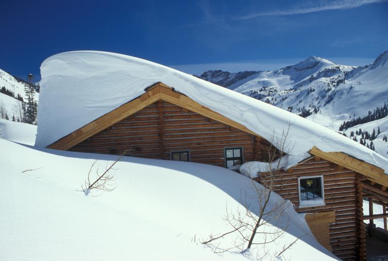
Unusual weather creates unusual avalanche conditions. The wind has been blowing from the east, which is an unusual direction for us. This means that the wind deposited the snow mostly on the west facing slopes, which are usually wind scoured. But remember that in the mountains wind swirls around a lot and you can find wind deposits on any aspect and elevation today. As usual, avoid any steep slopes with recent wind drifts. You can recognize them by their smooth, rounded shape and can range from being hard to soft. Remember wind erodes from the upwind side and deposits on the downwind side. This is an old photo illustrating the concept:
|
| type | aspect/elevation | characteristics |
|---|

|

|
LIKELIHOOD
 LIKELY
UNLIKELY
SIZE
 LARGE
SMALL
TREND
INCREASING DANGER
SAME
DECREASING DANGER
|
|
description
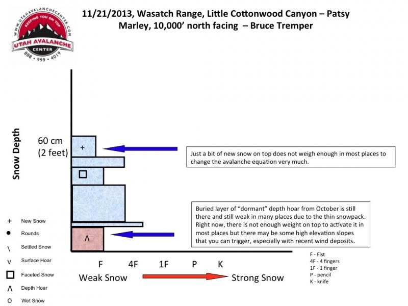
Last Sunday, we had a rash of human triggered avalanches breaking on the weak depth hoar near the ground. And yes, there are still monsters in the basement but they have been mostly dormant through the week. The last storm did not have enough weight to reactivate the depth hoar but I'm sure you can still find a number of slopes where the weight of a person can still trigger a deep, dangerous avalanche. You can find buried depth hoar on almost all the upper elevation, shady aspects, meaning above about 9,000' that face northwest, north, northeast and east. Since the south and the east facing slopes are still very rocky, it forces everyone to recreate on the upper elevation, north and east facing slopes, which are the exact same slopes with weak, sugary depth hoar near the ground. Continue to choose conservative routes in this terrain.
|
 |
weather Southern Utah may get a couple inches of water weight--meaning a couple feet of snow in the mountains. Northern Utah will remain high and dry with decreasing wind from the east today. The high should be near 30 with the overnight lows near 20. We don't see any significant snow in the forecast for the next 10 days or so but we will get a few clouds this weekend and perhaps something as next weekend approaches. |
| general announcements If you trigger an avalanche in the backcountry - especially if you are adjacent to a ski area – please call the following teams to alert them to the slide and whether anyone is missing or not. Rescue teams can be exposed to significant hazard when responding to avalanches, and do not want to do so when unneeded. Thanks. Salt Lake and Park City – Alta Central (801-742-2033), Canyons Resort Dispatch (435-615-3322) Twitter Updates for your mobile phone - DETAILS UDOT canyon closures UDOT at (801) 975-4838 Get your advisory on your iPhone with the Utah Avalanche Center mobile app, along with great navigation and rescue tools. Remember your information can save lives. If you see anything we should know about, please participate in the creation of our own community avalanche advisory by submitting snow and avalanche conditions. You can also call us at 801-524-5304 or 800-662-4140, email by clicking HERE, or include #utavy in your tweet or Instagram. |


_3.jpg)