SPECIAL ANNOUNCEMENT |
 |
Saving lives and building stoke in the backcountry. There *could be* an app for that. We are applying for a grant to help unify our website, email, SMS, and soc media alerts and create an open source platform that could be used by any avalanche center. We need your ideas and your support - check out the link and spread this among your friends.http://bit.ly/FRcRsM |
|
|
BOTTOM LINE
Danger by aspect and elevation on slopes approaching 35° or steeper.
(click HERE for tomorrow's danger rating)
|

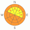
Danger Rose Tutorial
|
The avalanche danger is Moderate this morning for triggering a dry snow sluff or soft slab avalanche, but will quickly rise to CONSIDERABLE on and below any steep slope that receives direct sun and or heating from high thin clouds. Plan your backcountry travels with low angle options and exits. As the day heats up, avoid travel both on and below steep, warming slopes. New snow avalanches have the potential to gouge down into wet snow at the mid to lower elevations, entraining large amounts of snow.
There continue to be isolated places where deep, dangerous avalanches can be triggered on old faceted weak layers –steep, upper elevation, northerly facing slopes with a shallow snow pack, including slopes that have slide this year. |
|
|
CURRENT CONDITIONS |

|
The official calendar “end of winter” storm is winding down, with the Cottonwoods and Park City side managing to squeak out another 2 to 6 inches of fluff overnight. This brings final storm snow totals of 2 to 4 feet in the Cottonwoods, 1 ½ to 2 feet on the Park City side, over a foot in the Ogden area mountains and 3 feet in the Provo area mountains, all of it right side up famous Utah powder.
This morning, under partly cloudy skies, the westerly winds are very light, averaging less than 10 mph; temperatures are in the single digits and teens, not bad for the first day of spring. |
|
|
RECENT ACTIVITY |

|
The reports of widespread new snow sluffs and soft slabs from slope cuts and explosives were expected, it’s the outliers that really need to catch your attention.
· There was a very close call on north facing Kessler (aka Gods Lawnmower), when a 200' wide by 3' foot deep hard slab was triggered on the up track at 10,200’. The person was caught and quickly grabbed tree, avoiding the 1,700' vertical ride. It was a repeater, failing in a shallow snow pack on a depth hoar/crust combination. There was also an explosive released hard slab into old snow, 3 to 4’ deep, in upper Little Cottonwood, north facing, above 10,500’. Report HERE.

· In the Provo area mountains, new snow avalanches released by control work stepped down twice into wet depth hoar, at 7,500’ and 8,200’, running to the ground. Wet depth hoar is also being reported in the Ogden area mountains. Provo photo below, more HERE.

|
|
|
THREAT #1 |

|
| WHERE |
PROBABILITY |
SIZE |
TREND |
|
|
|
|
| |
|
|
Over the next
11 hours.
|
|
|
The most widespread avalanche activity today will be related to any sun and heating. It is now officially Spring, and even quick glimpses of the hot, strong sun will rapidly heat the new powder snow on steep sunny slopes, making it easy to trigger sluffs and even slab avalanches. In addition, any periods of high thin clouds will reflect radiation, heating the snow on the shady, northerly facing slopes. While some increasing clouds this afternoon may extend the period of cool snow, be prepared to finish early. Plan your backcountry travel carefully - don’t get trapped in steep gullies, slopes that funnel and or have no options for escape if the sun suddenly comes out and the snow heats up. Wet snow avalanche debris sets up like concrete. |
|
|
THREAT #2 |

|
| WHERE |
PROBABILITY |
SIZE |
TREND |

|
|
|
|
| |
|
|
Over the next
24 hours.
|
|
|
We would love to be dealing with only the predictable new snow avalanche issues, but the persistent weak layers in the snowpack are continuing to haunt us like an old Twilight Zone rerun. Yesterday’s avalanche activity highlights two issues:
· First - upper elevation, northerly facing slopes still have weak dry facets, mostly likely triggerable in the same shallow snow pack areas that we have been concerned with for most of the winter. Avoid very steep, shallow rocky high elevation slopes, especially if they have slide one or more times. These deep hard slab avalanches could be unsurvivable.
· Second, the damp and wet facets at the low to mid elevations seem to be active with big triggers. A new snow slide or wet sluff moving down slope could step down and triggered a larger wet slide. These lower elevation wet snow slides can gouge to the ground, particularly in thinner, saturated snowpack areas. |
|
|
MOUNTAIN WEATHER |

|
Cloud cover will be variable today – perhaps a period of clearing this morning, with direct sun, followed by increasing clouds later this afternoon. Temperatures will warm to near 30 at 8,000’ and to near 20 along the highest ridge lines. The westerly winds should remain very light all day, in the 5 to 15 mph range. Strong high pressure will bring very warm temperatures and sunny skies through the weekend. |
|
|
GENERAL ANNOUNCEMENTS |
GENERAL ANNOUNCEMENTS
If you trigger an avalanche in the backcountry - especially if you are adjacent to a ski area – please call the following teams to alert them to the slide and whether anyone is missing or not. Rescue teams can be exposed to significant hazard when responding to avalanches, and do not want to do so when unneeded. Thanks.
Salt Lake and Park City – Alta Central (801-742-2033)
Ogden – Snowbasin Patrol Dispatch (801-620-1017)
Provo – Sundance Patrol Dispatch (801-223-4150)
Dawn Patrol Forecast Hotline, updated by 05:30: 888-999-4019 option 8.
Twitter Updates for your mobile phone http://utahavalanchecenter.org/twitter)
Daily observations are frequentlypostedby 10 pm each evening.
Subscribe to the daily avalanche advisory e-mail clickHERE.
UDOT canyon closuresUDOTat (801) 975-4838
Wasatch Powderbird Guides does daily updates about where they'll be operating on this blog http://powderbird.blogspot.com/.
Remember your information can save lives.If you see anything we should know about, please participate in the creation of our own community avalanche advisory by submittingavalanche and snow observations. You can also call us at 801-524-5304 or 800-662-4140, or email by clickingHERE
Donate to your favorite non-profit –The Friends of the Utah Avalanche Center. The UAC depends on contributions from users like you to support our work.
We will update this forecast tomorrow morning. Thanks for calling. |
|
|
This information does not apply to developed ski areas or highways where avalanche control is normally done. This advisory is from the U.S.D.A. Forest Service, which is solely responsible for its content. This advisory describes general avalanche conditions and local variations always occur. |
|
This advisory provided by the USDA Forest Service, in partnership with:
The Friends of the Utah Avalanche Center, Utah Division of State Parks and Recreation, Utah Division of Emergency Management, Salt Lake County, Salt Lake Unified Fire Authority and the friends of the La Sal Avalanche Center. See our Sponsors Page for a complete list. |
