25th Annual Black Diamond Fall Fundraising Party
Thursday, September 13; 6:00-10:00 PM; Black Diamond Parking Lot
25th Annual Black Diamond Fall Fundraising Party
Thursday, September 13; 6:00-10:00 PM; Black Diamond Parking Lot
| Advisory: Moab Area Mountains | Issued by Eric Trenbeath for Monday - April 2, 2018 - 6:55am |
|---|

|
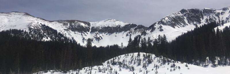
bottom line Mostly stable snow conditions exist and the avalanche danger is generally LOW. A few slopes still harbor weak, potentially re-active snow where it may be possible to trigger a persistent slab avalanche 2'-3' deep. You are most likely to encounter this problem right around treeline on slopes that face N-E. Surfaces in the high country are firm and smooth, and slides for life are a real possibility. Ice axes, whippets and or crampons are recommended for alpine pursuits.
|
 |
special announcement The newest issue of the Powder Cloud, the newsletter of the Utah Avalanche Center is hot off the presses.
The UAC Marketplace is still open. Our online marketplace still has deals on skis, packs, airbag packs, beacons, snowshoes, soft goods and much more. INSTAGRAM! We now have a UAC-Moab Instagram page. You can find it here....but better yet follow us on your smartphone. Confused? Ask a teenager. |
 |
current conditions
Southwest winds are on the increase ahead of a fast moving storm system passing through to the north. They are currently averaging 20-25 mph with gusts into the 40's. 10,000' temps are in the low to mid 30's. Turning and riding conditions leave something to be desired but travel is fast and easy over mostly supportable surfaces. Corn-like snow is developing at mid elevations on SE-S-W aspects. Most other surfaces range from wind hammered to sun crusted. In my travels over the weekend I discovered that people have been getting after it, and that many of the big lines in Gold Basin had been skied without incident. Mostly stable snow conditions exist, but surfaces in the high country are firm and smooth, and slides for life are a real possibility. Ice axes, whippets and or crampons are recommended for alpine pursuits. New snow totals in Gold Basin. Snow totals at the Geyser Pass Trailhead, (9600') Wind, temperature, and humidity on Pre Laurel Peak (11,700') |
 |
recent activity |
 |
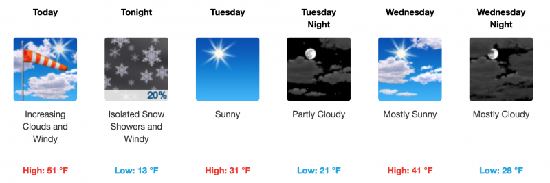
weather Today look for increasing clouds and SW winds as a fast moving storm system moves through to the north. Speeds will average 20-30 mph with gusts into the 40's. High temps at 10,000' will be near 50 degrees. Tonight will see colder temperatures followed by a dry northwest flow through the week. We may see a chance for some snow by the weekend. |
| general announcements The UAC has new support programs with Outdoor Research and Darn Tough. Support the UAC through your daily shopping. When you shop at Smith's, or online at Outdoor Research, REI, Backcountry.com, Darn Tough, Patagonia, NRS, Stio, Amazon, and eBay a portion of your purchase will be donated to the FUAC. See our Donate Page for more details on how you can support the UAC when you shop. Benefit the Utah Avalanche Center when you buy or sell on eBay - set the Utah Avalanche Center as a favorite non-profit in your eBay account here and click on eBay gives when you buy or sell. You can choose to have your seller fees donated to the UAC, which doesn't cost you a penny. This information does not apply to developed ski areas or highways where avalanche control is normally done. This advisory is from the U.S.D.A. Forest Service, which is solely responsible for its content. This advisory describes general avalanche conditions and local variations always occur. |