25th Annual Black Diamond Fall Fundraising Party
Thursday, September 13; 6:00-10:00 PM; Black Diamond Parking Lot
25th Annual Black Diamond Fall Fundraising Party
Thursday, September 13; 6:00-10:00 PM; Black Diamond Parking Lot
| Advisory: Moab Area Mountains | Issued by Eric Trenbeath for Monday - December 19, 2016 - 6:54am |
|---|


|
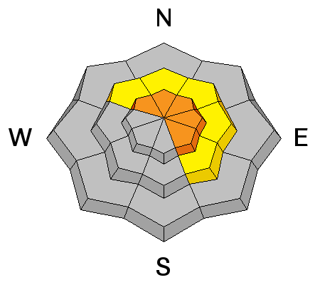
bottom line Overall, the avalanche danger is MODERATE but areas of CONSIDERABLE danger still exist on steep, upper elevation terrain that has a NW-NE-SE aspect where it is still possible to trigger a dangerous persistent slab avalanche. Heightened avalanche awareness, careful terrain selection and snowpack analysis is required in these areas. There is also a MODERATE danger for wind slab avalanches in upper elevation, wind exposed terrain.
|
 |
current conditions The December 15-16 storm event brought about 18" of much needed snow to the mountains and conditions are excellent. On Sunday, people were out and about enjoying the mountains and fresh snow with gusto. Thanks to Reed Kennard for this observation. With sunny skies, cool mountain temperatures, and light northwesterly winds on tap for most of the week, things should stay quite good at least through Thursday when a change in the pattern is looming. Base depth in Gold Basin is 39" and we have received 92" of total snowfall for the season. Storm totals and temperature in Gold Basin.(10,000') Wind, temperature and humidity on Pre Laurel Peak.(11,700') Snow totals, temperature and snow/water equivalent at the Geyser Pass Trailhead.(9600') |
 |
recent activity
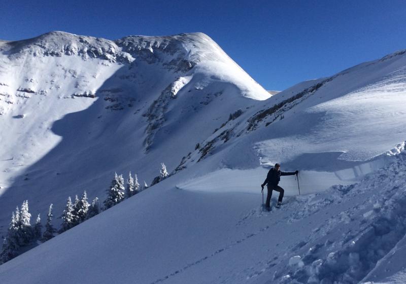
The storm cycle of December 15-16, produced some large avalanches including this one in Horse Creek Chute on a NE aspect at about 11,400'. Overall I was surprised that there wasn't more activity given the prevalence of the weak, faceted layer that this and, the other slides apparently ran on. For a list of the other slides I observed go here. |
| type | aspect/elevation | characteristics |
|---|

|
|
LIKELIHOOD
 LIKELY
UNLIKELY
SIZE
 LARGE
SMALL
TREND
 INCREASING DANGER
SAME
DECREASING DANGER
|
|
description
The snowpack is gaining strength and snowpits dug on Sunday, December 18 revealed a much less reactive weak layer. Reports of whumphing and collapsing of the snowpack are still coming in however, and I personally experienced a large, hair raising collapse on an upper elevation slope of around 25 degrees on SE aspect. This tells me that a little more patience is required, and I think there is still a fairly high likelihood of being able to trigger a large avalanche on steep, upper elevation terrain that has a NW-NE-SE aspect.
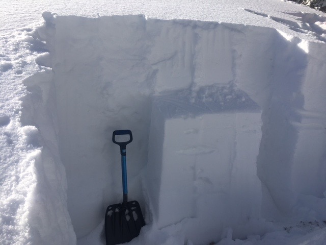
The buried, weak faceted layer illustrated here produced that avalanches that occurred on Friday. Though much less reactive, it is still present and warrants continued attention. |
| type | aspect/elevation | characteristics |
|---|

|

|
LIKELIHOOD
 LIKELY
UNLIKELY
SIZE
LARGE
SMALL
TREND
INCREASING DANGER
SAME
DECREASING DANGER
|
|
description
Wind slabs formed during the December 16 wind event have largely stabilized, but they still exist in the high country and if triggered they present the very real danger of stepping down into a buried weak layer causing a larger and more dangerous persistent slab avalanche. Continue to be suspicious of smooth, rounded deposits of wind drifted snow, particularly on steep, upper elevation terrain that has a NW-NE-SE aspect. Additionally, there is plenty of loose snow available for transport should winds pick up. In that case you will need to be alert to recent deposits of wind drifted snow. |
 |
weather Monday Sunny, with a high near 22. North northwest wind 5 to 10 mph becoming west southwest in the afternoon. Tonight Mostly clear, with a low around 12. West wind around 10 mph. Tuesday Sunny, with a high near 29. West southwest wind 10 to 15 mph. Tuesday Night Partly cloudy, with a low around 14. West southwest wind 10 to 15 mph. Wednesday Mostly sunny, with a high near 23. Northwest wind 10 to 15 mph. Wednesday Night Mostly clear, with a low around 10. Thursday Mostly sunny, with a high near 23. |