25th Annual Black Diamond Fall Fundraising Party
Thursday, September 13; 6:00-10:00 PM; Black Diamond Parking Lot
25th Annual Black Diamond Fall Fundraising Party
Thursday, September 13; 6:00-10:00 PM; Black Diamond Parking Lot
| Advisory: Moab Area Mountains | Issued by Eric Trenbeath for Thursday - December 15, 2016 - 7:34am |
|---|

|
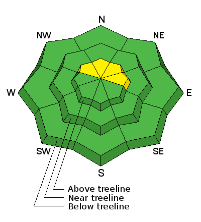
bottom line The avalanche danger is LOW this morning but areas of unstable snow may exist on isolated terrain features, particularly in upper elevation, wind exposed terrain that has a NW-N-E aspect. Expect the danger to rise significantly over the next few days as a powerful storm system with strong winds and heavy snow moves into our area.
|
 |
special announcement I'll be presenting a free Know Before You go avalanche awareness talk tonight at the Grand County Library at 6:00 p.m. The presentation includes an exciting and educational video produced by the Utah Avalanche Center that has been chosen as an official selection in the Banff Mountain Film Festival. Following will be a powerpoint presentation, and a question and answer session on staying safe in the winter backcountry.Hope to see you there! |
 |
current conditions Snow conditions have taken a turn for the worse over the past week, and most surfaces are now wind scoured or crusted. Some soft snow can still be found in sheltered areas and the base is still mostly supportable, but it's thin, and weeds, rocks and dead fall are becoming more apparent. Southwesterly winds are in the increase ahead of the next storm system and are currently blowing in the 30-40 mph range along ridge tops. Temperatures are warm, it's 26 degrees on Pre-Laurel Peak and 35 at the Geyser Pass Traihead. Storm totals and temperature in Gold Basin.(10,000') Wind, temperature and humidity on Pre Laurel Peak.(11,700') Snow totals, temperature and snow/water equivalent at the Geyser Pass Trailhead.(9600')
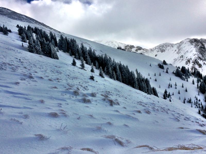
Reed took this shot at the top of the Funnel. The southwest facing aspect has been stripped by the wind.
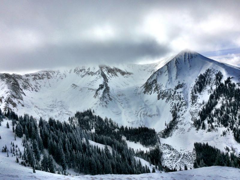
Looking across into the high cirques of Gold Basin there are lots of rocks showing in the moraines. |
 |
weather A powerful storm system is on the way bringing strong winds and heavy snow starting tonight and lasting until Saturday. Today A slight chance of rain and snow showers before 1pm, then a chance of rain showers between 1pm and 4pm, then a chance of rain and snow showers after 4pm. Increasing clouds, with a high near 38. Windy, with a west southwest wind 30 to 35 mph, with gusts as high as 50 mph. Chance of precipitation is 40%. Tonight Snow showers, mainly after 7pm. The snow could be heavy at times. Widespread blowing snow. Low around 25. Very windy, with a southwest wind 35 to 45 mph, with gusts as high as 70 mph. Chance of precipitation is 100%. New snow accumulation of 5 to 9 inches possible. Friday Snow showers. The snow could be heavy at times. Some thunder is also possible. Widespread blowing snow. High near 30. Very windy, with a west southwest wind 45 to 50 mph increasing to 55 to 60 mph in the afternoon. Winds could gust as high as 85 mph. Chance of precipitation is 100%. New snow accumulation of 7 to 11 inches possible. Friday Night Snow. The snow could be heavy at times. Widespread blowing snow. Low around 3. Wind chill values as low as -20. Very windy, with a west northwest wind 40 to 50 mph decreasing to 30 to 40 mph after midnight. Winds could gust as high as 75 mph. Chance of precipitation is 90%. New snow accumulation of 5 to 9 inches possible. Saturday A 50 percent chance of snow, mainly before 11am. Partly sunny and cold, with a high near 10. Windy, with a northwest wind 25 to 30 mph decreasing to 15 to 20 mph in the afternoon. Winds could gust as high as 45 mph. |
| general announcements The road to Geyser Pass Trailhead is plowed and clear but slick. Grooming of cross country trails has commenced for the season and the lower meadow and road into Gold Basin was groomed on Thursday. |