25th Annual Black Diamond Fall Fundraising Party
Thursday, September 13; 6:00-10:00 PM; Black Diamond Parking Lot
25th Annual Black Diamond Fall Fundraising Party
Thursday, September 13; 6:00-10:00 PM; Black Diamond Parking Lot
| Advisory: Moab Area Mountains | Issued by Eric Trenbeath for Thursday - November 24, 2016 - 7:04am |
|---|


|
bottom line Overall the avalanche danger is LOW with a shallow and well anchored snowpack. The exception are isolated wind slabs on upper elevation, northerly facing slopes. Even a small slide triggered in these areas could take you for a nasty, bumpy ride over rocks. Coverage in this rocky, alpine terrain is still quite thin, and that's reason enough to avoid those areas.
|
 |
special announcement Regularly scheduled advisories will commence December 1, and I will be updating this periodically as conditions warrant until then. I'll be keeping my eye on a storm system slated for Sunday and Monday that will likely bring the next significant change. |
 |
current conditions
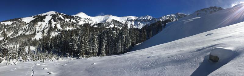
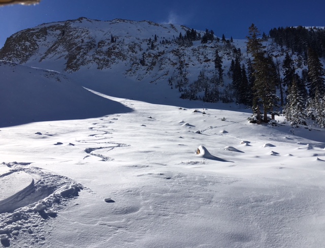
Happy Thanksgiving! On this day, along with so many other things, we can be thankful that we are on our way to a decent base. In the past week, the mountains received more than 2 feet of snow and we are currently sitting on a nice dense base of about 20" in Gold Basin. I was out and about yesterday and was pleasantly surprised to find that it is possible to slide around. Monday's dense snow has settled out nicely, and I was only sinking in 3-4" which made it possible to ride up and over buried obstacles. It can't be overstated however, that snow cover is very thin, and you don't want to be letting it run. Rocks, branches, and dead fall are everywhere apparent, so keep your enthusiasm in check until we get more snow. Overnight mountain temperatures have dropped into the single digits, and ridge top winds have averaged 20-30 mph with gusts to 40 shifting from SW-W-NW. Base depth in Gold Basin: 20" Total snow fall to date: 29" Last 24 hours: 0" Temperature, humidity and new snow totals in Gold Basin. Temperature and base depth at the Geyser Pass Trailhead. Winds, temperature, and humidity on Pre Laurel Peak.
You can wiggle out a few turns if you are careful, but as you can see, there are plenty of visible and invisible land mines out there. |
| type | aspect/elevation | characteristics |
|---|

|
|
LIKELIHOOD
 LIKELY
UNLIKELY
SIZE
 LARGE
SMALL
TREND
 INCREASING DANGER
SAME
DECREASING DANGER
|
|
description
With a 20" base, we currently have a shallow, well anchored, and mostly stable snowpack. The exception may be some isolated wind slabs in the upper elevations. Other than that, the greatest danger is injury from hitting submerged rocks, branches or dead fall. As the season gets underway, start thinking avalanches, tune into current and changing conditions, and put some fresh batteries in your beacon. |
| type | aspect/elevation | characteristics |
|---|

|

|
LIKELIHOOD
 LIKELY
UNLIKELY
SIZE
 LARGE
SMALL
TREND
 INCREASING DANGER
SAME
DECREASING DANGER
|
|
description
Winds have been blowing enough snow around over the past few days that there may be some isolated wind drifts on the lee sides of ridge crests and terrain features on upper elevation, northerly aspects. I wouldn't be riding in these areas anyway due to lack of coverage, but if you found yourself up there, and managed to trigger even a small slide, you could take a nasty and bumpy ride over some rocky terrain. Look for the usual tell tale signs - smooth rounded deposits of wind drifted snow or cracking in the snow surface.
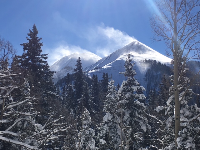
Plumes of wind transported snow off the highest peaks will likely deposit a few isolated wind slabs in upper elevation terrain. |
 |
weather A brief ridge of high pressure will build over the next couple off days, with what looks like a significant storm system moving in to the area on Sunday. I'll keep you posted. Thanksgiving Day A 20 percent chance of snow before noon. Sunny, with a high near 27. North wind 5 to 15 mph. Tonight Clear, with a low around 21. North northwest wind 5 to 10 mph becoming south after midnight. Friday Sunny, with a high near 31. South wind around 15 mph. Friday Night Mostly clear, with a low around 23. South southwest wind around 15 mph. Saturday Sunny, with a high near 33. South wind around 15 mph, with gusts as high as 25 mph. Saturday Night A 50 percent chance of snow, mainly after 11pm. Mostly cloudy, with a low around 20. Breezy. Sunday Snow likely. Mostly cloudy, with a high near 22. Breezy. Chance of precipitation is 70%. Sunday Night Snow likely, mainly before 11pm. Mostly cloudy, with a low around 14. Monday A slight chance of snow. Partly sunny, with a high near 20. |