| Please join us at the 23rd annual Black Diamond Fall Fundraiser Party Thursday Sept 15. Tickets are on sale now here, at the Black Diamond store & at REI. Special bonus raffle for online ticket purchasers! |
| Please join us at the 23rd annual Black Diamond Fall Fundraiser Party Thursday Sept 15. Tickets are on sale now here, at the Black Diamond store & at REI. Special bonus raffle for online ticket purchasers! |
| Advisory: Moab Area Mountains | Issued by Eric Trenbeath for Saturday - March 12, 2016 - 6:47am |
|---|

|
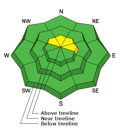
bottom line The avalanche danger is MODERATE in steep upper elevation, wind drifted terrain, primarily on slopes with a NW-N-E aspect where it is possible to trigger a recently deposited wind slab. A more remote danger exists for triggering a deeper persistent slab down to weak, shallow, sugary snow on similar aspects and elevation. Terrain choices are key - suspect slopes with steep convexities and be leery of rocky and more radical terrain. The avalanche danger is generally LOW outside of wind affected terrain.
|
 |
special announcement Confused about danger ratings and how to apply them to your terrain choices? Check out this great video produced by the USFS National Avalanche Center.
|
 |
current conditions Skies are mostly clear over the Moab area this morning but there are a few clouds lingering over the mountains. Southwest winds up high have been pretty relentless for the last 24 hours averaging 20-30 mph with gusts into the high 50's. Temperatures at 10,000' are right around freezing this morning, the coldest they have been all night, and it's currently 26 degrees on Pre Laurel Peak. I was down in the Abajos yesterday, but local observer Reed Kennard was out and about and he reported the usual mixed bag of spring conditions including breakable sun crusts, sloppy wet snow, and dry settled powder on sheltered, shady aspects. Check out his obervation here. Base depth in Gold Basin: 66" Winds, temperature and humidity on Pre-Laurel Peak New snow totals, temperature and humidity in Gold Basin Total snow depth and temperature at Geyser Pass Trailhead
|
 |
recent activity An avalanche accident occurred in Gold Basin on Wednesday in area of steep, rocky, radical terrain. Though slides like this are more the exception than the rule, this is a reminder of the potential consequences for venturing into this type of terrain, even during periods of low danger. Full report here.
|
| type | aspect/elevation | characteristics |
|---|

|

|
LIKELIHOOD
 LIKELY
UNLIKELY
SIZE
 LARGE
SMALL
TREND
 INCREASING DANGER
SAME
DECREASING DANGER
|
|
description
In spite of the crusted over south facing slopes, sustained southwest winds have been able to move snow around, and Reed reported a fair amount of transport going on at upper elevations. Be on the lookout for recently developed, shallow wind slabs on the lee sides of ridge crests and terrain features in upper elevation, wind exposed terrain. Additionally, it may still be possible to trigger an isolated, but deeper wind slab that formed earlier in the week. Suspect smooth rounded pillows of drifted snow on steep, northerly aspects. .
|
| type | aspect/elevation | characteristics |
|---|

|

|
LIKELIHOOD
 LIKELY
UNLIKELY
SIZE
 LARGE
SMALL
TREND
 INCREASING DANGER
SAME
DECREASING DANGER
|
|
description
Much more the exception than the rule, it is still possible to trigger an avalanche on weak, sugary, faceted snow near the ground in isolated locations. You may still encounter this problem on northerly aspects in areas of steep, rocky, radical terrain where the snowpack is shallow and weak. Slide paths that have been repeat runners during the season are also suspect. |
 |
weather A weak system will move through the 4 Corners later today, bringing us mostly cloudy skies by this afternoon and a remote chance at a shot of snow. Skies will clear by tomorrow as the system moves on. By Monday, another weak system on a westerly flow offers another chance at snow. Today Snow showers likely, mainly between 11am and 4pm. Mostly cloudy, with a high near 31. South southwest wind 10 to 15 mph, with gusts as high as 25 mph. Chance of precipitation is 60%. Total daytime snow accumulation of 1 to 2 inches possible. Tonight A 30 percent chance of snow showers, mainly before 9pm. Mostly cloudy, with a low around 23. Northwest wind around 15 mph, with gusts as high as 25 mph. Sunday A 10 percent chance of snow before 11am. Partly sunny, with a high near 30. Northwest wind 5 to 15 mph becoming southwest in the morning. Sunday Night A 30 percent chance of snow, mainly after 11pm. Mostly cloudy, with a low around 22. Breezy, with a west southwest wind 15 to 20 mph. Monday Snow likely. Cloudy, with a high near 30. Windy, with a southwest wind 25 to 30 mph, with gusts as high as 40 mph. Chance of precipitation is 70%.
|
| general announcements Road Conditions: The road is a mix of dirt at lower elevations that turns to mud as the day progresses. It is snowpacked higher up. To post an observation go here. You can view Moab observations here. You can also give me a call on my cell phone at 801-647-8896 To receive this advisory by email go here. This information does not apply to developed ski areas or highways where avalanche control is normally done. This advisory is from the U.S.D.A. Forest Service, which is solely responsible for its content. This advisory describes general avalanche conditions and local variations always exist. |


