| Please join us at the 23rd annual Black Diamond Fall Fundraiser Party Thursday Sept 15. Tickets are on sale now here, at the Black Diamond store & at REI. Special bonus raffle for online ticket purchasers! |
| Please join us at the 23rd annual Black Diamond Fall Fundraiser Party Thursday Sept 15. Tickets are on sale now here, at the Black Diamond store & at REI. Special bonus raffle for online ticket purchasers! |
| Advisory: Moab Area Mountains | Issued by Eric Trenbeath for Thursday - February 18, 2016 - 7:29am |
|---|

|
bottom line In upper elevation, wind exposed terrain there is a MODERATE avalanche danger both for newly deposited wind slabs, and older persistent slabs. This danger exists primarily on steep, northerly facing aspects, on the lee sides of terrain features, gully walls, or beneath rock bands. At mid and lower elevations, the avalanche danger is generally LOW.
|
 |
special announcement With the freedom of the backcountry comes responsibility, and this social responsibility in backcountry avalanche terrain is paramount as backcountry use explodes. Establishing a clear set of expectations in terms of Knowledge, Awareness and Wisdom is imperative to protect ourselves as well as our access to backcountry terrain. Check out this new video on backcountry responsibility just released by Drew Hardesty and Trent Meisenheimer from the Utah Avalanche Center.
|
 |
current conditions The story is the wind. Overnight, winds have averaged 35 mph with gusts into the 50's from the southwest and they are expected to increase today. Temperatures this morning at 10,000' are right around freezing, an it is 24 degrees on Pre Laurel Peak. The snow surface continues to be a mixed bag of mostly wind and sun crusts with occasional areas of soft, re-crystallized powder in sheltered locations.
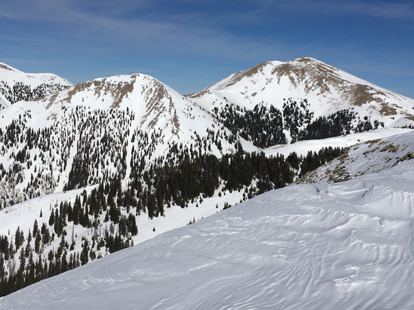
Where did all the snow go? View north from the summit of Haystack Mountain.
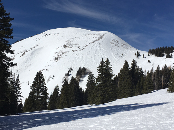
Southeast side of Haystack Mountain. Wind damaged snow exists on all aspects which is hindering the corn snow process. You have to seek out very sheltered areas to find smooth snow.
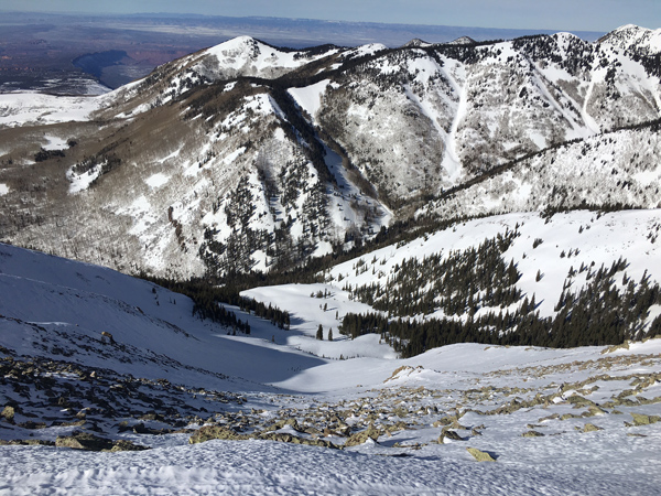
Looking down the north face of Haystack Mountain. Northwest winds have scoured out the upper elevations.
Winds, temperature and humidity on Pre-Laurel Peak New snow totals, temperature and humidity in Gold Basin Total snow depth and temperature at Geyser Pass Trailhead |
 |
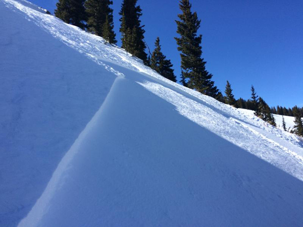
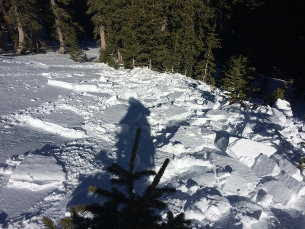
recent activity I received this report of a snowboard triggered, shallow, hard wind slab near Colorado Bowl that occurred on Saturday. The avalanche was triggered on a north facing aspect around 11,000' in wind exposed terrain. These types of wind slabs can be difficult to detect as they are often wind etched on the surface and they lay scattered behind subtle terrain features in otherwise wind scoured terrain.
|
| type | aspect/elevation | characteristics |
|---|

|
|
LIKELIHOOD
 LIKELY
UNLIKELY
SIZE
 LARGE
SMALL
TREND
 INCREASING DANGER
SAME
DECREASING DANGER
|
|
description
With the kind of winds we are going to see today, I would be remiss not to mention the potential for new wind slab development. But with so little snow available for transport, they are going to be very shallow and isolated. The biggest concern is that new slabs may accumulate on top of pre-existing old, hard wind slabs, and when triggered, they may pack a bit more of a punch. Be alert to new slab development in upper elevation, wind exposed terrain on the lee sides of terrain features, gully walls, and underneath rock bands. |
| type | aspect/elevation | characteristics |
|---|

|

|
LIKELIHOOD
 LIKELY
UNLIKELY
SIZE
 LARGE
SMALL
TREND
 INCREASING DANGER
SAME
DECREASING DANGER
|
|
description
In general, the danger for triggering a persistent slab, or deep persistent slab is growing increasingly unlikely and north facing aspects are mostly stable. Areas where you may still encounter a problem are on steep, northerly facing aspects where the snow is shallow, or in areas of extreme rocky terrain. |
 |
weather A fast moving storm system moving through to the north will bring strong winds, and a slight chance for trace amounts of snow to our area. A dry, zonal flow returns for the weekend. Today A chance of snow before 11am, then snow showers likely, mainly after 3pm. Cloudy, with a high near 38. Very windy, with a southwest wind 45 to 55 mph increasing to 55 to 65 mph in the afternoon. Winds could gust as high as 80 mph. Chance of precipitation is 60%. Total daytime snow accumulation of less than a half inch possible. Tonight A 40 percent chance of snow showers, mainly before 9pm. Areas of blowing snow before 10pm. Mostly cloudy, then gradually becoming mostly clear, with a low around 25. Very windy, with a west wind 40 to 50 mph decreasing to 15 to 25 mph. Winds could gust as high as 70 mph. Friday Mostly sunny, with a high near 37. Windy, with a southwest wind 20 to 30 mph, with gusts as high as 40 mph. Friday Night Partly cloudy, with a low around 27. Southwest wind 10 to 15 mph, with gusts as high as 25 mph. Saturday Sunny, with a high near 36. West wind 5 to 10 mph. Saturday Night Mostly clear, with a low around 25. Sunday Mostly sunny, with a high near 34. |
| general announcements Road Conditions: The road is plowed and mostly melted out down to the dirt. Grooming: The trails were groomed on Monday. To post an observation go here. You can view Moab observations here. You can also give me a call on my cell phone at 801-647-8896 To receive this advisory by email go here. This information does not apply to developed ski areas or highways where avalanche control is normally done. This advisory is from the U.S.D.A. Forest Service, which is solely responsible for its content. This advisory describes general avalanche conditions and local variations always exist. |