| Please join us at the 23rd annual Black Diamond Fall Fundraiser Party Thursday Sept 15. Tickets are on sale now here, at the Black Diamond store & at REI. Special bonus raffle for online ticket purchasers! |
| Please join us at the 23rd annual Black Diamond Fall Fundraiser Party Thursday Sept 15. Tickets are on sale now here, at the Black Diamond store & at REI. Special bonus raffle for online ticket purchasers! |
| Advisory: Moab Area Mountains | Issued by Bruce Tremper for Sunday - January 31, 2016 - 6:11am |
|---|

|
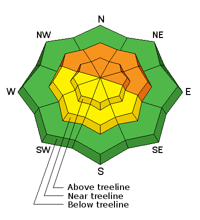
bottom line Although the avalanche danger is mostly LOW to MODERATE today, it should rise to CONSIDERABLE overnight and perhaps even to HIGH on Monday with the expected snow. The avalanche danger will depend on the amount of snow and wind we get, so you should monitor the snow amounts on the automated weather stations and on this advisory, which I will update again tomorrow morning.
|
 |
avalanche watch I will continue to avalanche watch today, likely turning to an avalanche warning overnight or on Monday with expected snowfall. |
 |
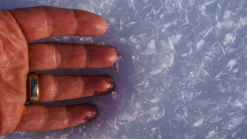
current conditions Hello, this is Bruce Tremper, filling in for Eric Trenbeath for the next week. We only got a measly 2-3 inches of snow overnight and temperatures have dropped into the mid teens from near freezing yesterday. But don't loose hope. We're supposed to have light snow showers today and the main part of the storm is supposed to kick in tonight and on Monday with about a foot of additional snow. Base depth in gold Basin: 66" Winds, temperature and humidity on Pre-Laurel Peak New snow totals, temperature and humidity in Gold Basin Total snow depth and temperature at Geyser Pass Trailhead
|
 |
recent activity
|
| type | aspect/elevation | characteristics |
|---|

|
|
LIKELIHOOD
 LIKELY
UNLIKELY
SIZE
 LARGE
SMALL
TREND
 INCREASING DANGER
SAME
DECREASING DANGER
|
|
description
Although the avalanche danger is mostly LOW to MODERATE today, it should rise to CONSIDERABLE overnight and on Monday with the expected snow. The pre-existing snowpack is mostly deep and stable but the weakest layers are on the pre-existing snow surface. In some of the upper elevation, steep, shaded slopes, I have been finding more near-surface faceted snow just under the snow surface, especially in repeater slide paths. Here's a quick video of what I found yesterday in the upper section of Corkscrew, which slid during the Solstice storm and the snow surface has remained as weak, sugary, faceted snow that is still quite sensitive.
In addition, I've been finding very weak and thick layers of surface hoar in the basin bottoms where the cold air pools and you may be able to trigger some more sensitive storm slabs on the more persistently-weak surface hoar in these areas.
|
 |
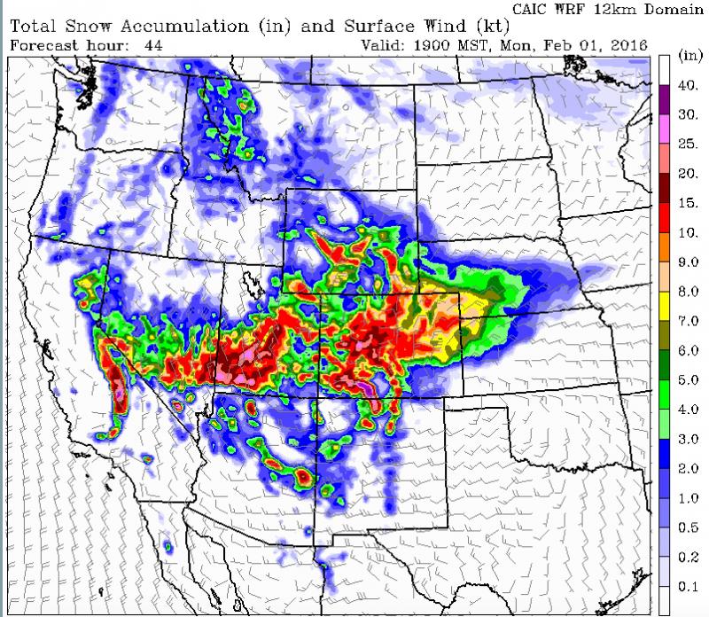
weather The storm is coming in two parts, the cold front that came through last night and the lingering snow showers today, and second, a closed low pressure that will track over the top and to the south of us tonight into Monday. The second part of the storm should be by far the snowiest for southern Utah. The forecast is for about a foot of snow--perhaps more tonight and Monday. Here's the National Weather Service link to the point forecast for the La Sal Mountains. Here's the total, forecast accumulation of snow by Monday the end of the day on Monday.
|
| general announcements Road Conditions: The road has not been plowed but vehicles have packed down the snow since the last storm and it's very passable with 4x4 and good tires. The Forest Service is working with Grand and San Juan Counties to develop a plowing solution. Please bear with us until it can be worked out. Grooming: The groomers put in a good track on Tuesday and it's still in great shape. Thanks for sending in your observations. You can view Moab observations here. To post an observation go here. To receive this advisory by email go here. This information does not apply to developed ski areas or highways where avalanche control is normally done. This advisory is from the U.S.D.A. Forest Service, which is solely responsible for its content. This advisory describes general avalanche conditions and local variations always exist. |