| Please join us at the 23rd annual Black Diamond Fall Fundraiser Party Thursday Sept 15. Tickets are on sale now here, at the Black Diamond store & at REI. Special bonus raffle for online ticket purchasers! |
| Please join us at the 23rd annual Black Diamond Fall Fundraiser Party Thursday Sept 15. Tickets are on sale now here, at the Black Diamond store & at REI. Special bonus raffle for online ticket purchasers! |
| Advisory: Moab Area Mountains | Issued by Eric Trenbeath for Friday - January 8, 2016 - 7:26am |
|---|


|
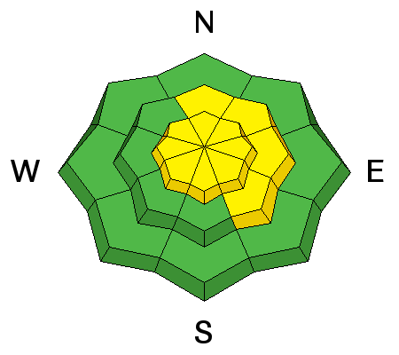
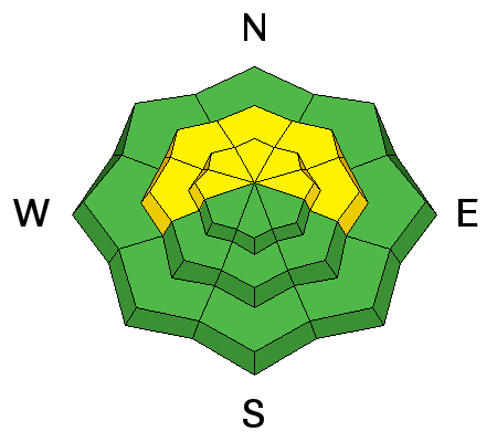
bottom line The avalanche danger is MODERATE on mid and upper elevation slopes steeper than 35 degrees that face W-N-E, and in areas where you can detect recent deposits of wind drifted snow.
|
 |
special announcement The road to Geyser Pass will be closed until San Juan County can get up to plow it. The road has narrowed to less than one lane wide with high banks making it too narrow for Grand County to work their grader. There is also a foot of new snow on it. We will provide more information as it becomes available. The road is not closed to snowmobile traffic. The Utah Avalanche Center-Moab will be hosting an Avalanche 101 class on January 15,16. This course is generously sponsored by Moab Gear Trader and will consist of an evening classroom session and a day out in the field. This course will cover avalanche characteristics and snowpack fundamentals, clues to instability, assessment of avalanche terrain, route finding and companion rescue. For more information, see the link below or contact me at [email protected]. https://utahavalanchecenter.org/classes/moab-backcountry-101 |
 |
current conditions About a foot of medium density snow has fallen since Tuesday and conditions are once again almost as good as it gets. Southerly winds were light most of the day yesterday. They switched to the northwest this morning and are averaging in the single digits with gusts as high as 15 mph. It is currently 15 degrees at 10,000' Thanks to Dave Garcia for submitting this observation. Winds, temperature and humidity on Pre-Laurel Peak New snow totals, temperature and humidity in Gold Basin Total snow depth and temperature at Geyser Pass Trailhead
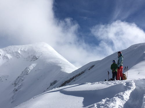
Another gorgeous day on Laurel Ridge.
|
 |
recent activity Yesterday we observed loose snow, point release sluffs on steep slopes approaching 40 degrees. We also noted two, isolated storm slab avalanches that broke on 40 degree convexities. These two pockets were about a foot deep and 20-30 feet wide. This activity was believed to have occurred overnight on the 6th during the period of greatest snowfall intensity. Though overall, a slab within the new snow was lacking, there was a weak bond between the new snow / old snow surface.
|
| type | aspect/elevation | characteristics |
|---|

|
|
LIKELIHOOD
 LIKELY
UNLIKELY
SIZE
 LARGE
SMALL
TREND
 INCREASING DANGER
SAME
DECREASING DANGER
|
|
description
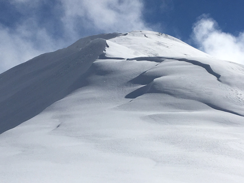
Winds were well behaved during the storm, and have remained mostly calm since. Yesterday we observed drifts up to 18" deep along upper elevation ridge crests, but they lacked cohesion and would only crack right at your skis and then break apart. Slope cuts through drifted areas produce no results. Nevertheless, these drifts are out there, and with a slight increase in westerly winds today, you will need to be on the lookout for increasing wind slab danger in wind exposed terrain.
Drifted snow yesterday lacked cohesion but if winds increase today, expect developing wind slab conditions. |
| type | aspect/elevation | characteristics |
|---|

|
|
LIKELIHOOD
 LIKELY
UNLIKELY
SIZE
 LARGE
SMALL
TREND
 INCREASING DANGER
SAME
DECREASING DANGER
|
|
description
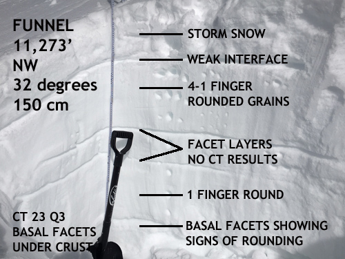
The snow pack is gaining strength and it appears as though some of our mid level faceted layers are gaining strength. Weaknesses still exist on slopes that face W-N- E, but the greatest danger exist on northeasterly facing terrain, in areas that still have a shallow and weak snowpack. In these areas it may be possible to trigger a full depth, deep slab avalanche. Particular caution needs to be given to areas of steep, rocky, and more radical terrain, or those areas on the periphery of slopes where pockets of trees or rock outcroppings can create shallower pockets or "trigger points" for releasing an avalanche. Mind your p's and q's and carefully analyze slopes steeper than 35 degrees that face the north half of the compass.
We dug this pit in the Funnel yesterday. Compression tests produced no results on mid level faceted layers. Failure on facets beneath a crust at 30 centimeters occurred with significant effort. For snow geeks, the score was CT 23 Q 3.
|
 |
weather Friday Snow likely, mainly before noon. Cloudy, with a high near 20. West wind 10 to 15 mph. Chance of precipitation is 60%. New snow accumulation of 3 to 5 inches possible. Friday Night A 50 percent chance of snow. Mostly cloudy, with a low around 12. Northwest wind 10 to 15 mph. New snow accumulation of less than one inch possible. Saturday A 30 percent chance of snow, mainly before 11am. Partly sunny, with a high near 20. West northwest wind 10 to 15 mph. Saturday Night A 20 percent chance of snow. Mostly cloudy, with a low around 7. West southwest wind around 10 mph. Sunday A 30 percent chance of snow, mainly after 11am. Partly sunny, with a high near 13. |
| general announcements Road Conditions: I don't have updated plowing information this morning so expect to find several inches of new snow on the road. I'll be heading up today and will provide more detailed information by tomorrow. Grooming: Groomers are holding off until this wave of storminess passes. I expect they will be out by tomorrow. Thanks for sending in your observations. You can view Moab observations here. To post an observation go here. To receive this advisory by email go here. This information does not apply to developed ski areas or highways where avalanche control is normally done. This advisory is from the U.S.D.A. Forest Service, which is solely responsible for its content. This advisory describes general avalanche conditions and local variations always exist. |