| Please join us at the 23rd annual Black Diamond Fall Fundraiser Party Thursday Sept 15. Tickets are on sale now here, at the Black Diamond store & at REI. Special bonus raffle for online ticket purchasers! |
| Please join us at the 23rd annual Black Diamond Fall Fundraiser Party Thursday Sept 15. Tickets are on sale now here, at the Black Diamond store & at REI. Special bonus raffle for online ticket purchasers! |
| Advisory: Moab Area Mountains | Issued by Eric Trenbeath for Sunday - November 29, 2015 - 6:45am |
|---|


|
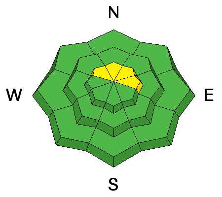
bottom line The avalanche danger is generally LOW at this time, but there is an isolated or MODERATE danger for triggering a recently deposited, soft, shallow wind slab along the lee sides of upper elevation ridge crests that face NE-N-NW. There also remains a very isolated, or MODERATE danger for triggering a persistent slab on slopes steeper than 35 degrees with a NW-N-E aspect right around tree line and above, in areas of rocky and radical terrain.
|
 |
current conditions Another inch of snow fell in the mountains last night. Combined with the 3" that came in on Friday night, conditions have improved a bit, particularly in sheltered areas where the underlying snow was still soft or where the surface was relatively smooth. Pre Laurel winds are unavailable until we get another part next week, but down on Abajo Peak, winds yesterday got up to near 30 mph from the SE, but they dropped off overnight into the single digits shifting to SW. It's a very frigid 3 degrees on Pre Laurel Peak, and 11 at the Geyser Pass Trailhead. The new snow definitely freshened things up a but, but the underlying surface had been pretty worked over by the wind and sun over the past couple of weeks. Seek sheltered areas for the best conditions, and remember that it is still a shallow, early season snow pack and many obstacles such as stumps, rocks, and dead fall lurk beneath the surface. Base depth in Gold Basin: 32" Base depth at Geyser Pass Trailhead: 21" Winds, temperature and humidity on Pre-Laurel Peak New snow totals, temperature and humidity in Gold Basin Total snow depth and temperature at Geyser Pass Trailhead
|
| type | aspect/elevation | characteristics |
|---|

|
|
LIKELIHOOD
 LIKELY
UNLIKELY
SIZE
 LARGE
SMALL
TREND
 INCREASING DANGER
SAME
DECREASING DANGER
|
|
description
There was just enough wind and new snow yesterday to form soft, shallow wind drifts along the lee sides of upper elevation ridge crests on slopes that face NE-N-NW. Most likely too soft and shallow to pose much of a problem, they are nevertheless something to be aware of, particularly if you find yourself in steep and radical terrain where one might sweep you off your feet. |
| type | aspect/elevation | characteristics |
|---|

|

|
LIKELIHOOD
LIKELY
UNLIKELY
SIZE
 LARGE
SMALL
TREND
INCREASING DANGER
SAME
DECREASING DANGER
|
|
description
Depth hoar development has accelerated near the ground, and the snow pack is still harboring some weak layers, but stability tests yesterday showed the pack to be mostly stable. It may still be possible to trigger a persistent slab avalanche in the usual suspect areas - steep, rocky slopes that face the north half of the compass, right around and above treeline, and these areas should always be approached with caution, but in general, the identified weaknesses are more of a concern for future snow loads. |
 |
weather The closed upper level low center that gave us another dose of snow last night will lift on into Wyoming today and the flow will shift to NW. We may see one more chance at some showers today and into tonight before the low spins out of here. A deepening trough over the eastern Pacific will build a ridge over our area by mid-week. Today A slight chance of snow before noon, then isolated snow showers between noon and 5pm, then a chance of snow after 5pm. Mostly cloudy, with a high near 34. Calm wind becoming west around 5 mph in the afternoon. Chance of precipitation is 30%. Tonight A 30 percent chance of snow, mainly before 8pm. Mostly cloudy, with a low around 16. West northwest wind 5 to 10 mph. Monday Mostly sunny, with a high near 32. West wind 5 to 10 mph. Monday Night Mostly clear, with a low around 15. West wind around 5 mph becoming east southeast after midnight. Tuesday Sunny, with a high near 36. East wind around 5 mph becoming northwest in the afternoon. Tuesday Night Mostly clear, with a low around 16. Wednesday Sunny, with a high near 38. Wednesday Night Mostly clear, with a low around 20. Thursday Sunny, with a high near 42. |
| general announcements The Road to the Geyser Pass Trailhead is plowed but with patches of mud, ice and packed snow. Thanks for sending in your observations. You can view Moab observations here. To post an observation go here. To receive this advisory by email go here. This information does not apply to developed ski areas or highways where avalanche control is normally done. This advisory is from the U.S.D.A. Forest Service, which is solely responsible for its content. This advisory describes general avalanche conditions and local variations always exist. |


