| During the month of April, Mark Miller will donate $75 to the charity of your choice (5 to chose from, including the Utah Avalanche Center!) Mark Miller Subaru has raised over $300k in the previous 6 Do Good Feel Good events. More Info here |  |
| During the month of April, Mark Miller will donate $75 to the charity of your choice (5 to chose from, including the Utah Avalanche Center!) Mark Miller Subaru has raised over $300k in the previous 6 Do Good Feel Good events. More Info here | |
| Advisory: Moab Area Mountains | Issued by Eric Trenbeath for Friday - January 17, 2014 - 6:47am |
|---|

|
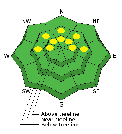
bottom line The avalanche danger is generally LOW at this time. Low danger doesn't mean no danger, and you still need to be alert to unstable snow on isolated terrain features. There are isolated pockets of MODERATE danger where it is possible to trigger a loose, faceted snow avalanche, primarily on very steep, shady terrain where the entire snow pack consists of weak, sugary snow. There also remains a very isolated MODERATE danger for triggering a buried persistent slab, primarily on upper elevation, steep terrain that faces the north half of the compass.
|
 |
current conditions
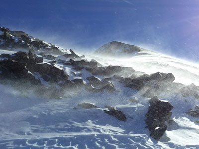
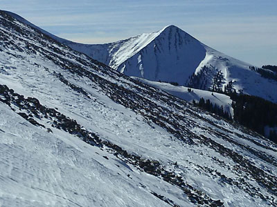
La Sal Mountains We need snow, need I say more? Adding insult to injury, north winds have been relentless. Over the past 24 hours, they have been blowing in the 20-30 mph range with gusts up to 50 mph along the ridge tops. On my tour to the summit of Mt. Mellenthin yesterday, I could literally watch the snow pack on the North Face being eroded away. The snow surface in exposed areas is beginning to resemble the surrounding red rock desert with a variety of hard and breakable wind and sun crusts. In the most sheltered, mid and lower elevations it is still possible to find soft snow, but in these areas, faceted grains, or sugar snow have taken over most of the pack and in some cases, it is possible to sink right through to the ground.
Abajo Mountains Winds have been better behaved on Abajo Peak, with averages in the teens and gusts in the 20's from the NW. However, low snow conditions prevail with many sun exposed slopes showing bare ground. |
| type | aspect/elevation | characteristics |
|---|

|
|
LIKELIHOOD
 LIKELY
UNLIKELY
SIZE
 LARGE
SMALL
TREND
 INCREASING DANGER
SAME
DECREASING DANGER
|
|
description
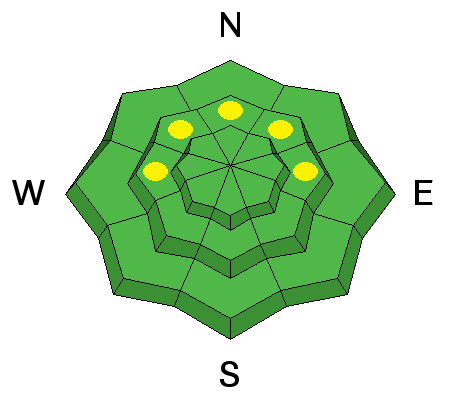
As the faceting process takes over the snow pack, there are areas where it is possible to trigger a loose, faceted snow avalanche. This danger exists primarily on steep, shady, sheltered slopes at mid to upper mid elevations.You can recognize these areas where the snow is unsupportable, or barely supportable for a skier or snowmobile, and where you can stick your ski pole right through to the ground. Though not large, these loose snow avalanches can sweep you of your feet, slamming you into trees or carrying you over a rock band.
|
| type | aspect/elevation | characteristics |
|---|

|
|
LIKELIHOOD
LIKELY
UNLIKELY
SIZE
 LARGE
SMALL
TREND
 INCREASING DANGER
SAME
DECREASING DANGER
|
|
description
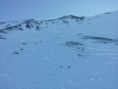
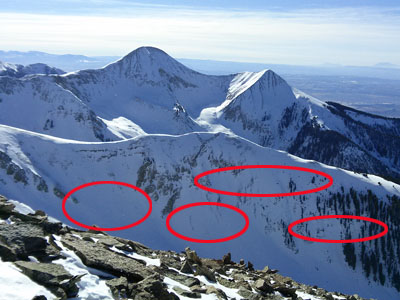
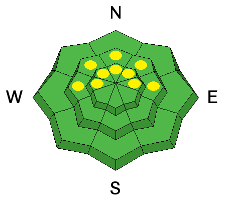
The snow pack is currently very weak, and in many cases, complex, with a variety of weak faceted layers, crust/facet combinations, as well as depth hoar. Persistent slabs themselves are deteriorating, but they can still be found, primarily on upper mid-elevation terrain facing the north half of the compass. Persistent north winds have scoured typical starting zones, so areas to suspect are further down slope than usual. This danger is very isolated, and persistent slabs would be difficult to difficult trigger, nevertheless, they would be fairly large and dangerous. Photo below shows the type of areas that remain suspect.
|
 |
weather We are firmly entrenched in high pressure. Expect light NW winds shifting to SW by Sunday.High temperatures during the day at 10,000' will climb into the upper 30's, with overnight lows in the lower 20's. |
| general announcements OBSERVATIONS: If you are out and about in the mountains, I'd love to know what you are seeing so please SUBMIT OBSERVATIONS You can read current OBSERVATIONS HERE. LUNA GROOMING INFORMATION: Grooming is scheduled for Mondays and Fridays. ROAD CONDITIONS: The road is clear. UAC MOBILE APP: Get your advisory on your iphone with this app
|


_2.jpg)