SPECIAL ANNOUNCEMENT |
 |
The Geyser Pass Road has been plowed today (Tuesday)
LUNA volunteer Matt Hebberd has rolled the entire track, including the Loppet loop and put a perfect groom into Gold Basin! Way to go Matt! Nordic Skiing is alive and well in the La Sal's! |
|
|
BOTTOM LINE
Danger by aspect and elevation on slopes approaching 35° or steeper.
(click HERE for tomorrow's danger rating)
|

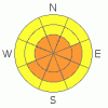
Danger Rose Tutorial
|
The Bottom Line for President's Day will be an Avalanche Danger of Considerable for all wind loaded and storm affected slopes greater than 35 degrees across both ranges. Large snow accumulations, strong winds and cold temperatures have combined to create brittle wind slabs.
It would be wise to enjoy the fruits of the storm in wind sheltered locations out of and not underneath avalanche terrain. Stay on low angled slopes and meadows and also out of terrain traps such as steep gullies. |
|
|
CURRENT CONDITIONS |

|
A sleeper of a storm rolled through southeast Utah on Sunday, bringing thunder snow to the Moab Valley and creating precipitation intensities of 3" per hour for six hours. Storm totals are impressive in the La Sal Mountains. 0.8"of H20 accumulated 13" of snow at the Geyser Pass Trailhead while Gold Basin topped 16" in a six hour period.
San Juan County will have their hands full. 4WD and chains will be necessary today. If you don't make it to the TH, park so the plows can still remove snow from the roads. |
|
|
RECENT ACTIVITY |

|
None to report, but that should change after today...if we can get up there! |
|
|
THREAT #1 |

|
| WHERE |
PROBABILITY |
SIZE |
TREND |
|
|
|
|
| |
|
|
Over the next
24 hours.
|
|
|
Winds have been quite consistent and strong out of the NW this morning, transporting snow onto leeward sides of slopes and ridges. Remember, wind slabs are the most reactive during or immediately after their formation. We are in this time frame. |
|
|
THREAT #2 |

|
| WHERE |
PROBABILITY |
SIZE |
TREND |

|
|
|
|
| |
|
|
Over the next
24 hours.
|
|
|
Hard telling, not knowing. The blanket Considerable is for the snow water equivalent of 0.8" (heavy for a continental snow pack) and assuming that the new snow/old snow interface has some type of faceted weak layer not allowing it to bond. |
|
|
MOUNTAIN WEATHER |

|
@ 10,000' in the La Sal Mountains, Utah Washington's Birthday: A 20 percent chance of snow before 8am. Mostly sunny, with a high near 26. Wind chill values as low as -20. North northwest wind 10 to 15 mph becoming southwest. Winds could gust as high as 25 mph. Tonight: A 30 percent chance of snow, mainly after 3am. Mostly cloudy, with a low around 11. Southeast wind around 10 mph becoming west southwest. Winds could gust as high as 25 mph. Tuesday: A slight chance of snow between 10am and 11am. Mostly sunny, with a high near 31. Calm wind becoming west between 5 and 10 mph. Chance of precipitation is 20%. Tuesday Night: Partly cloudy, with a low around 16. South southwest wind around 5 mph becoming calm. Wednesday: Sunny, with a high near 36. Calm wind becoming west between 5 and 10 mph. |
|
|
This information does not apply to developed ski areas or highways where avalanche control is normally done. This advisory is from the U.S.D.A. Forest Service, which is solely responsible for its content. This advisory describes general avalanche conditions and local variations always occur. |
|
This advisory provided by the USDA Forest Service, in partnership with:
The Friends of the Utah Avalanche Center, Utah Division of State Parks and Recreation, Utah Division of Emergency Management, Salt Lake County, Salt Lake Unified Fire Authority and the friends of the La Sal Avalanche Center. See our Sponsors Page for a complete list. |
