BOTTOM LINE
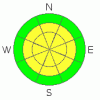
Danger by aspect and elevation on slopes approaching 35° or steeper.
(click HERE for tomorrow's danger rating)
|

Danger Rose Tutorial
|
MODERATE or Level 2 avalanche danger still exist in the mountains of SE Utah. Watch for wind slabs in the high country. Watch daytime heating. Reports of good skiing now being limited by formation of suncrusts now that the warm-up has arrived. Powder skiing on E-NE-NW facing slopes is your best bet for good skiing and riding conditions. With the warm temperatures and forecast high pressure, we may enter into our first corn snow cycle soon. |
|
|
CURRENT CONDITIONS |

|
Clear skies continue to dominate the area with a high pressure ridge parked over the Great Basin. Warmer temperatures have arrived in all but the most stubborn snow-covered valley locations. No major change in the current pattern is expected until mid week of next week. Winds have finally started to subside - they're in the single digits from the NW right now - but there is wind damage to snow coverage up high. The best skiing and riding conditions will be found on shady side slopes E-NE-NW facing at low and mid elevations. We have 150 Cm at our Gold Basin Study Plot and we're at 108% of normal in the La Sals, 139% in the Abajos.
Roads to all SE Utah mountain accesses have been opened up including Geyser Pass, La Sal Eastside and Abajo north end access.
The entire La Sal Nordic Track has been groomed for skate skiing. Gold Basin and the Lower Nordic loops have been groomed for both cross-country and skate skiing. Enjoy. Thanks volunteers. |
|
|
RECENT ACTIVITY |

|
Limited class 2 activity noted from Wednesday. Quiet since then.
You can submit photos and snowpack or avalanche observations here. Send 'em in!! |
|
|
THREAT #1 |

|
| WHERE |
PROBABILITY |
SIZE |
TREND |
|
|
|
|
| |
|
|
Over the next
48 hours.
|
|
|
Avalanche Dangers are on the decline with 4 days passing since our last storm and the freight train winds finally abating. We do have buried weak layer in the snow pack but we've not heard about any more avalanche activity since the day after our last storm. Our buried weak layers, in the form of faceted crystals and surface hoar, formed during January high pressure and now linger as weaknesses that are hard to absolutely predict failure on. This uncertainty, and the variable distribution of our new snow due to the windy nature of our peaks, has wreaked havoc on the psyches of avalanche professionals and ski mountaineers at our latitudes for generations. You just can't trust the mid winter continental snowpack. Wind slabs on these weak layers remain our biggest threat. We are grudgingly lowering the avalanche danger to MODERATE, meaning Human Triggered avalanches are still possible, but natural avalanches are unlikely. Watch out on wind loaded E-SE-SW facing slopes or any other slopes that may be cross-loaded by canyon winds. |
|
|
THREAT #2 |

|
| WHERE |
PROBABILITY |
SIZE |
TREND |

|
|
|
|
| |
|
|
Over the next
8 hours.
|
|
|
Today's forecast high of 45 for 10,000 feet means things will be warm in the high country. Expect avalanche dangers to climb to MODERATE (Level 2) with daytime heating. Don't stay out on sunny steeps too late in the day today. Our buried weak layers (discussed in the previous section) are not limited to cold, powder snow and could be activated by heating. |
|
|
MOUNTAIN WEATHER |

|
NOAA MOUNTAIN WEATHER FORECAST FOR THE LA SALS @10,000FT:
Today: Sunny, with a high near 45. Calm wind becoming north around 5 mph. Tonight: Clear, with a low around 21. Calm wind becoming east around 5 mph. Sunday: Sunny, with a high near 49. Calm wind becoming south around 5 mph. Sunday Night: Mostly clear, with a low around 23. East wind around 5 mph becoming calm. Monday: Mostly sunny, with a high near 55. Calm wind becoming east southeast around 5 mph. Monday Night: Partly cloudy, with a low around 25. Tuesday: Mostly sunny, with a high near 57. Tuesday Night: Partly cloudy, with a low around 26. Wednesday: Mostly sunny, with a high near 57. |
|
|
GENERAL ANNOUNCEMENTS |
We will update this message Monday morning.
If you see an avalanche or would like to share any snowpack observations (please do!) you can call us at 435-636-3363, e-mail Dave at : dave@utahavalanche center.org, or use the backcountry observations form here. These observations really help! |
|
|
This information does not apply to developed ski areas or highways where avalanche control is normally done. This advisory is from the U.S.D.A. Forest Service, which is solely responsible for its content. This advisory describes general avalanche conditions and local variations always occur. |
|
This advisory provided by the USDA Forest Service, in partnership with:
The Friends of the Utah Avalanche Center, Utah Division of State Parks and Recreation, Utah Division of Emergency Management, Salt Lake County, Salt Lake Unified Fire Authority and the friends of the La Sal Avalanche Center. See our Sponsors Page for a complete list. |
