BOTTOM LINE
Danger by aspect and elevation on slopes approaching 35° or steeper.
(click HERE for tomorrow's danger rating)
|
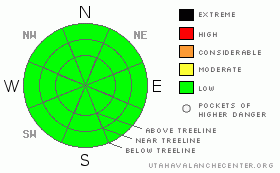
Danger Rose Tutorial
|
LOW or Level 1 Avalanche Dangers will be encountered in the mountains of SE Utah at the moment. Pockets of wind slab on high mountain ridgelines are still possible but they will be very isolated. We expect a rise in the avalanche danger over the next couple of days.
It is getting tougher and tougher to find good skiing in SE Utah. Very sheltered shady side slopes are the only place where you'll find good snow. You may be able to find some mid-winter corn snow, but it will only be available for harvesting this morning, after that a return to winter weather is forecast. |
|
|
CURRENT CONDITIONS |

|
Warmer temperatures at Trailhead elevations today>30 degrees at the Geyser Pass Snotel site. 18.5 degrees on Pre-Laurel Peak with winds from the SW in the high 20's gusting to 45. Won't feel warm there. Skiing and Riding conditions are in dire need of a reset. We've got 51.5" inches of snow at our Gold Basin Study Plot in the La Sals and our percentage of normal water on the year hangs in there at an amazing 106% of normal. Even more amazing, water totals in the Abajos are still at 160%. The problem is, that the bulk of our snowpack arrived in two storm events way back in 2010. La Nina seems to have us firmly in her grasp at the moment. The snow at and near the surface has been etched, sculpted, lifted, drifted, stripped, pounded, pressed, re-cycled, skied and faceted for all of 2011 and it's a mosaic of crusts, slabs, sastrugi, facets and wind board. Low to Mid elevation shady side slopes are your best bet for decent turns right now and good luck finding those. Pray for snow
All mountain trailhead accesses are open at this time. Geyser Pass, Lasal East side, and the access road to the old Blue Mountain Ski Area are all clear. The La Sal Mountain Loop road is open from the Castle Valley side as well.
All of the La Sal Nordic system has been groomed by Luna Volunteers for classic cross-country and skate skiing. It's the best bet in the La Sals right now for good conditions. Thanks Matt, Kristi and Jesse. Conditions are fast. |
|
|
RECENT ACTIVITY |

|
We're quite a ways out from any recent activity. An archive of avalanches and terrain photos for SE Utah has been posted under the "current conditions" tab if you are interested.
You can also submit photos and snowpack or avalanche observations here. |
|
|
THREAT #1 |

|
| WHERE |
PROBABILITY |
SIZE |
TREND |

|
|
|
|
| |
|
|
Over the next
48 hours.
|
|
|
WInd Slabs remain possible in "the Alpine" above treeline. This is most likely in areas loaded, or cross-loaded, with wind drifted snow. While avalanche dangers are mostly LOW , a residual danger may still exist for an isolated pocket to pop out. We have lowered the danger rating to this level only grudgingly. Low danger does not mean no danger. Expect the danger rating to rise as snow (hopefully) piles up with this next storm.
We DO have buried persistent weak layers buried in our snow pack that are likely to become active when we get a real storm in our region. Weak snowpack structures continue to be identified and linger in the thinner snowpack areas of both the Abajos and the La Sal Mountains. Weakness between hard wind slabs were noted in snowpit tests yesterday near treeline and did not inspire confidence. Near surface faceting has been occurring during this extended high pressure and avalanche conditions should be predictably spectacular when and if we ever get any more snow. Dig around and see if you can locate buried surface hoar or faceted grains between the Christmas and New Year's storms and above the New Year's storm. You can feel this layering in most areas by poking your pole in the snow. Note the character of the surface snow. This layering is one of the characteristics of our Southwestern Snowpack and might lead to big avalanches ripping down into old snow. |
|
|
MOUNTAIN WEATHER |

|
NOAA MOUNTAIN WEATHER FORECAST FOR THE LA SALS @10,000FT:
Today: Increasing clouds, with a high near 36. South wind around 10 mph. Tonight: A slight chance of flurries before 11pm, then snow likely. Cloudy, with a low around 22. South wind between 5 and 10 mph. Chance of precipitation is 60%. New snow accumulation of less than one inch possible. Monday: Snow likely. Cloudy, with a high near 28. Southeast wind 5 to 10 mph becoming west northwest. Chance of precipitation is 70%. New snow accumulation of 1 to 3 inches possible. Monday Night: Snow likely. Cloudy, with a low around 9. Northwest wind between 5 and 15 mph. Chance of precipitation is 60%. New snow accumulation of 1 to 2 inches possible. Tuesday: Snow likely. Cloudy, with a high near 19. Blustery, with a north northwest wind 5 to 10 mph increasing to between 15 and 20 mph. Winds could gust as high as 30 mph. Chance of precipitation is 70%. Tuesday Night: A 30 percent chance of snow. Mostly cloudy and blustery, with a low around -4. Wednesday: Sunny, with a high near 19. |
|
|
GENERAL ANNOUNCEMENTS |
We will update this message by Tuesday morning, sooner if conditions change.
La Sal Mountain Ski Hut Open House @ Tag-a-Long Tours Tomasaki Cabin Feb 12th & 13. www.tagalong.com
If you see an avalanche or would like to share any snowpack observations (please do!) you can call us at 435-636-3363, e-mail Dave at : dave@utahavalanche center.org, or use the backcountry observations form here. These observations really help! |
|
|
This information does not apply to developed ski areas or highways where avalanche control is normally done. This advisory is from the U.S.D.A. Forest Service, which is solely responsible for its content. This advisory describes general avalanche conditions and local variations always occur. |
|
This advisory provided by the USDA Forest Service, in partnership with:
The Friends of the Utah Avalanche Center, Utah Division of State Parks and Recreation, Utah Division of Emergency Management, Salt Lake County, Salt Lake Unified Fire Authority and the friends of the La Sal Avalanche Center. See our Sponsors Page for a complete list. |
