BOTTOM LINE
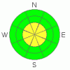
Danger by aspect and elevation on slopes approaching 35° or steeper.
(click HERE for tomorrow's danger rating)
|

Danger Rose Tutorial
|
The BOTTOM LINE for tomorrow in the Abajo and La Sal Mountains is an avalanche danger of MODERATE or LEVEL 2. Watch for wind slabs in the Alpine Terrain.
It is getting tougher and tougher to find good skiing in SE Utah. Very sheltered shady side slopes are the only place where you'll find good snow. We really need to freshen things up at this point. |
|
|
CURRENT CONDITIONS |

|
Radar Echoes are increasing ahead of a weak shortwave that is supposed to hit SE Utah today and early tonight. Temperatures remain mild with trailhead temperatures of 27 degrees this morning and light-moderate NW winds.
Good skiing conditions are getting harder and harder to find. Sheltered E-NE-N slopes are your best bet
The Geyser Pass road is buffed. Access to the old Blue Mountain Ski area in the Abajos has been plowed to the base of the hill - very convenient!
Almost all of the La Sal Nordic system has been groomed by Luna Volunteers. It's the best bet in the La Sals right now for good conditions. |
|
|
RECENT ACTIVITY |

|
We're quite a ways out from any recent activity. An archive of avalanches and terrain photos for SE Utah has been posted under the "current conditions" tab if you are interested. |
|
|
THREAT #1 |

|
| WHERE |
PROBABILITY |
SIZE |
TREND |
|
|
|
|
| |
|
|
Over the next
48 hours.
|
|
|
Isolated wind slabs in the Alpine remain a possibility. Look for localized area of wind drifting. Avoid hollow sounding or snow that has a drum like quality to it. "Lens-shaped" depositions of snow should be suspect. South and Southeast facing slopes may be loaded by winds from the north of late. Cross loading on other aspects is possible. |
|
|
THREAT #2 |

|
| WHERE |
PROBABILITY |
SIZE |
TREND |

|
|
|
|
| |
|
|
Over the next
24 hours.
|
|
|
We have persistent weak layers buried in our SE Utah snowpack. I have been harping on about them for a while now...Buried Surface Hoar and layers of Faceted grains may come back as failure layers when we finally get another real snowstorm. They are more prevalent, observable and REACTIVE in thinner snowpack areas. Take the time to feel around...dig into or poke the snowpack and feel for weaker layers. |
|
|
MOUNTAIN WEATHER |

|
NOAA MOUNTAIN WEATHER FORECAST FOR THE LA SALS @10,000FT:
Today: A 50 percent chance of snow. Cloudy, with a high near 31. West wind between 5 and 15 mph, with gusts as high as 35 mph. Total daytime snow accumulation of around an inch possible. Tonight: A 30 percent chance of snow. Mostly cloudy, with a low around 12. North northwest wind around 10 mph, with gusts as high as 25 mph. Sunday: Mostly sunny, with a high near 33. North wind around 5 mph, with gusts as high as 20 mph. Sunday Night: Partly cloudy, with a low around 16. West northwest wind around 5 mph becoming southeast. Winds could gust as high as 20 mph. Monday: A 20 percent chance of snow. Partly sunny, with a high near 35. Breezy, with a north northeast wind around 20 mph. Monday Night: Mostly cloudy and breezy, with a low around 20. Tuesday: Mostly sunny and breezy, with a high near 36. Tuesday Night: Partly cloudy and breezy, with a low around 20. Wednesday: Mostly sunny and breezy, with a high near 35. |
|
|
GENERAL ANNOUNCEMENTS |
We will update this message Sunday morning, sooner if conditions change.
The Utah Avalanche Center has a limited number of discount lift tickets available for several Utah Ski Resorts. Follow this link for more information: http://www.backcountry.com/utah-avalanche-center
Our yearly Level 1 class will be held January 28, 29 and 30 of this winter season. The level 1 class focuses on avalanche phenomena, recognition and management of terrain where you might encounter these beasts and basic rescue.
Call 435-636-3363 and speak to Dave or Max for more information or to sign up. |
|
|
This information does not apply to developed ski areas or highways where avalanche control is normally done. This advisory is from the U.S.D.A. Forest Service, which is solely responsible for its content. This advisory describes general avalanche conditions and local variations always occur. |
|
This advisory provided by the USDA Forest Service, in partnership with:
The Friends of the Utah Avalanche Center, Utah Division of State Parks and Recreation, Utah Division of Emergency Management, Salt Lake County, Salt Lake Unified Fire Authority and the friends of the La Sal Avalanche Center. See our Sponsors Page for a complete list. |
