SPECIAL ANNOUNCEMENT |
 |
Please note the the LSAC has changed the date of our 3-day AIARE Level 1 avalanche class from the last weekend of January to the first weekend of February. The dates are now February 5,6,7. Click here for more info. |
|
|
BOTTOM LINE
Danger by aspect and elevation on slopes approaching 35° or steeper.
(click HERE for tomorrow's danger rating)
|
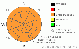
Danger Rose Tutorial
|
Click here to see the newly revised North American Avalanche Danger Scale.
CONSIDERABLE Avalanche Danger in the Mountains of SE Utah including the La Sal and Abajo Ranges. Reports of excellent conditions have come in, but they have been very limited due to closed access roads. Information is sparse other than the knowledge of massive snow totals on a weak snowpack. Pre-Laurel weather station is down. Ski and ride safely and avoid open slopes steeper than 30 degrees. |
|
|
CURRENT CONDITIONS |

|
We are calling the Avalanche Danger in SE Utah CONSIDERABLE at the moment. Conditions are good and this last storm has pushed us from below normal to 113% of normal in the La Sals and 165% of normal in the Abajos. With over 3 inches of new water in the La Sals and over 6 inches of water in the Abajos, skiers and rider have a lot to smile about, but don't rush into steep terrain just yet. Read on for more on this.
Roads to the winter trailheads have been cleared on the east and west access points to the La Sals. the road to Geyser Pass is narrow however as they have not had the grater up yet. Be prepared for evasive manoeuvers if you encounter another vehicle.
The road into Gold Basin has been groomed for skate skiing. Thanks Matt! |
|
|
RECENT ACTIVITY |

|
Check out more info on avalanche classification here.
In limited visibility Wednesday we saw one slide on the west side of TUKNO, class R2D2+.
Observations from the La Sals are very limited at this time due to lack of access. Please keep in mind that in the San Juans to our east with a similar snowpack, they are seeing a massive avalanche cycle larger than anything they've seen in 17 years.
There has been a fatality in Northern Utah and several other close calls. Heads up. Here's a link to Sunday's accident near Snowbasin. |
|
|
THREAT #1 |

|
| WHERE |
PROBABILITY |
SIZE |
TREND |

|
|
|
|
| |
|
|
Over the next
48 hours.
|
|
|
Click here to see the newly revised North American Avalanche Danger Scale.
Limited observations from out mountain due to damaged equipment and blocked roads are keeping forecasting details to the absolute basics. Massive Load + Weak Old Snowpack = High avalanche danger. As time passes and the snowpack adjusts to it's new load the avalanche danger diminishes. With persistent weak layers (near surface facets and depth hoar) the danger diminishes much more slowly. Human triggered avalanches are still likely on slopes steeper than 30 degrees in the Mountains of SE Utah. Please be conservative until we get evidence that travel on steeper slopes can be done with safety.
More snow is in the forecast so an increase in the Avalanche Danger across the region is not out of the question. |
|
|
MOUNTAIN WEATHER |

|
National Weather Service Forecast for 10,000 Ft. :
Tonight: A 50 percent chance of snow, mainly after 11pm. Cloudy, with a low around 17. South wind around 10 mph. Total nighttime snow accumulation of 1 to 2 inches possible. Wednesday: Snow. High near 29. South wind between 5 and 15 mph. Chance of precipitation is 90%. New snow accumulation of 2 to 4 inches possible. Wednesday Night: Snow. Low around 18. West northwest wind between 5 and 10 mph. Chance of precipitation is 90%. New snow accumulation of 3 to 7 inches possible. Thursday: Snow. High near 27. Calm wind becoming north northwest between 5 and 10 mph. Chance of precipitation is 80%. New snow accumulation of 1 to 2 inches possible. Thursday Night: Snow likely before 11pm. Mostly cloudy, with a low around 15. North wind around 5 mph becoming east. Chance of precipitation is 60%. Friday: Mostly sunny, with a high near 31. Friday Night: Partly cloudy, with a low around 16.
|
|
|
GENERAL ANNOUNCEMENTS |
As the season gets underway, we would like to thank the hard working volunteers at the Friends of the La Sal Avalanche Center. Without their help the center would not meet it's funding or staffing requirements. Thanks all! If you would like more information about donating to the Friends or simply helping out, click here.
Local Avalanche Education:
LSAC Level One Avalanche Class - 3 days, February 5-7 - Call 435-636-3363 to reserve a spot or get more info.
This advisory will expire in 48 hours! |
|
|
This information does not apply to developed ski areas or highways where avalanche control is normally done. This advisory is from the U.S.D.A. Forest Service, which is solely responsible for its content. This advisory describes general avalanche conditions and local variations always occur. |
|
This advisory provided by the USDA Forest Service, in partnership with:
The Friends of the Utah Avalanche Center, Utah Division of State Parks and Recreation, Utah Division of Emergency Management, Salt Lake County, Salt Lake Unified Fire Authority and the friends of the La Sal Avalanche Center. See our Sponsors Page for a complete list. |
