SPECIAL ANNOUNCEMENT |
 |
Please note the the LSAC has changed the date of our 3-day AIARE Level 1 avalanche class from the last weekend of January to the first weekend of February. The dates are now February 5,6,7. Click here for more info. |
|
|
BOTTOM LINE
Danger by aspect and elevation on slopes approaching 35° or steeper.
(click HERE for tomorrow's danger rating)
|

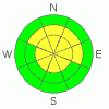
Danger Rose Tutorial
|
MODERATE avalanche dangers can be found in the Mountains of SE Utah at this time. Even at 100% of normal snowpack ground hazards are, uh, pronounced. Winds have been at work and some areas are alternately stripped or loaded above treeline and there is a fair bit of wind damaged snow up high. Sheltered below treeline slopes will provide the best turning and riding conditions until we get some more snow. Maybe midweek next week.
Click here to see the newly revised North American Avalanche Danger Scale. |
|
|
CURRENT CONDITIONS |

|
On our tour to Mt. Tomasaki today we experienced great views and a beautiful day. Unfortunately the beauty was only skin deep. Shallow , rotten snow and a variety of crusts await the traveler who ventures onto south facing terrain. From where we were, the shady side skiing wasn't much more appetizing. It seems like a much more shallow snowpack around the east and north side of Geyser Pass than in Gold Basin. We were walking around on 1-2 feet of snow (or less...) for the majority of our tour. The snow was surprisingly shallow considering the 20 Inch storm we had a week ago. Best to keep the turning to sheltered and more filled in areas. We are at 100% of normal based on the snowpack weight at the NRCS Snotel site, and where there is enough snow to ski or ride there are some good conditions to be found. Beware of ground hazards.
Roads are clear and passable to the trailheads. Lot's of traffic is making them slick in places. East and West accesses clear in the La Sals.
LUNA Groomers were up today and attended to the entire nordic trail system in the La Sal. The upper and Lower nordic loops, Geyser Pass and Gold Basin have all been groomed. |
|
|
RECENT ACTIVITY |

|
Check out more info on avalanche classification here.
Nothing recent. Collapsing and cracking seem to be quieting down significantly. |
|
|
THREAT #1 |

|
| WHERE |
PROBABILITY |
SIZE |
TREND |
|
|
|
|
| |
|
|
Over the next
48 hours.
|
|
|
Click here to see the newly revised North American Avalanche Danger Scale.
Dropping the Avalanche Danger down a notch above treeline as a week has passed since our last precipitation and the snowpack has had time to adjust to the load. Winds from 2 days ago not only stripped or damaged snow above treeline but might have created a few "skier education pockets" out in the high country and our weak underlying snowpack is never to be completely trusted. We are calling the Avalanche Danger in the Mountains of SE Utah MODERATE. Human triggered avalanches are still possible at this rating. Rounded wind deposits on E-NE-NW facing terrain are likely trouble spots. |
|
|
MOUNTAIN WEATHER |

|
National Weather Service Forecast for 10,000 Ft. :
Tonight: Mostly clear, with a low around 11. North northeast wind around 5 mph becoming calm.
Saturday: Mostly sunny, with a high near 27. Calm wind becoming northwest around 5 mph.
Saturday Night: Mostly cloudy, with a low around 15. Calm wind.
Sunday: Partly sunny, with a high near 31. Calm wind becoming northwest around 5 mph.
Sunday Night: Partly cloudy, with a low around 17. East southeast wind around 5 mph becoming calm.
Monday: Mostly sunny, with a high near 29.
Monday Night: Partly cloudy, with a low around 14.
Tuesday: Mostly cloudy, with a high near 29.
Tuesday Night: Mostly cloudy, with a low around 15.
Wednesday: A chance of snow. Mostly cloudy, with a high near 30.
|
|
|
GENERAL ANNOUNCEMENTS |
As the season gets underway, we would like to thank the hard working volunteers at the Friends of the La Sal Avalanche Center. Without their help the center would not meet it's funding or staffing requirements. Thanks all! If you would like more information about donating to the Friends or simply helping out, click here.
Local Avalanche Education:
Basic Avalanche Awareness Class - Grand County Library, January 12th - 5:30 - 8:00 PM.
LSAC Level One Avalanche Class - 3 days, February 5-7 - Call 435-636-3363 to reserve a spot or get more info.
This advisory will expire in 48 hours! |
|
|
This information does not apply to developed ski areas or highways where avalanche control is normally done. This advisory is from the U.S.D.A. Forest Service, which is solely responsible for its content. This advisory describes general avalanche conditions and local variations always occur. |
|
This advisory provided by the USDA Forest Service, in partnership with:
The Friends of the Utah Avalanche Center, Utah Division of State Parks and Recreation, Utah Division of Emergency Management, Salt Lake County, Salt Lake Unified Fire Authority and the friends of the La Sal Avalanche Center. See our Sponsors Page for a complete list. |
