Moab Avalanche Advisory

Forecaster: Dave Medara

SPECIAL ANNOUNCEMENT

This is Dave Medara with the La Sal Avalanche Center. We are up and running for 2008-2009 season. We will be issuing twice weekly forecast through the 2008-2009 season. Forecasts are scheduled for Monday and Friday but this schedule may be altered to reflect changing conditions. Additional updates will be issued if the avalanche danger increases between scheduled forecasts. Budgetary restraints are the primary cause for this reduction in services. We are hoping that this is a temporary situation.


BOTTOM LINE

Danger by aspect and elevation on slopes approaching 35° or steeper.
(click HERE for tomorrow's danger rating)


Danger Rose Tutorial

CONSIDERABLE Hazard of Avalanches in the Northern and Central La Sal Mountains at this time.  High winds have transported snow to East NE and North facing slopes and will elevate the danger on these slopes above treeline. Inadequate cover for off trail travel in most areas.

HIGH  Hazard in the  Southern La Sals and Abajo Mountains where much higher snow totals were reported and measured. Expect 20 inches or more in the mountains around Old La Sal and Monticello and a greatly increased avalanche danger there.


CURRENT CONDITIONS

This is Dave Medara with the La Sal Avalanche Center. We are up and running for 2008-2009 season. We will be issuing twice weekly forecast through the 2008-2009 season. Forecasts are scheduled for Monday and Friday but this schedule may be altered to reflect changing conditions. Additional updates will be issued if the avalanche danger increases between scheduled forecasts. Budgetary restraints are the primary cause for this reduction in services. We are hoping that this is a temporary situation.


RECENT ACTIVITY

Human triggerd avalanche triggered on the back side of Julie's glade today. HS-AS-R3-D2... Meaning that this avalanche, though pretty small, pulled out a sizeable chunk of snow relative to the size of the path. If the skier who triggered it (myself) would have been caught, there could have been consequences. I triggered it from a safe spot near the edge of the slide in a classic thinner snowpack area after traversing over where the crown eventiually broke into stonger thicker snow. The crown face was over three feet deep and the pocket was about 60 feet wide. I have never seen this small pocket release in 15 years of skiing the La Sals. Heads Up!!


THREAT #1

WHERE PROBABILITY SIZE TREND
      Over the next 48 hours.

Link to the U.S. Avalanche danger scale here: utahavalanchecenter.org/education/dangerscale

Expect to find a CONSIDERABLE to HIGH avalanche danger in the La Sal and Abajo mountains at this time. Avalanche danger will be limited to slopes steeper than 30 degrees and avalanche runout zones. Areas of High avalanche danger will be limited to upper elevation alpine zones with North and East Aspects. This is where SW and NW winds will have deposited the most significant snow load. Expect to find a higher avalanche hazard the farther south in the forecast area you are traveling as well. Expect to find a CONSIDERABLE avalanche hazard elsewhere. Our underlying snowpack - hardly deep enough to slide in most places before this storm - is gradually adding weight to a house of cards that can't support much of a new snow load. High winds are compounding this problem making any downwind slope over 30 degrees a very dangerous place. On slopes with new snow or wind deposition, human triggered avalanches are likely so, travel with a high level of caution.


MOUNTAIN WEATHER

La Sal Mountain Weather for 10,000 ft:
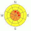
This Afternoon:

Snow and areas of blowing snow. Patchy fog. High near 22. Breezy, with a southwest wind around 20 mph, with gusts as high as 40 mph. Chance of precipitation is 100%. Total daytime snow accumulation of 6 to 10 inches possible.

Tonight:

Areas of blowing snow and a chance of snow. Patchy fog after 11pm. Otherwise, mostly cloudy, with a low around 7. South wind between 10 and 15 mph, with gusts as high as 35 mph. Chance of precipitation is 40%.

Friday:

A 30 percent chance of snow. Patchy fog before 11am. Otherwise, cloudy, with a high near 23. South wind between 10 and 15 mph.

Friday Night:

Snow, mainly after 11pm. Low around 3. Wind chill values as low as -10. South southwest wind around 10 mph, with gusts as high as 30 mph. Chance of precipitation is 80%. New snow accumulation of 1 to 3 inches possible.

Saturday:

Snow likely. Cloudy, with a high near 18. Northwest wind 5 to 10 mph becoming south southwest. Winds could gust as high as 30 mph. Chance of precipitation is 70%.

Saturday Night:

A 40 percent chance of snow. Mostly cloudy, with a low around -1.

Sunday:

Mostly cloudy, with a high near 21.

Sunday Night:

Cloudy, with a low around 9.

Monday:

Snow. Cloudy, with a high near 24.

Monday Night:

Snow. Cloudy, with a low around 11.

Tuesday:

A chance of snow. Cloudy, with a high near 19.

Tuesday Night:

A chance of snow. Mostly cloudy, with a low around 13.

Wednesday:

Partly sunny, with a high near 33.


GENERAL ANNOUNCEMENTS

Our yearly AIARE level I avalanche course will be held this year from Friday, January 30th - Sunday February 1st. Proceeds from this class go directly to the Friends of La Sal Avalanche Center and help pay for the forecasting and education services provided by the Center. Please call Dave or Max 435-636-3363 to sign up for the class or get more information.

We will also be teaching some Avalanche Awareness seminars  this winter. The first is scheduled for Monday, January 12th at 6:00 PM at the Grand County Library. These FREE seminars run about 2 hours and cover avalanche phenomena, basic travel techniques and self-rescue equipment overviews. They are a good opportunity to learn about the hazards of backcountry winter travel. Suitable for skiers, hikers, snow machiners, hunters and snowboarders. 


This information does not apply to developed ski areas or highways where avalanche control is normally done.  This advisory is from the U.S.D.A. Forest Service, which is solely responsible for its content. This advisory describes general avalanche conditions and local variations always occur.


This advisory provided by the USDA Forest Service, in partnership with:

The Friends of the Utah Avalanche Center, Utah Division of State Parks and Recreation, Utah Division of Emergency Management, Salt Lake County, Salt Lake Unified Fire Authority and the friends of the La Sal Avalanche Center. See our Sponsors Page for a complete list.