SPECIAL ANNOUNCEMENT |
 |
Through a generous donation by Backcountry.com to our partners the Friends of the Utah Avalanche Center we will continue forecasting until April 24th. Thank You!! I'll update this advisory again for next weekend.. |
|
|
BOTTOM LINE
Danger by aspect and elevation on slopes approaching 35° or steeper.
(click HERE for tomorrow's danger rating)
|
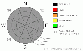
Danger Rose Tutorial
|
I'm not issuing a danger rating for the midweek period, but we found dangerous conditions in the backcountry on Monday, and you are likely to trigger wet avalanches on steep slopes with saturated fresh snow at all elevations... |
|
|
CURRENT CONDITIONS |

|
The rain/snow-line should drop in elevation with temperatures today, but it was several degrees warmer overnight than it was Friday night and it looks like rain fell up to the highest elevations... You'll find wet snow conditions in the backcountry... As temperatures drop, rain will hopefully turn to snow and 3 to 5 inches of snow could accumulate at higher elevations today. The 8400' Tony Grove Snotel reports 37 degrees and 6/10ths of an inch of water in the last 24 hrs, with an inch or two of new snow reported. There's 132 inches of total snow at the station, with 158% of average water content for the date.. I'm also reading 37 degrees at the Hwy 89 Logan Summit Weather Station, which is currently reporting continued sustained west winds averaging 20 mph with gust near 30.. |
|
|
RECENT ACTIVITY |

|
A rider remote triggered a shallow and moist wind slab on a north facing slope at around 8700 near White Pine Lake yesterday, which entrained lots of wet snow in descent and piled up to 6 feet deep in lower angled terrain at the bottom.
On Monday afternoon, we easily triggered several loose wet avalanches which entrained significant piles of fresh wet snow, ran pretty far and packed a destructive punch
.See our avalanche list HERE
|
|
|
THREAT #1 |

|
| WHERE |
PROBABILITY |
SIZE |
TREND |

|
|
|
|
| |
|
|
Over the next
12 hours.
|
|
|
Overnight temperatures remained well above freezing and thick cloud-cover did not allow for much radiation cooling of the snow surface, so I'd expect only a superficial refreeze at best. Hopefully cooling temperatures will help, but the danger of wet avalanches may still rise on many slopes as the saturated snow softens with inevitable midday heat. Moist fresh snow that falls today may be prone to loose snow avalanching and even shallow new snow avalanches could entrain significant wet snow in descent and pile up deeply. We'll be looking for areas with safer solid and supportable snow, and when we start sinking more deeply into soft saturated snow, we know it's time to leave... Be aware of trees or other potential terrain traps below you. |
|
|
THREAT #2 |

|
| WHERE |
PROBABILITY |
SIZE |
TREND |

|
|
|
|
| |
|
|
Over the next
24 hours.
|
|
|
Continue to avoid the large overhanging ridge-top cornices, which continue to build with sustained west winds and moist snow... These things are most likely to naturally fail in midday heat, but could be triggered anytime.. You could break huge cornices from much further back than you expect, and you can't see them when you approach from above or flat appearing ridge-top terrain... It's always wise to give the monsters lots of distance, and its better to stay well on the windward side of ridge crests. Cornice falls could trigger dangerous slab avalanches on steep slopes below. |
|
|
THREAT #3 |

|
| WHERE |
PROBABILITY |
SIZE |
TREND |

|
|
|
|
| |
|
|
Over the next
12 hours.
|
|
|
You might trigger fresh shallow wind slab avalanches at upper elevations on the lee sides of ridge lines and in and around terrain features like sub-ridges, gullies, scoops, and cliff bands.... You should avoid smooth, rounded, hollow sounding, or stiffer snow on steep slopes, especially above trees or other potential terrain traps...
Dangerous persistent slab avalanches are rather unlikely yet still possible on isolated slopes with buried weak layers and poor snow structure.. Some avalanches may break a couple feet deep on a weak sugary layer sandwiched between melt-freeze crusts, or even more deeply buried mid-winter persistent weak layers. Persistent slab avalanches might be triggered by overrunning wet avalanches, cornice fall, or smaller wind slab avalanches... |
|
|
MOUNTAIN WEATHER |

|
. Cool and moist weather under a continued westerly zonal flow should continue through much of the week... |
|
|
GENERAL ANNOUNCEMENTS |
I'll update this advisory next weekend......
Help us improve the information we provide. Please take the time to answer 10 quick questions in our spring user survey... click HERE
You can view a photo summary of last year's avalanche activity in the Logan Area HERE
Join the friends of the Utah Avalanche Center in Logan on facebook. Click HERE
You have the opportunity to participate in the creation of our own community avalanche advisory by submitting avalanche and snow observations. You can also call us at 801-524-5304 or Toby at 435-757-7578, or email by clicking HERE
Donate to your favorite non-profit – The Friends of the Utah Avalanche Center. The UAC depends on contributions from users like you to support our work.
This advisory is from the U.S.D.A. Forest Service, which is solely responsible for its content. This advisory describes general avalanche conditions and local variations always occur. |
|
|
This information does not apply to developed ski areas or highways where avalanche control is normally done. This advisory is from the U.S.D.A. Forest Service, which is solely responsible for its content. This advisory describes general avalanche conditions and local variations always occur. |
|
This advisory provided by the USDA Forest Service, in partnership with:
The Friends of the Utah Avalanche Center, Utah Division of State Parks and Recreation, Utah Division of Emergency Management, Salt Lake County, Salt Lake Unified Fire Authority and the friends of the La Sal Avalanche Center. See our Sponsors Page for a complete list. |
