AVALANCHE WATCH »
The risk of an avalanche is expected to increase significantly
but the timing and location are still uncertain. Stay tuned for updates.
|
 |
Notice: We will continue an AVALANCHE WATCH for the mountains of northern and central Utah. Heavy wet snow and rain falling on a weak snowpack is creating dangerous avalanche conditions. The avalanche danger will continue to rise all weekend and into early next week. Backcountry travelers should avoid steep slopes and avalanche runout zones. |
|
|
BOTTOM LINE
Danger by aspect and elevation on slopes approaching 35° or steeper.
(click HERE for tomorrow's danger rating)
|
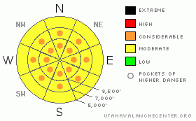
Danger Rose Tutorial
|
The onset of a winter storm with prolonged heavy and wet snowfall will cause heightened avalanche conditions and a level 2 or Moderate avalanche danger in the backcountry today.The danger of storm snow and wind slab avalanches will likely rise to level 3 (Considerable) in areas which receive significant accumulations and/or wind by this afternoon, and heavy wet snow tomorrow could cause the danger to rise still further. Rain at lower elevations will cause a danger of wet avalanches on steep slopes with saturated snow. Careful snowpack evaluation, cautious route finding, and conservative decision making will become crucial in the backcountry this weekend. |
|
|
CURRENT CONDITIONS |

|
This weekend's winter storm will rapidly increase the avalanche danger in the backcountry. The cold temperatures that kept the snow nice this week also created weak surface layers above a widespread and slick rain or rime-rust
The Tony Grove Snotel at 8400' reports 4 new inches with 3/10ths of an inch of water overnight. There's 66 inches of total snow at the site containing 173% of average water for the date. The CSI weather station on Logan Peak reports sustained 15-20 mph winds overnight from the southwest, and its 18 degrees at 9400'. |
|
|
RECENT ACTIVITY |

|
We've received reports of and observed numerous natural and a few triggered loose dry sluffs and a few small shallow soft slabs, mainly at upper elevations..... A couple from yesterday cleaned out all the powdery snow down to the glassy ice crust from last weekend, leaving streaks all the way down the steep north facing slope.... |
|
|
THREAT #1 |

|
| WHERE |
PROBABILITY |
SIZE |
TREND |

|
|
|
|
| |
|
|
Over the next
24 hours.
|
|
|
Weak layers formed in the past few days, and with potentially rapid accumulations of heavy new snow and increasing southwest winds forecast for today and through the weekend, we expect conditions to develop where larger and much more dangerous avalanches will occur. As snow accumulates we expect soft slabs to be initiated easier. Remote triggered and natural avalanches will probably occur on slopes as soon as enough weight builds up to tip the balance.
Loose avalanches involving the weakening surface snow snow are likely again today. These are fairly manageable and generally non-threatening unless you are on a steep slope above trees or other potential terrain traps like cliffs or sink holes, or you get hit by one from above..... |
|
|
THREAT #2 |

|
| WHERE |
PROBABILITY |
SIZE |
TREND |

|
|
|
|
| |
|
|
Over the next
24 hours.
|
|
|
Overnight southwest winds sustained hourly average windspeeds in the 15-20 mph range, which is plenty strong enough to drift the light surface snow and last night's couple inches into wind slabs on weak surface layers formed by cold temperatures in the past few days. Watch for stiffer drifted snow or potential wind slabs near ridge lines and in and around deposition prone terrain features like gullies, cliff-bands, and sub-ridges. You could trigger wind slabs around a foot deep on freshly drifted slopes approaching 35 degrees or steeper. |
|
|
THREAT #3 |

|
| WHERE |
PROBABILITY |
SIZE |
TREND |

|
|
|
|
| |
|
|
Over the next
24 hours.
|
|
|
Rain will saturate the lower elevation snow increasing the danger of wet avalanches on steep slopes |
|
|
MOUNTAIN WEATHER |

|
The National Weather Service has issued a Winter Storm Warning for the mountains of Northern Utah and southern Idaho through Monday afternoon. A moist flow from the southwest will bring a prolonged period of snow for the weekend. The rain/snow line will rise to around 7000' feet today and 7500' or 8000' or higher on Sunday. Two feet of accumulation or is possible on upper elevation slopes in favored areas by Monday afternoon. Increasing southwest winds are also expected.... |
|
|
GENERAL ANNOUNCEMENTS |
You can view a photo summary of last year's avalanche activity in the Logan Area HERE
Send us your avalanche and snow observations. You can also call me at 435-757-7578, or email to uac@utahavalanchecenter.org
Donate to your favorite non-profit – The Friends of the Utah Avalanche Center. The UAC depends on contributions from users like you to support our work.
This advisory is from the U.S.D.A. Forest Service, which is solely responsible for its content. This advisory describes general avalanche conditions and local variations always occur. |
|
|
This information does not apply to developed ski areas or highways where avalanche control is normally done. This advisory is from the U.S.D.A. Forest Service, which is solely responsible for its content. This advisory describes general avalanche conditions and local variations always occur. |
|
This advisory provided by the USDA Forest Service, in partnership with:
The Friends of the Utah Avalanche Center, Utah Division of State Parks and Recreation, Utah Division of Emergency Management, Salt Lake County, Salt Lake Unified Fire Authority and the friends of the La Sal Avalanche Center. See our Sponsors Page for a complete list. |
