SPECIAL ANNOUNCEMENT |
 |
The National Weather Service in Salt Lake City has issued a Winter Weather Advisory for the mountains of Northern Utah through tomorrow afternoon. Upper elevations may pick up as much as a foot of new snow from this storm. |
|
|
BOTTOM LINE
Danger by aspect and elevation on slopes approaching 35° or steeper.
(click HERE for tomorrow's danger rating)
|
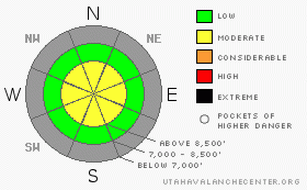
Danger Rose Tutorial
|
Snowfall at upper elevations in the backcountry will cause the danger to rise to MODERATE on steep slopes. It may become possible to trigger storm snow and/or soft wind slab avalanches on some slopes with significant deposits of recently deposited or drifted new snow. Practice safe backcountry travel protocols and be aware of potential consequences due to shallow snow cover. |
|
|
CURRENT CONDITIONS |

|
There's one to two feet of snow, mostly from last week, at the highest elevations. This has settled out into a reasonable base, but the snow is still too shallow for me to risk venturing anywhere but the smooth, grassy slopes south of Tony Grove Lake. The winds increased overnight at the CSI weather station on Logan Peak and they are now puffing along out of the southeast in the twenty MPH range. |
|
|
THREAT #1 |

|
| WHERE |
PROBABILITY |
SIZE |
TREND |

|
|
|
|
| |
|
|
Over the next
24
hours.
|
|
|
The danger of storm snow avalanches will increase as new snow piles up on steep slopes, and you might trigger small soft slab avalanches on steep slopes later this afternoon. |
|
|
THREAT #2 |

|
| WHERE |
PROBABILITY |
SIZE |
TREND |

|
|
|
|
| |
|
|
Over the next
24
hours.
|
|
|
Last night's winds probably did not cause extensive drifting, but stiff wind slabs could be an issue this morning along exposed upper elevation ridges. As new snow accumulates today, winds could build sensitive drifts or soft slabs in fetch areas, in exposed gullies, and on the lee sides of exposed ridges. |
|
|
MOUNTAIN WEATHER |

|
The main energy with this storm will slide to our west and pass to the south, but ample moisture in the atmosphere should produce a fair amount of snowfall in the mountains. Expect snow this morning in the mountains to increase in intensity and the snowline to drop in elevation as the day progresses. The wind will be the wild-card, both as a driving force of the precipitation and a producer of potential avalanches. Expect unsettled weather under a northwesterly flow in the fist half of the coming work week. |
|
|
GENERAL ANNOUNCEMENTS |
The Friends of the Utah Avalanche Center in Logan will present the annual fund-raiser party at the Bullen Center on Friday, November 21st. Proceeds will help support your local avalanche center right here in Logan. Hope to see you there. Join us for dinner and a movie this Thursday Nov. 13th at Brewvies Cinema in Salt Lake City for the second annual Boondockers/Thunderstruck premier. Festivities start at 6:30 (food and drink) with the movies rolling at 7:00. Tickets are $10.00 and all proceeds go to the Friends of the UAC for snowmobile specific avalanche awareness programs.Click here for more details and a discount coupon. |
|
|
This information does not apply to developed ski areas or highways where avalanche control is normally done. This advisory is from the U.S.D.A. Forest Service, which is solely responsible for its content. This advisory describes general avalanche conditions and local variations always occur. |
|
This advisory provided by the USDA Forest Service, in partnership with:
The Friends of the Utah Avalanche Center, Utah Division of State Parks and Recreation, Utah Division of Emergency Management, Salt Lake County, Salt Lake Unified Fire Authority and the friends of the La Sal Avalanche Center. See our Sponsors Page for a complete list. |
