25th Annual Black Diamond Fall Fundraising Party
Thursday, September 13; 6:00-10:00 PM; Black Diamond Parking Lot
25th Annual Black Diamond Fall Fundraising Party
Thursday, September 13; 6:00-10:00 PM; Black Diamond Parking Lot
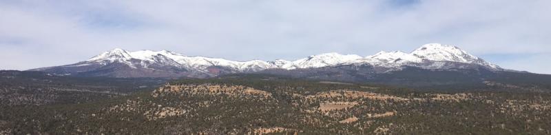
| Advisory: Abajo Area Mountains | Issued by Eric Trenbeath for Sunday - March 12, 2017 - 6:53am |
|---|


|
bottom line The avalanche danger is generally LOW and mostly stable snow conditions exist. But low danger doesn't mean no danger and we still have a few things to consider. With daytime heating, the potential exists for loose, wet avalanches on steep, sun exposed slopes. If you feel the snow getting wet and sloppy, or if you notice signs of instability such as roller balls or pinwheels, get off of, and out from under steep slopes. it may still be possible to trigger an isolated wind slab, or persistent slab avalanche in areas of more extreme, upper elevation, northerly facing terrain. Carefully evaluate individual slopes for smooth hard slabs, with weak, underlying snow if you venture into this type of terrain.
|
 |
special announcement The Abajo/Blue Mountain avalanche advisory will provide detailed information on the weekends. During the week, general information and a danger rating will be posted. |
 |
current conditions
We've had a good re-freeze overnight with temperatures above 10,000' dipping into the mid 20's. Winds are light and westerly. Snow conditions are a mixed bag though the dedicated enthusiast can still find something to get excited about. Supportable corn-like snow can be found on SE-W aspects at mid elevations. Work the sun for best results and finish up before the snow becomes wet an sloppy. Northerly facing aspects offer a variety of conditions from wind affected, to soft, settled powder. |
| type | aspect/elevation | characteristics |
|---|

|
|
LIKELIHOOD
 LIKELY
UNLIKELY
SIZE
 LARGE
SMALL
TREND
 INCREASING DANGER
SAME
DECREASING DANGER
|
|
description
Generally stable snow conditions exist but as always, low danger doesn't mean no danger, and here are a few things to consider when traveling in avalanche terrain. Loose Wet Snow: With warm daytime temperatures, the potential exists for loose wet slide activity on sun exposed slopes. Look for signs of instability such as roller balls or pinwheels, and of course, natural, loose wet slide activity. Stay off of and out from under steep, sun exposed slopes if any of these signs are present, or if the snow is wet and sloppy over your boot tops. Wind Slab: Extreme, upper elevation, wind exposed terrain still harbors the occasional wind slab. If you push into this type of terrain, carefully evaluate wind rolls, and hard, hollow feeling slabs. Persistent Slab: In general, snowpits and stabilty tests have shown a stabilization of the early February, faceted weak layer. There are however, some isolated areas with weak faceted snow where it may be possible to trigger an avalanche, primarily on upper elevation, northerly aspects. If you find yourself contemplating a steep line on a northerly facing aspect, probe around with your pole, or dig down to look for underlying weak facets. If you find them, and there is a slab on top, reconsider your slope selection. |
 |
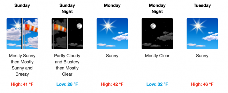
weather
|
| general announcements If you are getting out into the mountains, we love to hear from you! You can SUBMIT OBSERVATIONS ONLINE If you would like to have avalanche advisories emailed to you, SIGN UP HERE Benefit the Utah Avalanche Center when you shop from Backcountry.com or REI: Click this link for Backcountry.com or this link to REI, shop, and they will donate a percent of your purchase price to the UAC. Both offer free shipping (with some conditions) so this costs you nothing! Benefit the Utah Avalanche Center when you buy or sell on ebayIf you sign up for AmazonSmile and designate the Utah Avalanche Center as your favorite charity, they will donate a portion of everything you spend to the UAC. I doesn't cost you a penny and we'd really appreciate the help. The information in this advisory is from the US Forest Service which is solely responsible for its content. This advisory describes general avalanche conditions and local variations always occur. |