25th Annual Black Diamond Fall Fundraising Party
Thursday, September 13; 6:00-10:00 PM; Black Diamond Parking Lot
25th Annual Black Diamond Fall Fundraising Party
Thursday, September 13; 6:00-10:00 PM; Black Diamond Parking Lot
| Advisory: Abajo Area Mountains | Issued by Eric Trenbeath for Sunday - February 26, 2017 - 7:27am |
|---|

|
bottom line The avalanche danger is generally LOW in the Abajo/Blue Mountains. You may find a few isolated wind slabs, or fresh drifts of unstable snow on the leeward sides of ridge crests and terrain features in upper elevation terrain that has a NW-N-E aspect. Continue to practice safe travel techniques by only putting one person at a time on steep, avalanche prone slopes.
|
 |
special announcement The Abajo/Blue Mountain avalanche advisory will provide detailed information on the weekends. During the week, general information and a danger rating will be posted. Earlier this month, Colorado experienced a snowbike fatality. This is the newest user group to venture into avalanche terrain, and we have several snowbikes in the area. It's a tragic story, and a complex situation where the victim had an airbag but wasn't wearing a beacon. Read the story in the official report from the Colorado Avalanche Information Center. |
 |
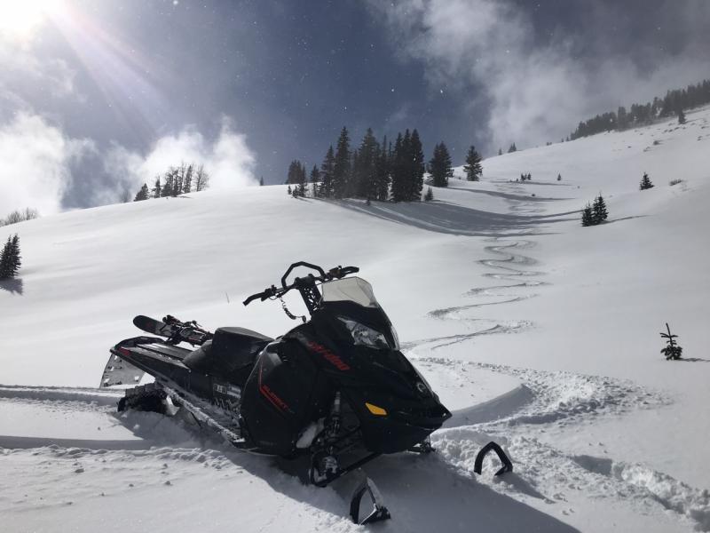
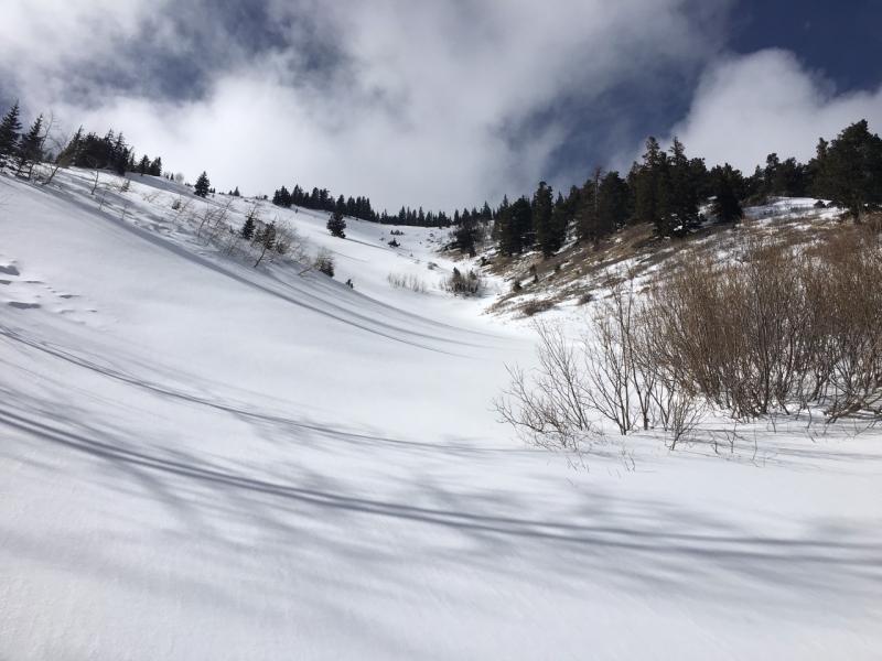
current conditions Skies are mostly clear, ridge top southwesterly winds are light, and it's slightly warmer this morning. Camp Jackson is reporting 13 degrees while it's still barely 2 degrees on Abajo Peak. In my travels on Friday, I was pleasantly surprised to find 2-4" of new snow that blew in on a fast moving wave around 7:30 a.m. The new coat of white definitely improved the look of things, and even improved riding conditions a bit though the underlying snow surface is everywhere evident.
Recent snow has improved conditions a bit and some fun turns can be had.
In spite of the above average snowpack, southerly facing slopes took a hit during early February's warm spell. Winds, temperature and humidity on Abajo Peak. Snow depth at Camp Jackson. |
| type | aspect/elevation | characteristics |
|---|

|
|
LIKELIHOOD
 LIKELY
UNLIKELY
SIZE
 LARGE
SMALL
TREND
 INCREASING DANGER
SAME
DECREASING DANGER
|
|
description
The avalanche danger is generally low in the Abajo Mountains, but low danger doesn't mean no danger. You may still be able to trigger an isolated wind slab in upper elevation, wind exposed terrain where drifting snow has accumulated on the lee side of a ridge crest or terrain feature. Continue to practice safe travel techniques by only putting one person at a time on steep, avalanche prone slopes. Changing weather creates changing avalanche conditions, and backcountry travelers need to be alert to increasing winds, new snow, or a rapid increase in temperature. |
 |
weather The remnants of the weekend storm will exit to the south, leaving mostly sunny skies today. High temperatures at 10,000' will be in the low to mid 20's. West southwest winds will be light this morning, and increase throughout the day. Unsettled weather continues into the new work week with our next Pacific storm moving in for Monday and Tuesday. |
| general announcements If you are getting out into the mountains, we love to hear from you! You can SUBMIT OBSERVATIONS ONLINE If you would like to have avalanche advisories emailed to you, SIGN UP HERE Benefit the Utah Avalanche Center when you shop from Backcountry.com or REI: Click this link for Backcountry.com or this link to REI, shop, and they will donate a percent of your purchase price to the UAC. Both offer free shipping (with some conditions) so this costs you nothing! Benefit the Utah Avalanche Center when you buy or sell on ebayIf you sign up for AmazonSmile and designate the Utah Avalanche Center as your favorite charity, they will donate a portion of everything you spend to the UAC. I doesn't cost you a penny and we'd really appreciate the help. The information in this advisory is from the US Forest Service which is solely responsible for its content. This advisory describes general avalanche conditions and local variations always occur. |