25th Annual Black Diamond Fall Fundraising Party
Thursday, September 13; 6:00-10:00 PM; Black Diamond Parking Lot
25th Annual Black Diamond Fall Fundraising Party
Thursday, September 13; 6:00-10:00 PM; Black Diamond Parking Lot
| Advisory: Abajo Area Mountains | Issued by Eric Trenbeath for Saturday - December 24, 2016 - 7:13am |
|---|


|
bottom line Expect the avalanche danger to rise to CONSIDERABLE today in steep, upper elevation terrain where blustery winds and blowing snow will result in fresh drifts and the formation of new wind slabs. As the snow load increases, the danger for triggering a deeper, more dangerous persistent slab will also increase to CONSIDERABLE on slopes that face NW-N-E. For MODERATE danger, stick to lower and mid elevation sheltered terrain.
|
 |
special announcement |
 |
current conditions Camp Jackson is reporting 8" of snow yesterday morning, and slowly things are starting to add up. Base depth there is now around 20". Overall, It's still pretty thin coverage with a lot of grass and bushes poking out, but every little bit helps. Southeasterly winds on Abajo Peak have been have been on the increase overnight, averaging 20-30 mph. They will continue to increase today into the 35-40 mph range with gusts as high as 60. With 2-4" of snow in the forecast, this will translate to a wild and blustery day in the mountains. Winds, temperature and humidity on Abajo Peak. Snow totals at Camp Jackson.
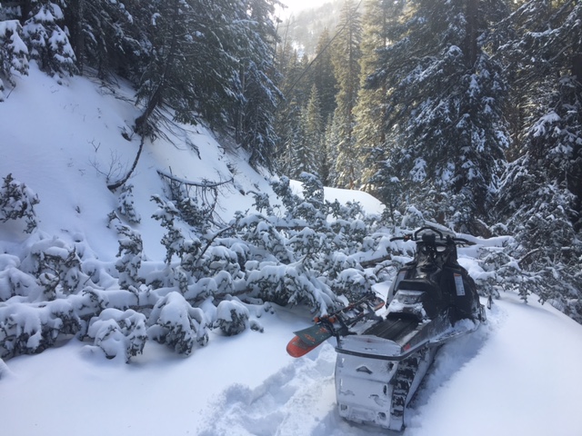
After making it around and over numerous down trees in the North Creek Road, this finally shut me down.
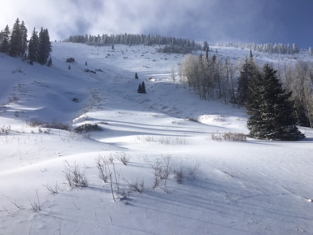
Still pretty thin up there. |
| type | aspect/elevation | characteristics |
|---|

|

|
LIKELIHOOD
 LIKELY
UNLIKELY
SIZE
 LARGE
SMALL
TREND
 INCREASING DANGER
SAME
DECREASING DANGER
|
|
description
Strong, gusty winds, plenty of loose snow available for transport, and more snow in the forecast, all translate to drifting snow and the formation of new wind slabs. Avoid areas of recently deposited, wind drifted snow and look for tell tale signs of instability such as cracking in the snow surface. A triggered wind slab also has the potential to step down into a deeper persistent slab. |
| type | aspect/elevation | characteristics |
|---|

|

|
LIKELIHOOD
 LIKELY
UNLIKELY
SIZE
LARGE
SMALL
TREND
INCREASING DANGER
SAME
DECREASING DANGER
|
|
description
The underlying snowpack is very weak, and additonal snow load from overriding wind slabs will increase the danger for trigger a deeper persistent slab avalanche. You are most likely to find this problem on steep, upper elevation slopes that have a NW-N-E aspect. |
 |
weather Today Snow. High near 26. Very windy, with a south wind 30 to 40 mph, with gusts as high as 65 mph. Chance of precipitation is 80%. Total daytime snow accumulation of 2 to 4 inches possible. Tonight Snow. Low around 11. Windy, with a southwest wind 30 to 35 mph decreasing to 25 to 30 mph in the evening. Winds could gust as high as 65 mph. Chance of precipitation is 100%. New snow accumulation of 6 to 10 inches possible. Christmas Day Snow likely, mainly before 11am. Cloudy, then gradually becoming mostly sunny, with a high near 17. Breezy, with a west southwest wind 15 to 20 mph, with gusts as high as 40 mph. Chance of precipitation is 70%. New snow accumulation of 1 to 3 inches possible. Sunday Night Partly cloudy, with a low around 8. Breezy, with a west southwest wind 15 to 20 mph. Monday Sunny, with a high near 19. West wind 10 to 15 mph. |