| Please join us at the 23rd annual Black Diamond Fall Fundraiser Party Thursday Sept 15. Tickets are on sale now here, at the Black Diamond store & at REI. Special bonus raffle for online ticket purchasers! |
| Please join us at the 23rd annual Black Diamond Fall Fundraiser Party Thursday Sept 15. Tickets are on sale now here, at the Black Diamond store & at REI. Special bonus raffle for online ticket purchasers! |
| Advisory: Abajo Area Mountains | Issued by Eric Trenbeath for Thursday - December 31, 2015 - 7:49am |
|---|

|
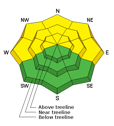
bottom line The avalanche danger is an elevated MODERATE today on slopes steeper than 35 degrees that face W-N-E. We are currently in a low probability - high consequence phase for triggering a deep and dangerous avalanche in these areas. Stick to slopes less steep than 35 degrees or choose a southerly facing aspect for safer riding conditions today.
|
 |
special announcement This advisory will provide detailed snow, avalanche and mountain weather information on weekends. During the week, general information and an overall danger rating will be provided. |
 |
current conditions Winds, temperature and humidity on Abajo Peak. Snow totals at Buckboard Flat.
|
 |
weather Today A 30 percent chance of snow, mainly before 8am. Mostly sunny and cold, with a high near 9. West northwest wind 5 to 10 mph becoming north northeast in the afternoon. Tonight A 10 percent chance of snow after 3am. Partly cloudy, with a low around -4. Wind chill values as low as -20. Northeast wind around 10 mph becoming southeast after midnight. New Year's Day A 20 percent chance of snow. Partly sunny, with a high near 11. Wind chill values as low as -25. South southeast wind around 15 mph. Friday Night A 30 percent chance of snow. Mostly cloudy, with a low around 4. Wind chill values as low as -15. South wind around 15 mph. Saturday A 30 percent chance of snow, mainly before 11am. Partly sunny, with a high near 17. South southwest wind around 15 mph. Saturday Night A 10 percent chance of snow before 11pm. Mostly cloudy, with a low around 13. Sunday Mostly sunny, with a high near 23. |
| general announcements This advisory is from the U.S.D.A. Forest Service, which is solely responsible for its content. This advisory describes general avalanche conditions and local variations always exist. |


