| Please join us at the 23rd annual Black Diamond Fall Fundraiser Party Thursday Sept 15. Tickets are on sale now here, at the Black Diamond store & at REI. Special bonus raffle for online ticket purchasers! |
| Please join us at the 23rd annual Black Diamond Fall Fundraiser Party Thursday Sept 15. Tickets are on sale now here, at the Black Diamond store & at REI. Special bonus raffle for online ticket purchasers! |
| Advisory: Abajo Area Mountains | Issued by Eric Trenbeath for Monday - December 21, 2015 - 7:27am |
|---|

|
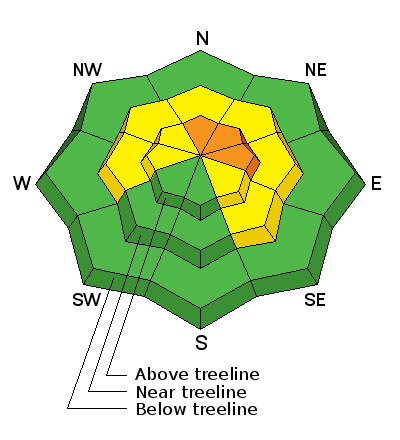
bottom line The avalanche danger remains CONSIDERABLE on slopes steeper than 35 degrees in upper elevation, wind exposed terrain, particularly on slopes with a NW-N-E aspect and riders should avoid these areas. The danger will likely rise and become more widespread with snow and wind in the forecast for the upcoming week.
|
 |
special announcement This advisory will be updated with detailed avalanche and mountain weather information on the weekends. During the week we will provide general informaiton and danger ratings. |
 |
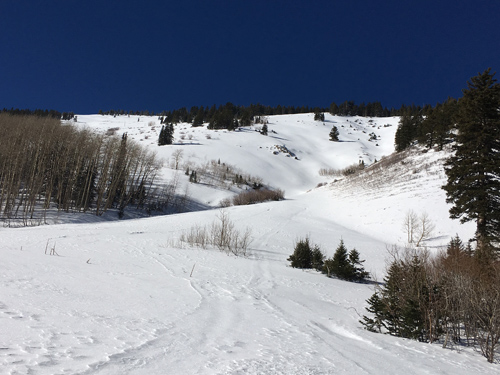
current conditions It's still pretty thin but the storm from last week was a vast improvement. Base depth varies from about 23" at Buckboard flat to about 30" at North Creek Pass. There are still plenty of obstacles lying just beneath the surface, especially on sun exposed slopes that were nearly bare ground prior to this storm. Excellent powder conditions remain in sheltered areas, but a strong sun and warm temperatures have crusted over sun exposed aspects. The existing snowpack is quite weak with a base of loose, sugary, faceted snow. This makes a very unstable base for new snow to land on, and the current structure is tenuous at best. Expect new snow, especially if accompanied by wind to translate to a significant increase in avalanche danger. Winds, temperature and humidity on Abajo Peak. Snow totals at Buckboard Flat.
Conditions are improving but it is still thin.
This tree is down over the road just below North Creek Pass.
|
 |
weather Today Snow likely, mainly after 5pm. Mostly cloudy, with a high near 24. Breezy, with a west northwest wind 10 to 15 mph becoming west southwest 15 to 20 mph in the afternoon. Winds could gust as high as 30 mph. Chance of precipitation is 60%. Total daytime snow accumulation of less than a half inch possible. Tonight Snow. Widespread blowing snow. Low around 20. Breezy, with a southwest wind around 25 mph, with gusts as high as 40 mph. Chance of precipitation is 100%. New snow accumulation of 2 to 4 inches possible. Tuesday Snow. Widespread blowing snow. High near 23. Windy, with a west southwest wind 20 to 30 mph, with gusts as high as 40 mph. Chance of precipitation is 90%. New snow accumulation of 3 to 5 inches possible. Tuesday Night A 50 percent chance of snow. Widespread blowing snow before 11pm. Mostly cloudy, with a low around 17. Blustery, with a west northwest wind around 25 mph, with gusts as high as 40 mph. New snow accumulation of 1 to 2 inches possible. Wednesday A 50 percent chance of snow. Mostly cloudy, with a high near 25. West northwest wind around 15 mph. Wednesday Night A 20 percent chance of snow. Mostly cloudy, with a low around 9. Blustery. Thursday Snow likely. Cloudy, with a high near 22. Chance of precipitation is 60%. Thursday Night Snow likely. Cloudy, with a low around 16. Breezy. Christmas Day Snow likely. Cloudy, with a high near 21. Breezy. |
| general announcements This advisory is from the U.S.D.A. Forest Service, which is solely responsible for its content. This advisory describes general avalanche conditions and local variations always exist. |