| Please join us at the 23rd annual Black Diamond Fall Fundraiser Party Thursday Sept 15. Tickets are on sale now here, at the Black Diamond store & at REI. Special bonus raffle for online ticket purchasers! |
| Please join us at the 23rd annual Black Diamond Fall Fundraiser Party Thursday Sept 15. Tickets are on sale now here, at the Black Diamond store & at REI. Special bonus raffle for online ticket purchasers! |
| Advisory: Abajo Area Mountains | Issued by Eric Trenbeath for Saturday - December 5, 2015 - 7:02am |
|---|

|
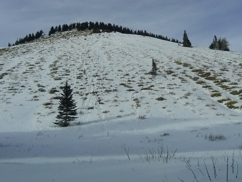
bottom line Due to the thin snow cover the avalanche danger is generally LOW at this time. But low danger doesn't mean no danger and there are areas where isolated, stiff wind slabs have formed over the weak, underlying snow, primarily on slopes with a N-NE-E aspect. These slabs exist on the lee sides of ridge crests and terrain features such as gully walls, and if triggered could possibly take you for a bumpy ride.
|
 |
special announcement The Utah Avalanche Center Moab has begun issuing weekend advisories for the Abajo / Blue Mountains. General information will be provided during the week. |
 |
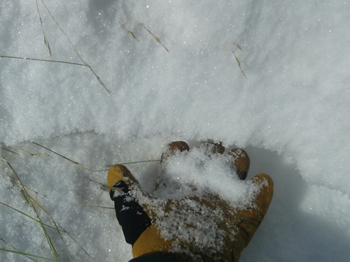
current conditions Temperatures this morning on Abajo Peak are about 10 degrees cooler than yesterday at this time. It's currently 14 degrees up there, and winds have shifted from the south to more westerly averaging 15-20 mph. Snow cover is quite thin offering little in the way of riding options beyond the road. There is about 8" on the ground at Dalton Springs and just over 2 feet near Cooley Pass. Wind and sun have taken their toll on the snow surface in exposed locations, and in some cases we are back down to bare ground. Read this observation for more detailed information. Winds, temperature and humidity on Abajo Peak. Snow totals at Buckboard Flat.
|
| type | aspect/elevation | characteristics |
|---|

|
|
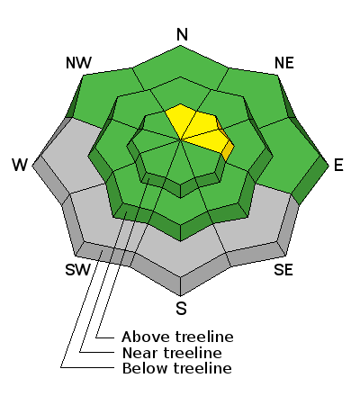
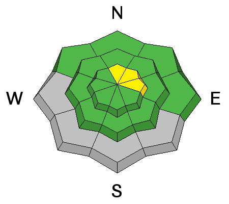
LIKELIHOOD
 LIKELY
UNLIKELY
SIZE
 LARGE
SMALL
TREND
 INCREASING DANGER
SAME
DECREASING DANGER
|
|
description
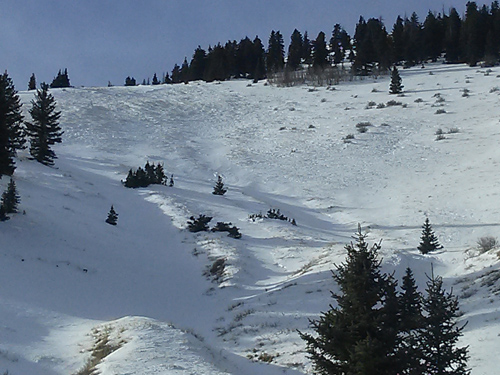
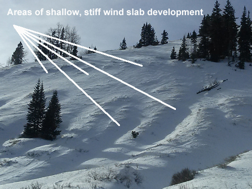
Westerly winds during the week have managed to move around what little snow is available for transport. Isolated, stiff wind slabs have formed on the lee sides of ridge crests and terrain features in wind exposed terrain primarily on slopes that face N-NE-E. In most cases, they are too shallow to be much of a problem but they are overlying very weak, faceted snow , and in some cases it may be possible to trigger one in more extreme terrain and have it take you for a very bumpy ride.
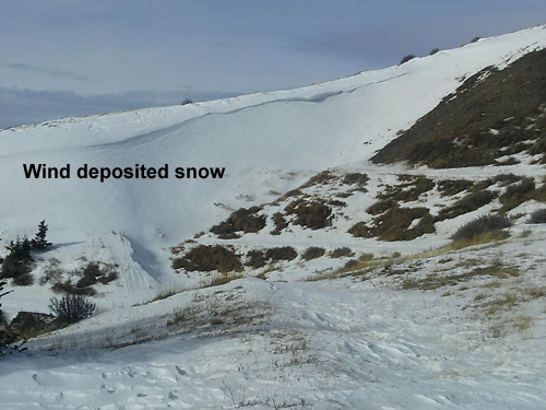
Areas of wind drifted snow have formed on the lee sides of these gully walls.
This cornice, and the smooth rounded pillow beneath it are indicators of wind drifted snow and hence, a potentially dangerous wind slab. If this situation was identified on a larger slope, it would warrant some serious caution.
Wind slabs are overlying weak, sugary, facted snow. |
 |
weather A high pressure ridge will build over our area for the weekend bringing sunny skies and mild temperatures. We may see a shift in the pattern later in the week. Today Sunny, with a high near 24. North northwest wind 10 to 15 mph. Tonight Mostly clear, with a low around 20. North wind 5 to 10 mph becoming south southwest after midnight. Sunday Mostly sunny, with a high near 34. South southwest wind 10 to 15 mph, with gusts as high as 25 mph. Sunday Night Partly cloudy, with a low around 16. West wind 5 to 15 mph. Monday Sunny, with a high near 31. West wind 5 to 10 mph. |
| general announcements This information does not apply to developed ski areas or highways where avalanche control is normally done. This advisory is from the U.S.D.A. Forest Service, which is solely responsible for its content. This advisory describes general avalanche conditions and local variations always exist. |