Check Out Our Holiday Auction!

Forecast for the Uintas Area Mountains

Craig Gordon
Issued by Craig Gordon on
Saturday morning, November 30, 2013

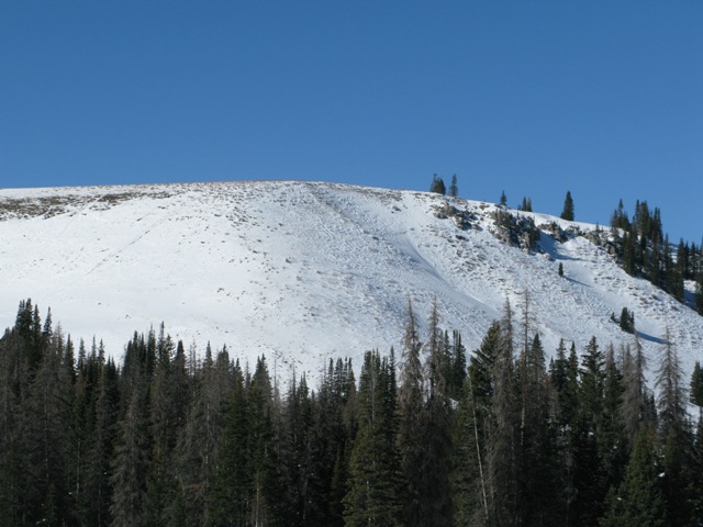
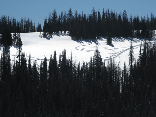
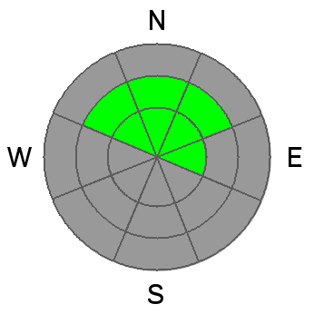
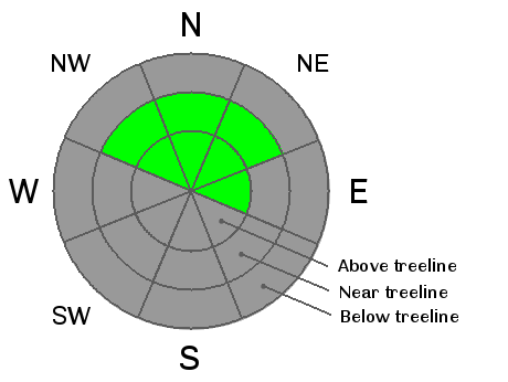
This weekend a LOW avalanche danger exists in the western Uinta's and human triggered avalanches are unlikely. However, LOW danger doesn't mean NO danger. Continue to avoid steep, rocky, north facing terrain, especially where strong solid feeling drifts overlay weak sugary snow near the ground.

Low
Moderate
Considerable
High
Extreme
Learn how to read the forecast here
Special Announcements

Join us at ADS Motorsports in Ogden at 4:00 for a free avalanche awareness presentation geared specifically for sledders

Weather and Snow

Clear skies, light winds, and temperatures in the mid 20's willl be found this morning on the eastern front. . Riding and turning conditions are a bit grim, but patches of soft snow can be found on very wind sheltered, north facing, rock free meadows.

Click here for current winds, temperatures, and snowfall throughout the range.

Recent winds have worked what little snow there is in upper elevation exposed terrain, leaving it thin and scoured.

Wind sheltered terrain does offer patches of soft settled snow.

Recent Avalanches

No new avalanche activity to report.

Avalanche Problem #1
New Snow
Type
Location
Likelihood
Size
Description

It's a mixed bag out there.... bottomless facets, exposed terrain scoured to the dirt, and an impenetrable feeling slab on the leeward side of mid and upper elevation ridgelines.We've been finding the wind drifts to be generally unreactive to our additional weight. However, these hard, solid feeling slabs are resting on very weak snow near the ground. Given the consequences of triggering a slide with the early season snow cover you'll want to continue avoiding any fat or rounded looking piece of snow, especially if it sounds hollow like a drum. Remember- even a small avalanche could take you for a nasty ride through rocks and stumps barely hidden under our shallow snowpack.


The thin snowpack easily breaks to the ground on old October snow that has grown sugary overtime. Winter will eventually arrive and this weak structure is a dangerous setup.

Additional Information

Sunny skies and temperatures warming into the mid 30's are on tap for the weekend, before strong winds on Monday signal a major pattern change with much colder conditions developing Tuesday through the end of the week. Strong west winds will likely develop ahead of the storm Sunday night into Tuesday morning. Accumulating snow looks likely, although confidence in amounts is low at this time. I'll have a better idea as to the evolution of the storm for Wednesday's midweek update.

General Announcements

Remember your information can save lives. If you see anything we should know about, please participate in the creation of our own community avalanche advisory by submitting snow and avalanche conditions. You can call me directly at 801-231-2170, email [email protected], or email by clicking HERE

This is a great time of year to schedule a free avalanche awareness presentation for your group or club. You can contact me at 801-231-2170 or email [email protected]

Donate to your favorite non-profit –The Friends of the Utah Avalanche Center. The UAC depends on contributions from users like you to support our work.

The information in this advisory is from the US Forest Service which is solely responsible for its content. This advisory describes general avalanche conditions and local variations always occur.

I will update this advisory by 7:00 AM on Wednesday Dec. 4, 2013