Forecast for the Uintas Area Mountains

Craig Gordon
Issued by Craig Gordon for
Friday, March 3, 2023
MODERATE avalanche danger exists on steep, leeward slopes in the wind zone at and above treeline. Human triggered avalanches are POSSIBLE, especially in wind drifted terrain facing the north half of the compass, and particularly slopes with an easterly component to its aspect. Today's slides might be a little hard to trigger, but they'll pack a punch and will definitely boss you around.
If you're looking for LOW avalanche danger, you came to the right place and have I got a deal for you! Excellent riding conditions are found on most mid and lower elevation slopes around the dial of the compass and human triggered avalanches UNLIKELY.

Low
Moderate
Considerable
High
Extreme
Learn how to read the forecast here
Special Announcements
Come out and ride for a cause! Utah Snowmobile Association's 6th annual RALLY IN THE VALLEY is this Saturday, March 4th at the cabins at Bear River Lodge. Bring family and friends to join in the fun! All the proceeds from RALLY IN THE VALLEY go directly to supporting the sport in our state. More deets found HERE
Also... to help you safely enjoy the backcountry, the UAC team is constantly evaluating and implementing new programs and technologies. Donate to the Spring Campaign to help our team implement innovative tools and better provide you
Weather and Snow
Nowcast- West and southwest wind blow in the 20's near the high peaks, ushering in a band of high clouds from the left coast, which help deliver a trace of snow overnight. Temperatures currently register in the low and mid teens... about 10 degrees warmer than at this time yesterday. On a go-anywhere base and with nearly two feet of storm snow stacking up since the beginning of the week, riding and turning conditions are all-time.
Forecast- A weak storm keeps scattered snow showers in the queue, though don't look for much more than an inch or two accumulating by closing bell. West and northwest winds are gonna be slightly obnoxious along the ridges, blowing in the 20's and 30's, with a gust or two in the 40's near the high peaks. High temperatures climb into the upper 20's while lows dip into the single digits with clearing skies overnight.
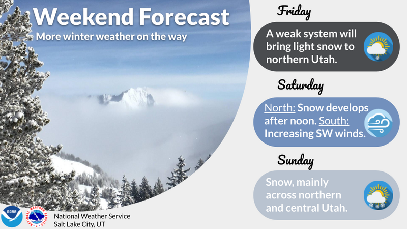
Futurecast- A break in the action delivers a beautifully sunny Saturday morning, but clouds increase late in the day, with a stormy pattern rounding out the weekend into early next week.
The graphic above lays out the timeline for our next series of weather systems.
Detailed trip reports and recent obs are found HERE.
Recent Avalanches
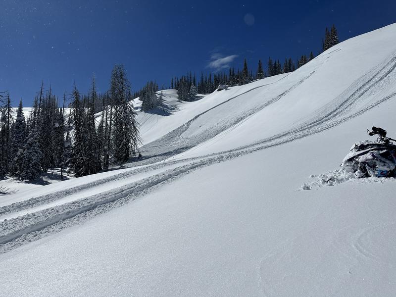
Breaking about a foot deep and 50' wide, not a big slide from yesterday in Upper Mill Hollow, but an attention grabber none-the-less, because it was triggered from about 30' feet away indicating a buried weak layer. I suspect a density inversion within our recent storm snow which is generally a short-lived instability.
Other recent avy activity ... Mt. Watson, to Hoyt Peak, to Double Hill, Upper Chalk Creek, and Browns Canyon all speak to the fact that we've got a big snow year with contiguous snow running tip to tail... from the valley floor to the ridgelines.
No other significant avalanche activity to report, but if ya wanna geek out, click HERE to track this years slide activity throughout the range.
Ad
Avalanche Problem #1
Wind Drifted Snow
Type
Location
Likelihood
Size
Description
Recent wind drifts settled out nicely and felt rather well-behaved yesterday. And while I think the vast majority of our terrain is good to go, the Uinta's are a big place and I bet if you wanted to find a wind drift sensitive to your additional weight, there's one lurking out there with your name on it. The most likely place is gonna be in the wind zone, on steep, leeward slopes at and above treeline. So for today, if your getting into big terrain you'll want to look for and avoid fat, rounded pieces of snow, especially if they sound of feel hollow like a drum. Give this avalanche dragon the respect it deserves and know avoidance is the ticket. Be ready to pump the brakes on objectives if you're seeing shooting cracks out in front your your skis, board, or sled.

Additional Information
Weather stations-
And... rime events have severely crippled the Uinta weather station network. I'm working to get it back up and running, but a few stations are found HERE (click weather stations, and then on the Western Uinta tab)
Observations-
Your observations are important, so please let me know what you're seeing... click HERE and contribute to this amazing community-based program
General Announcements
Issued at 03:19 on Friday March 3rd this forecast expires 24 hours after the date and time posted, but will be updated by 07:00 Saturday March 4th 2023.
Before it gets too crazy, now is the time to book an avalanche awareness presentation for your group, club, or posse. You can reach Craig directly at 801-231-2170 or [email protected].

This forecast is from the U.S.D.A. Forest Service, which is solely responsible for its content. This forecast describes general avalanche conditions and local variations always occur.