Many ski areas are now closed to uphill travel in order to prepare for winter operations. Resort uphill travel policies can be found
HERE. Snow: Some mountain locations picked up a dusting of light snow late yesterday, with storm totals since Monday of 1-2' of snow containing over 2" of water.
Currently: Temperatures this morning are in the low teens and winds from the west/northwest and light, averaging less than 10 mph with gusts in the teens at mid elevations. 11,000' winds increased overnight, with gusts in the 30's mph, but have diminished and are now averaging in the teens with gusts in the 20's mph.
Today: Mostly sunny with a few clouds. Temperatures will rise into the mid 20's F and the northwest winds will remain light, gusting into the teens at mid elevations and into the mid 20's mph at the highest elevations. High-level clouds will increase late in the day and winds will remain generally light, backing to the south and southwest for Saturday as a weak system that only delivers a few clouds moves through. High pressure builds behind this weak system. Unfortunately, we see no new snow in the extended forecast period.
The
Week in Review is centric to the Salt Lake mountains and will appear regularly by early to mid-December, but given the impressive storm cycle over this past week, we have
published a special early November edition.
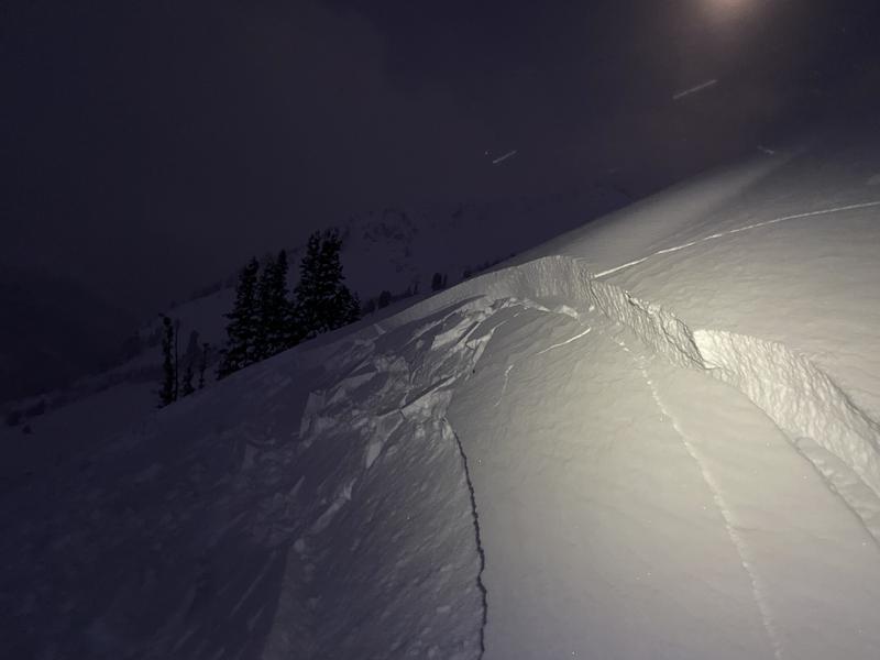
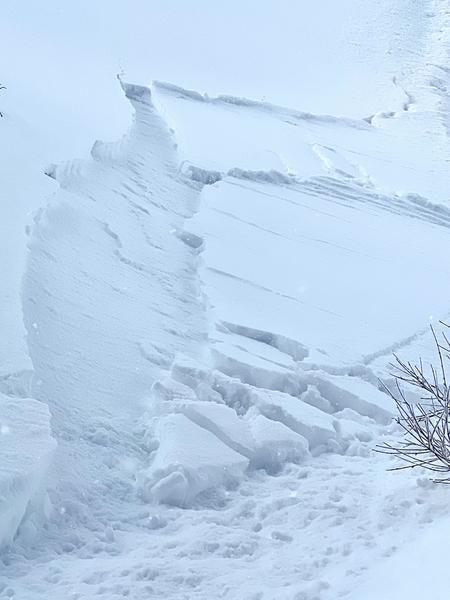
Further north in the Salt Lake mountains, several observers found pockets of sensitive, wind-drifted snow at the upper elevations, including on a southeast aspect at 9,500' on
Flagstaff Ridge that was 7" and 50' wide (photo below).
We received several excellent observations from Thursday and I recommend you include
reviewing all observations as part of your backcountry planning.