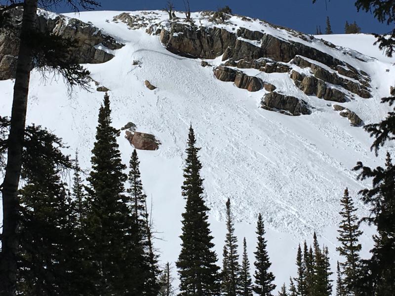
Weak layer appeared to at the old snow/new snow interface in the previously cited trouble graupel layer. Slab appeared to initiate as a result of daytime heating warming the cliff band from above, that overlies at least the right half of the crown face area. Assumption was free water was percolating as a result of the new snow melting from around this massive heat gathering source. Other snow structure tests in the vicinity indicate the graupel layer from the first part of the latest event was having problems bonding to the slick old snow surface. Note, the other smaller slab that released just to the right of the main slab, and it was directly under the rocks. Also of note, graupel pooling may have also contributed to the reactivity of this slab/weak layer interface. And finally, this slab most likely was also thickened, and created by the NW winds that were active during the storm event on Saturday evening. There is a very large fetch directly above this feature.
Photo by Tremper