

Observer Name
Brian H
Observation Date
Saturday, March 4, 2017
Avalanche Date
Saturday, March 4, 2017
Region
Salt Lake » Little Cottonwood Canyon » Hogum
Location Name or Route
Hypodermic Needle
Elevation
10,000'
Aspect
East
Slope Angle
40°
Trigger
Skier
Trigger: additional info
Unintentionally Triggered
Avalanche Type
Soft Slab
Avalanche Problem
Wind Drifted Snow
Weak Layer
New Snow/Old Snow Interface
Depth
Unknown
Vertical
600'
Caught
1
Carried
1
Comments
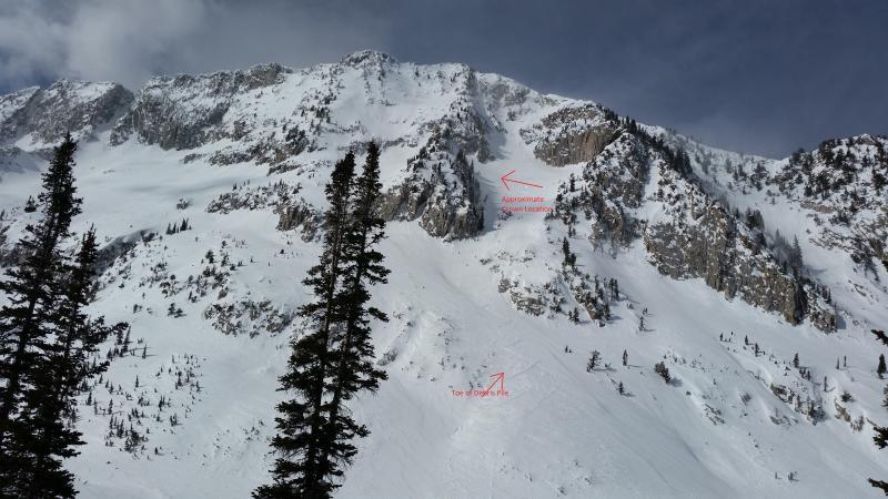
This report is being submitted vicariously for another party, in case it is not reported directly. Wind was the story today in upper LCC. Though the wind was blowing out of the S/SW, most of the high terrain was subject to some combination of wind scouring and cross loading of hard wind slabs due to eddying and convective upcanyon winds meeting the upper level winds. My partner and I were headed for the coalpit headwall, but after climbing and skiing the Hogum Hobgack and looking up the Hypodermic Needle, we were not convinced topping out would be feasible. Snow whirls were eddying up the chute and snow was pluming off the top of the headwall. "Let's head partway up and assess."
As we started up the bottom of the hypo, one party ahead of us head already topped out and another party was near the top. One quarter of way up the ascent, wind slab avalanche debris from a moderate sized slide came down the needle at us. My partner Mike made a quick move to ski down and out of the way. Shortly after, a party of 3 skied down to us. The first skier reported that even though the snow surface had seemed like bulletproof wind slab on the ascent, he had triggered a slightly softer wind slab on the descent on the skiers right (leeward side of cliffband). The slide carried him 300' and he went under at one point but ended up on top. The slide ran about 600' total and was not huge, but certainly enough to bury a person (pic 1).
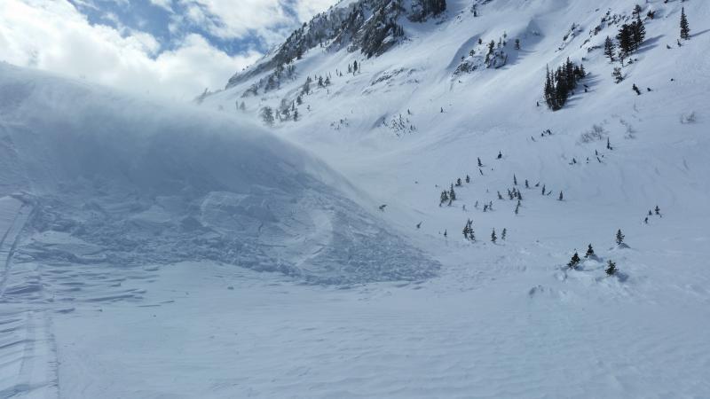
We all decided to bail and head down Hogum Fork. On the way down, in the bottom of the drainage, I ski cut a small but steep rollover in otherwise benign terrain that released a wind slab up to 3' deep (pic 2).
Coordinates