

Observer Name
Ted scroggin
Observation Date
Thursday, January 23, 2014
Avalanche Date
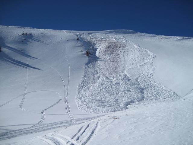
Monday, January 20, 2014
Region
Uintas » Bear River Ranger District » Whitney Basin
Location Name or Route
Whitney Basin-Super Bowl
Elevation
10,800'
Aspect
East
Slope Angle
36°
Trigger
Snowmobiler
Trigger: additional info
Unintentionally Triggered
Avalanche Type
Hard Slab
Avalanche Problem
Persistent Weak Layer
Weak Layer
Depth Hoar
Depth
4'
Width
200'
Vertical
600'
Comments
Thinking this could be another sled triggered slide from earlier in the week. There were no tracks going into the slide, but there are tracks nearby and at the bottom of the debris. It might still be possible to trigger some of these isolated areas from a distance?
Coordinates