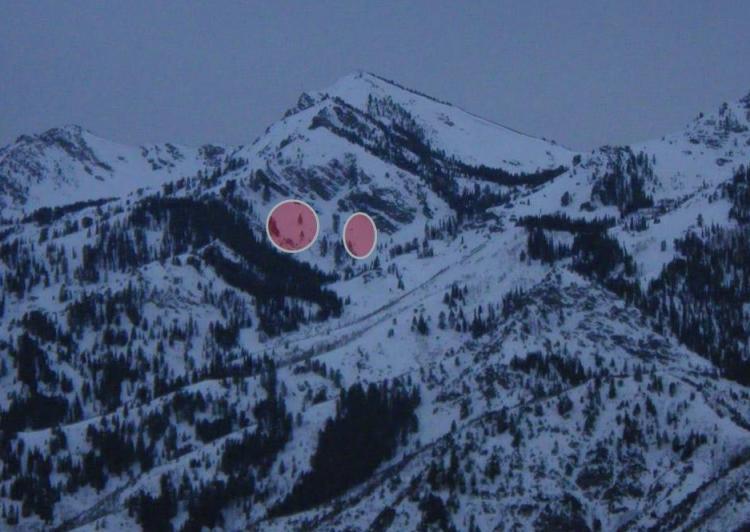
Looking through binoculars from Mountain Green this evening, I could see dozens of wet sluffs between Snowbasin and Thurston Peak on the East side of the mountains. I also saw two medium sized wet slabs just NE of Thurston Peak - the approx. location of both slabs are marked on the map above, and shown on the photo below.
I'm not sure when these slides came down. I don't recall seeing any of these slides over the weekend, but I didn't have a great view of this area. All of the slides have white-looking debris and bed surfaces, but the snow all around them is tan-looking and covered with dust. Curious if the warm winds and the March sun heatied up the dust layer and helped these slides to release. They look are fresh enough to make me believe they are only 1 or 2 days old at most.
The largest wet loose slide was probably 800' vertical, up to 40' wide and filled a gully with 10' of debris. Aspects of WL slides ranged from South to East, to North.