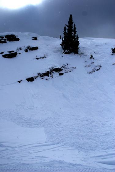
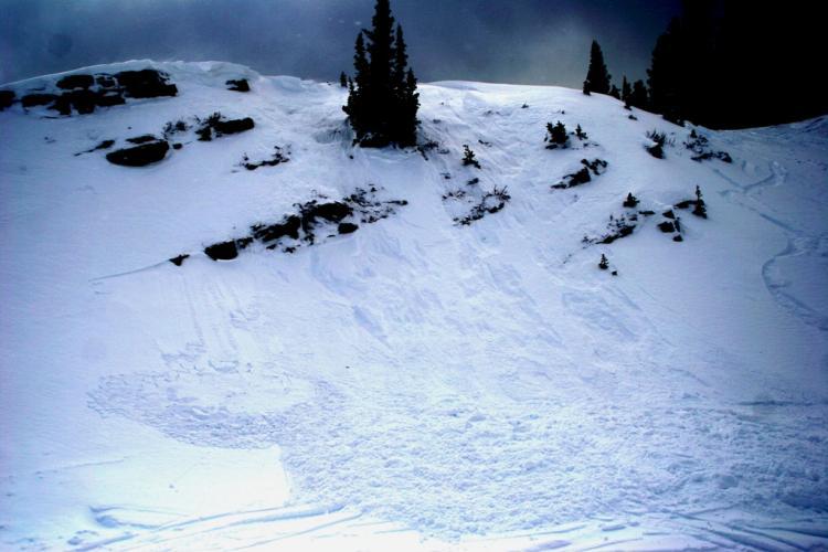
On the last run of the day I decided to ride a 40-45 north facing slope. The slope received a fair amount of wind loading throughout the blustery day. The slope was about 75 to 100 feet tall. As I dropped in I figured it was a good possibility that it would slide, but the consequences of a slide were very low. Sure enough, about 10 feet down the slope, a wind slab 1-2 feet thick and about 50 feet wide let loose. I pointed it straight down, left of the tree in the picture, and over the small cliff at the bottom and came out ahead of the slide. The debris appeared to be 3-4 feet deep.
We rode many other mellow slopes throughout the day with no signs of instability. Pit tests looked pretty good all around. I got an ECTP 26 on a 22 degree west facing slope earlier in the day. The failure occurred about 2 inches below the faceted/2-week-old snow interface. Another pit in a similar area didn’t produce any CT failures. It was interesting to note that the facets near the ground are becoming slightly more rounded and look like they are beginning to bond.