

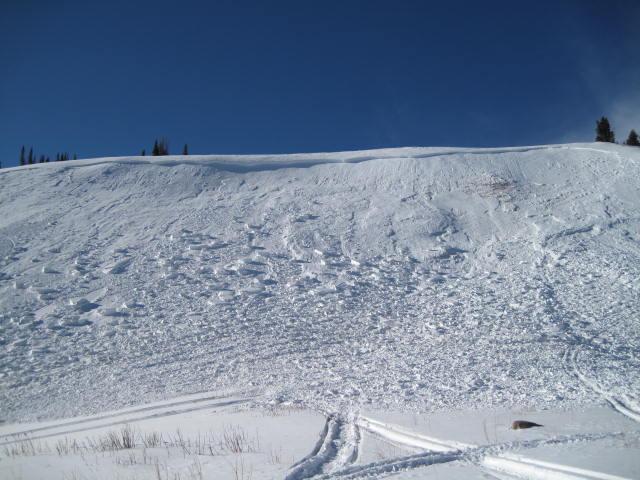
Headed to the Windy Peak weather station to perform some maintenance when we spotted this slide on Yamaha Hill. This east-northeast facing slope was heavily windloaded as a result of the Dec. 30th. hurricane force winds.

1'-4' deep and approx. 300' wide, this avalanche wasn't reported to us, so we can only speculate. Given the current snowpack structure climbing anything steep is nearly impossible and we think this avalanche was triggered low on the slope. The rider collapsed the slope and basically kicked the legs out from under the slab, releasing the whole slope.
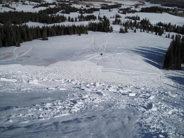
Looking down the path this avalanche could have easily ruined your day, especially had the terrain characteristics been slightly different. Had all this debris slammed into a thick group of trees or piled deeply into a narrow gully the outcome could have been much different. Fortunately everyone came out unscathed.
This photo clearly shows a distinct dust layer formed during last Friday's big winds. The avalanche broke to very weak snow near the ground. These are tricky avalanche conditions because the slab will feel very solid under our sled or skis, luring us into steep avalanche prone terrain.
