

Observer Name
Weed/Archibald
Observation Date
Monday, November 14, 2011
Avalanche Date
Monday, November 14, 2011
Region
Logan » Logan River » Tony Grove » Tony Grove-Blind Hollow Saddle
Location Name or Route
Tony Grove-Blind Hollow Saddle
Elevation
8,800'
Aspect
North
Slope Angle
40°
Trigger
Natural
Avalanche Type
Hard Slab
Weak Layer
Facets
Depth
2'
Width
100'
Vertical
200'
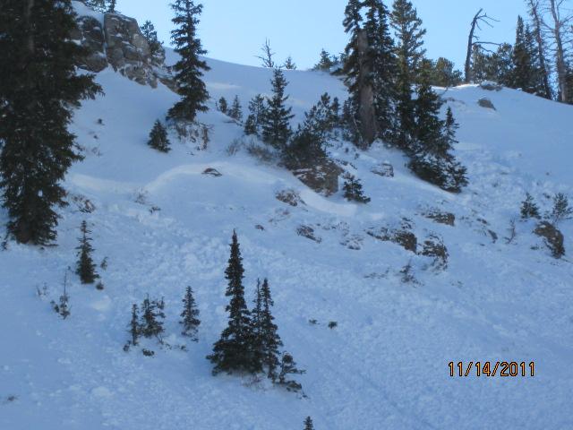
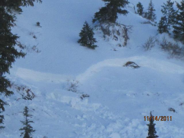
Comments
This natural avalanche occurred overnight 11-13-2011/11-14-20.... The area is heavily loaded by strong westerly winds like those from over the weekend... Only the western half of the bowl released and the route into it crossed the side the hadn't yet avalanched, so we deemed an inspection of the crown too risky...
By the looks of it, the 2 foot deep by around 100' wide avalanche ran on faceted snow just above the solid early October snow. I observed and red flagged the layer late last week.... Here's a link
Coordinates