Approaching from below, we joined an existing skintrack that bee-lined up the slope. Aprox 30' below the ridgeline we were startled by a loud whumph as the slab dropped beneath us. A series of parallel, cross-slope cracks appeared above us, beginning just below the ridgeline and traveling at least 300' to either side of the skin track. Thankfully, the failure plane was high enough friction that the slab did not move on the mid- to upper-20 degree slope.
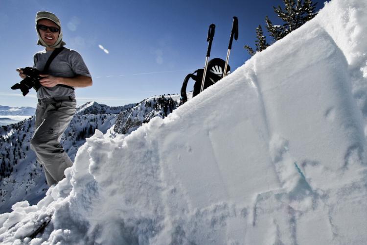
Investigation revealed 28cm of storm snow and rain crust had collapsed into 1.5cm of small-grained facets sandwiched above a second crust. Interestingly, we noted well-preserved surface hoar buried another foot down.
Also of note, we had covered some ground through Dry Fork and Snake Creek and noticed how rapidly the crust changed from thick rain crust to just a fragile rime layer in other places. If there was a pattern to the crust thickness as we crossed different aspects and elevations I wasn't able to discern it.
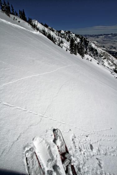
Cracks extended at least to the trees.
Profile of a cross-slope crack and the failure plane
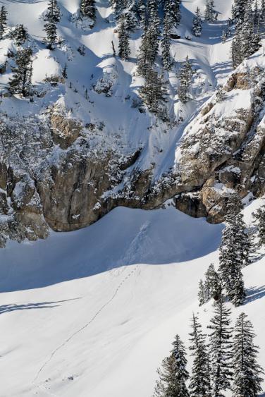
Here's a photo of what had, until that big whumph, been the most interesting obs of the day - a critter traversing above a steep gully had been sluffed 60' down the choke and over a cliff. Tracks showed that the animal had then crawled out of it's good-sized bomb hole and continued on its way.