

Observer Name
Doug Wewer
Observation Date
Tuesday, January 12, 2010
Avalanche Date
Thursday, December 30, 2010
Region
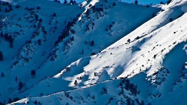
Ogden » Strawberry Creek
Location Name or Route
middle Earth, Strawberry Creek, Ogden area mountians
Elevation
9,000'
Aspect
Northeast
Trigger
Natural
Depth
2'
Width
2,500'
Vertical
2,500'
Comments
I just heard the other day from a friend who skied out the Strawberry Creek drainage (we call it Middle Earth). He reported that all of the adjacent bowls at the top of the drainage must have avalanched simultaneously. The slide left the starting zones bare down to the rain crust from a few weeks ago. He said the skiing was awful, and basically just “ice”, probably with just a few inches of snow and SH on top. He also said the slide deposited a mile-long swath of debris that twisted and turned down the drainage. Sounds like it carved out steep walls, similar to the Rattlesnake Canyon slide that Toby looked at this weekend.
Also of note, is the possibility that the entire path could repeat, especially if there is a large area of exposed rain crust, with NSF sitting on top.
Coordinates