

Observer Name
Scroggin/Gordon
Observation Date
Thursday, November 18, 2010
Avalanche Date
Tuesday, November 16, 2010
Region
Uintas » Bear River Ranger District » Bear River West Fork » Moffit Basin » Yamaha Hill
Location Name or Route
Elevation
10,000'
Aspect
Northeast
Slope Angle
34°
Trigger
Natural
Avalanche Type
Hard Slab
Depth
Unknown
Width
Unknown
Vertical
350'
Comments
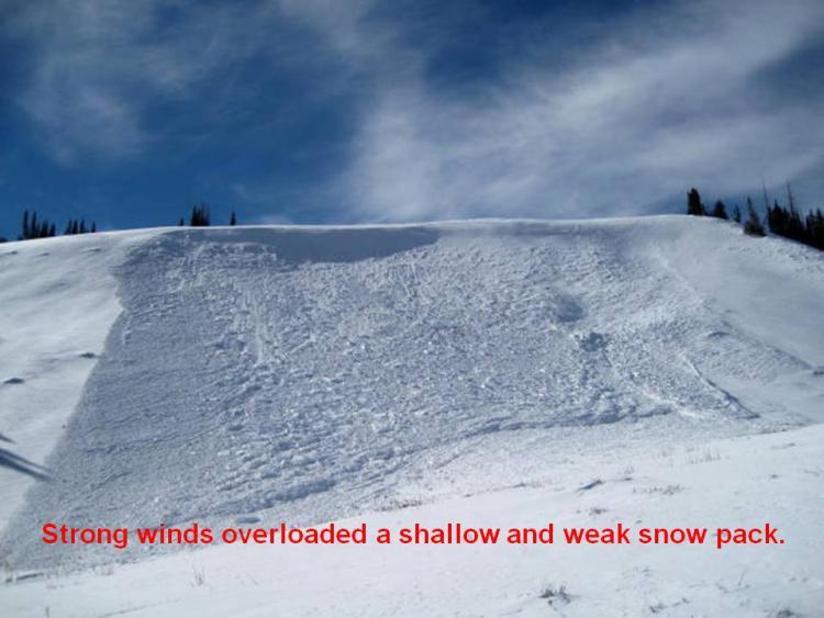
A weakening mid pack structure was overloaded by our midweek wind event.
Comments
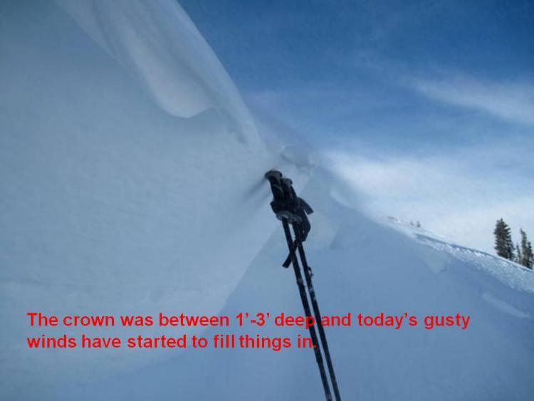
The crown was 1'-3' deep, breaking to the ground in portions of the slope that had a weak snowpack.
Comments
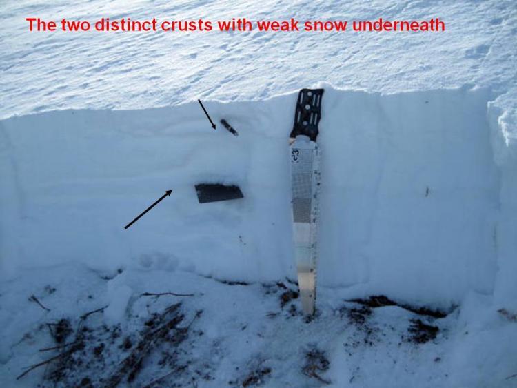
This is a dangerous set up and these crusts will take quite a bit of weight before failing, resulting in a large and dangerous avalanche.
Coordinates