

The third and fourth are pictures of the avalanche our group remotely triggered in South Monitor Bowl off the Park City ridge line.
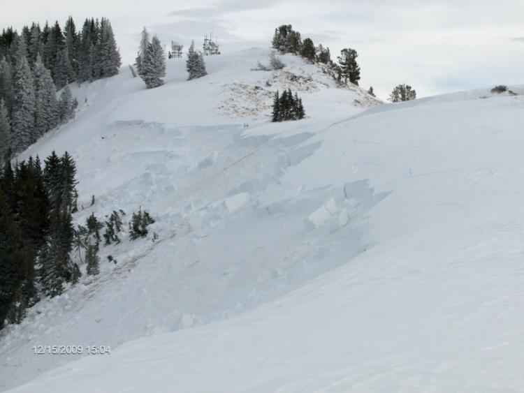
The slide was most definitely a wind slab. The wind was moving a fair amount of snow from the southerly slopes to the northerly aspects.

Started our day heading up the north ridge of "No Name" Bowl on the Park City side. We got our first collapse about 2 minutes out of the car with a thunderous whumph. From that point on we experienced shooting cracks and collapsing approximately every 5 to 10 steps for the remainder of our day all the way back to the trail head.
This is what looked like 3 naturals in Radar Love Bowl due to wind loading. These looked to be from early today or yesterday. The wind was still transporting a fair amount of snow from the south into the northerly aspects when we observed the avalanches, and the paths were starting to fill back in at around 3pm today.
After reading the forecast this morning, and then taking into account our observations it seems it was more HIGH with pockets of Considerable, and perhaps today's forecast may be more suited to tomorrow.