Observer Name
Michael
Observation Date
Wednesday, May 15, 2013
Avalanche Date
Sunday, May 5, 2013
Region
Salt Lake » Big Cottonwood Canyon » Broads Fork
Location Name or Route
Broads Fork
Elevation
10,000'
Aspect
East
Slope Angle
Unknown
Trigger
Natural
Avalanche Type
Wet Slab
Avalanche Problem
Wet Snow
Weak Layer
Ground Interface
Depth
4'
Width
200'
Vertical
1,500'
Comments
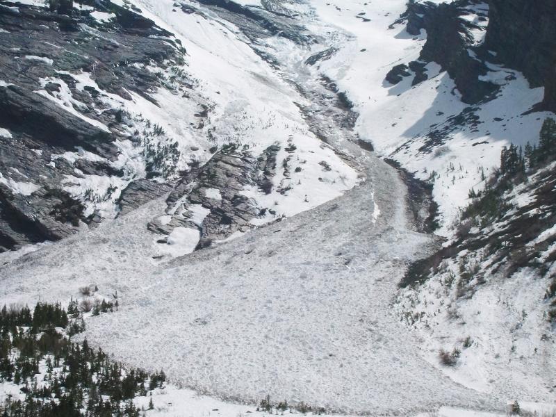
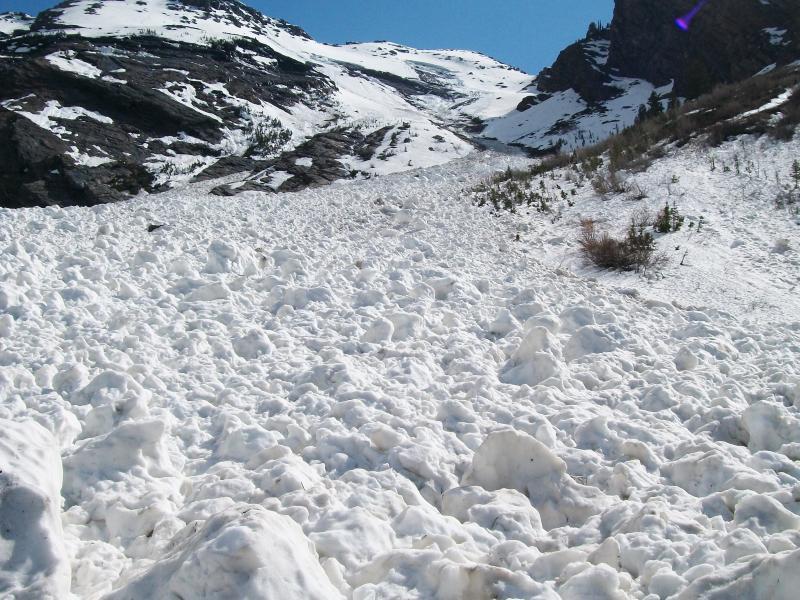
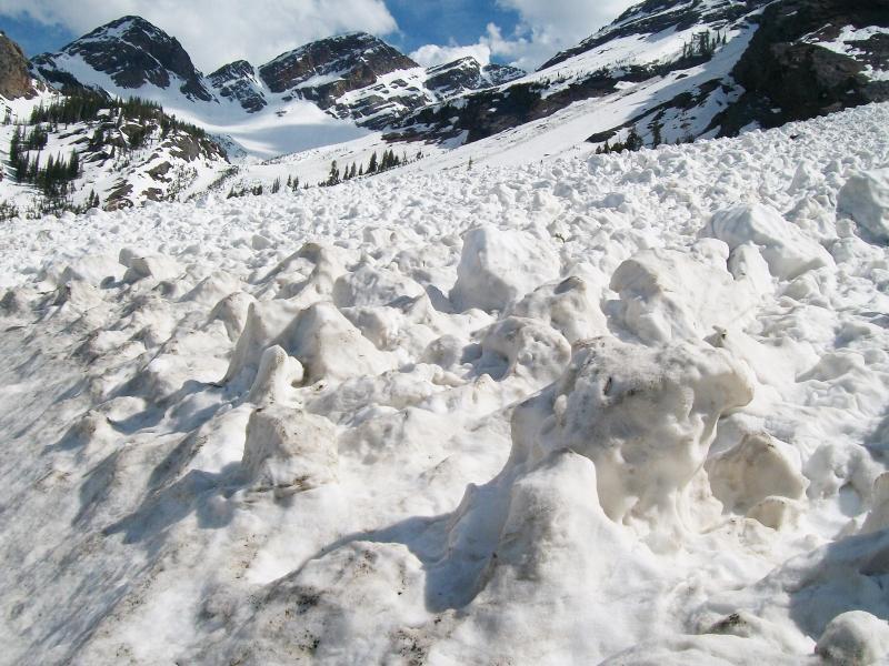
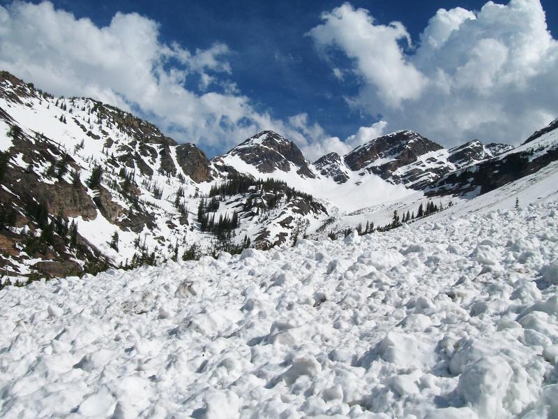
While hiking the Broads Fork trail I noted several avalanches that had occurred off the east facing slopes. As you know, these areas commonly run throughout the winter and this year was no exception. As I hiked further, this large slide came into my view. It had entrained a significant amount of snow and was easily several hundred yards wide at its terminus. The avalanche was also choked with large chunks of ice/snow and was perhaps 6-7 feet deep in most spots w/some areas up to 10 feet deep further up the avy's path. The avalanche date of May 5th is an estimate but seemed to match reasonably well with the snows appearance and previous weather conditions...although could have been w/in the past two weeks. The pics below show the slides full path and also looking up/across the avalanches impressive mass.
Forecasters note: from looking at the photos, the avalanche could be more recent than May 5. It could have occurred during the very warm period on Monday or Tuesday the 13th or 14th. With these glide avalanches it's hard to tell since they come down quite randomly. Tremper