

Observer Name
i. reddel, c. merrill
Observation Date
Sunday, November 11, 2012
Avalanche Date
Sunday, November 11, 2012
Region
Salt Lake » Big Cottonwood Canyon » Sunset Peak
Location Name or Route
catherine pass, sunset pk.
Elevation
10,400'
Aspect
North
Slope Angle
Unknown
Trigger
Skier
Trigger: additional info
Remotely Triggered
Avalanche Type
Soft Slab
Weak Layer
Facets
Depth
3.5'
Width
1,500'
Vertical
800'
Comments
Three of us toured from Brighton to low saddle between Rocky Point and Sunset Pk. On the way we experienced four collapses, three of which produced remotely triggered avalanches.
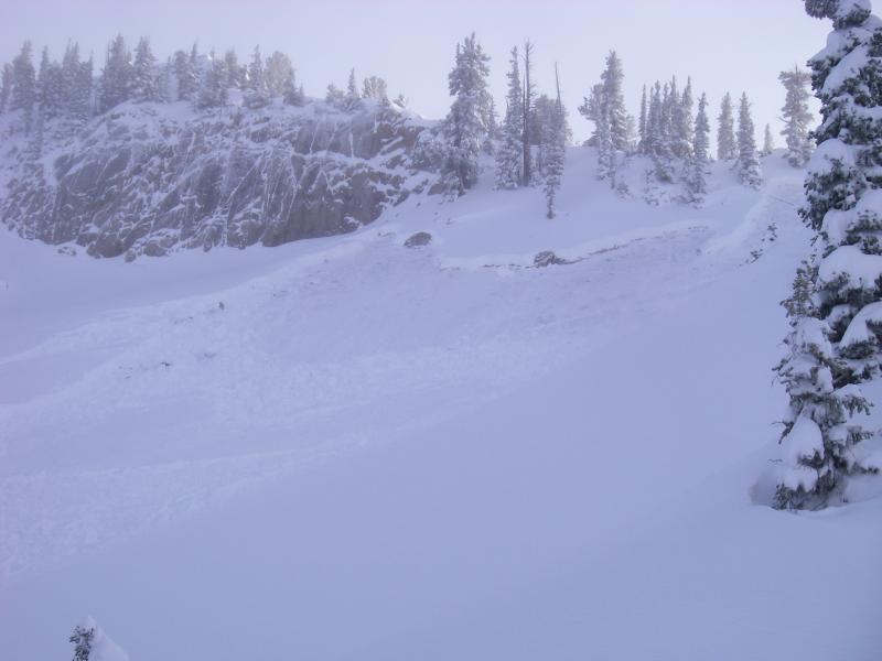
1st collapse ; treed, north facing, 9900', with two skier tracks 50' away, no avalanche.
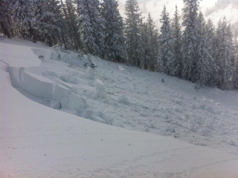
2nd collapse; partially open terrain (obvious slide path), with trees marking the flanks, northwest, 10300', avalanche. The slide released 40' down slope where the angle increased, approx. 39 degrees. The collapse happened on a 20 degree or less angle. Size D2, 100'X3'X200'vert., old snow facets 1.5mm., full depth.
3rd collapse; open terrain, north, 10450', avalanche. This was triggered 50' downslope from the ridge, with a similar slope angle as the first slide. We could not see the depth of the crown from our vantage point, but it's fair to say 3-4'deep, full depth. D2, 60'X3-4'X 700'vert., old snow facets.
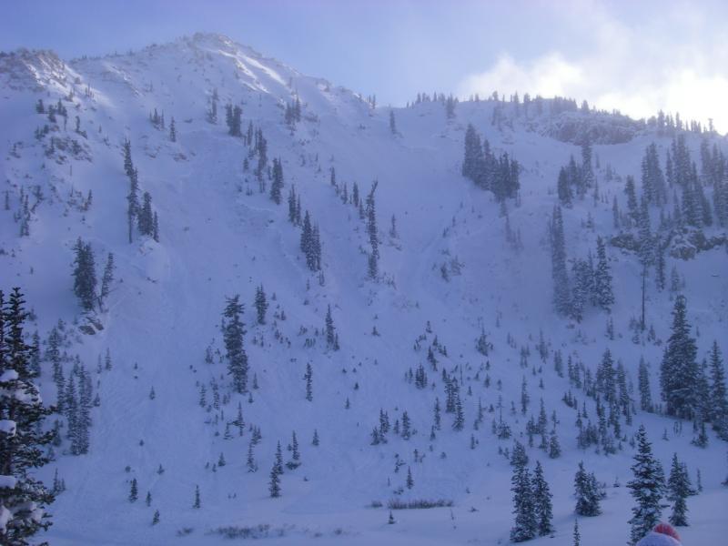
4th collapse; third skier on slope, open terrain, 10350', north, avalanche. The slope angle was approx. 30 degrees or less. This was the most significant collapse and avalanche , as this produced at least five slides at different elevations and fracture widths with the widest crown approx. 1000' wide, aspects N-NW. Lake Catherine was hit by debris.
Just a couple of side notes. Our party knew the avalanche hazard for today. We knew the terrain that we were in. We knew this seasons snow pack history, on going new snow totals, and snow pack structure . We put the skin track in and monitored it visually to keep tabs on other users. One other person used it up to Catherine pass. We did not drop in until the other user was at the pass. We kept our slope angle low and identified safe spots. We had good visibility, the run out zone was clear should an avalanche happen. We thought we would kick a slide off, but we were a bit surprised to see how well the soft slab was connected. With hard slab failure it is not uncommon to see crowns travel long distances through non uniform terrain, soft slabs however not so much in non uniform terrain. The snow felt right side up, no wind effect, 4 finger to fist resistance, not very supportable, we could barely make turns on the low angle slope we skied. We had less than a dozen good turns for the day based on the terrain we chose to ski in/ be in, but we did it safely.

Coordinates